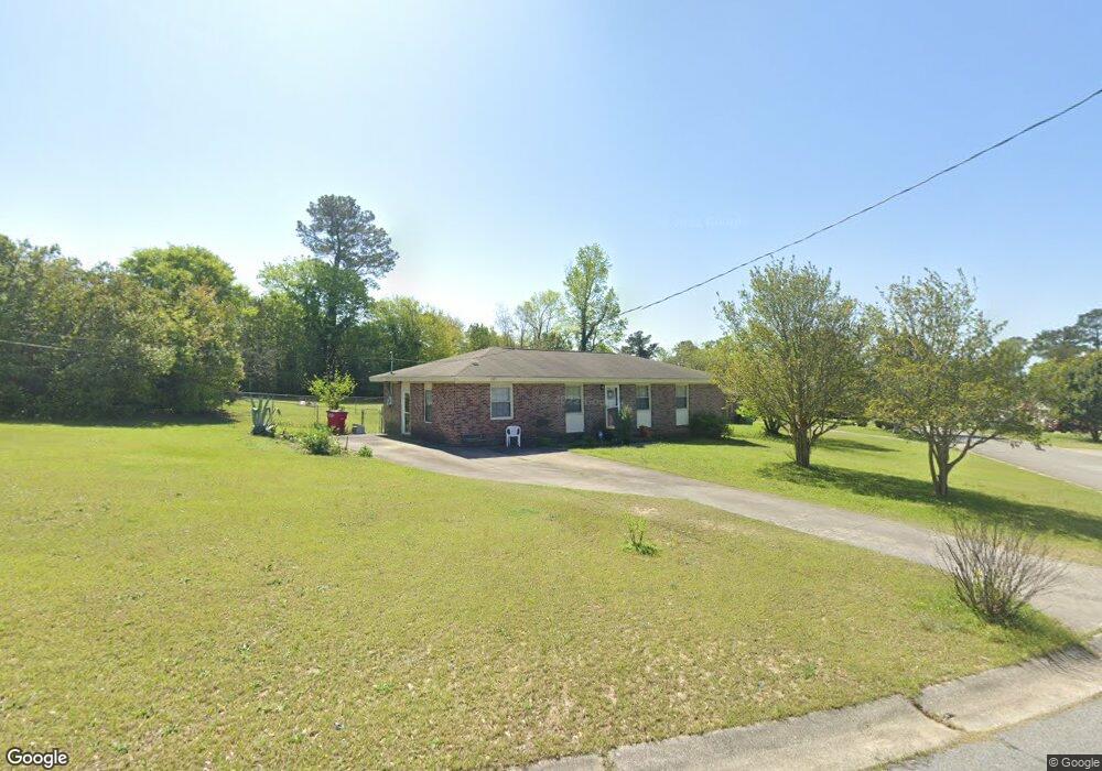
1971 Winston Dr Macon, GA 31206
Estimated Value: $102,000 - $134,000
3
Beds
1
Bath
1,350
Sq Ft
$85/Sq Ft
Est. Value
About This Home
This home is located at 1971 Winston Dr, Macon, GA 31206 and is currently estimated at $114,714, approximately $84 per square foot. 1971 Winston Dr is a home located in Bibb County with nearby schools including Hartley Elementary School, Southwest High School, and Cirrus Charter Academy.
Ownership History
Date
Name
Owned For
Owner Type
Purchase Details
Closed on
Mar 17, 2022
Sold by
Oaklam Watson
Bought by
Watson Okkum
Current Estimated Value
Purchase Details
Closed on
Aug 22, 2005
Sold by
Halcomb Torry P
Bought by
Watson Okkum
Home Financials for this Owner
Home Financials are based on the most recent Mortgage that was taken out on this home.
Original Mortgage
$77,000
Interest Rate
5.61%
Mortgage Type
New Conventional
Purchase Details
Closed on
Mar 29, 2000
Purchase Details
Closed on
Feb 27, 1998
Create a Home Valuation Report for This Property
The Home Valuation Report is an in-depth analysis detailing your home's value as well as a comparison with similar homes in the area
Home Values in the Area
Average Home Value in this Area
Purchase History
| Date | Buyer | Sale Price | Title Company |
|---|---|---|---|
| Watson Okkum | -- | None Listed On Document | |
| Watson Okkum | $77,000 | None Avilebel | |
| -- | $57,900 | -- | |
| -- | $52,500 | -- |
Source: Public Records
Mortgage History
| Date | Status | Borrower | Loan Amount |
|---|---|---|---|
| Previous Owner | Watson Okkum | $77,000 |
Source: Public Records
Tax History Compared to Growth
Tax History
| Year | Tax Paid | Tax Assessment Tax Assessment Total Assessment is a certain percentage of the fair market value that is determined by local assessors to be the total taxable value of land and additions on the property. | Land | Improvement |
|---|---|---|---|---|
| 2025 | $576 | $38,020 | $6,240 | $31,780 |
| 2024 | $598 | $38,020 | $6,240 | $31,780 |
| 2023 | $60 | $34,615 | $6,240 | $28,375 |
| 2022 | $296 | $22,460 | $5,038 | $17,422 |
| 2021 | $203 | $17,113 | $3,839 | $13,274 |
| 2020 | $157 | $14,745 | $2,879 | $11,866 |
| 2019 | $157 | $14,745 | $2,879 | $11,866 |
| 2018 | $240 | $14,745 | $2,879 | $11,866 |
| 2017 | $137 | $14,745 | $2,879 | $11,866 |
| 2016 | $113 | $14,745 | $2,879 | $11,866 |
| 2015 | $211 | $16,530 | $2,879 | $13,651 |
| 2014 | $111 | $16,530 | $2,879 | $13,651 |
Source: Public Records
Map
Nearby Homes
- 1740 Downing Cir
- 1504 Berkshire Dr
- 808 Patton Ave
- 800 Patton Ave
- 815 Edwards Ave
- 2350 Anthony Terrace
- 736 Key St
- 1870 Bethlea Ave
- 3254 Markwood Dr
- 717 Patton Ave
- 1740 Dixon Dr
- 742 Grayson Ave
- 1727 Eveline Ave
- 777 Grosso Ave
- 2249 Lowe St
- 755 Grosso Ave
- 1545 Anthony Rd
- 3758 Mercer University Dr
- 646 Straight St
- 2019 Winston Dr
- 1949 Winston Dr
- 2027 Winston Dr
- 2000 Winston Dr
- 1941 Winston Dr
- 1958 Winston Dr
- 2008 Winston Dr
- 1970 Winston Dr
- 2018 Winston Dr
- 1948 Winston Dr
- 2035 Winston Dr
- 2026 Winston Dr
- 1931 Winston Dr
- 1940 Winston Dr
- 1922 Canterbury Rd
- 2045 Winston Dr
- 1930 Canterbury Rd
- 1914 Canterbury Rd
- 1930 Winston Dr
- 2036 Winston Dr