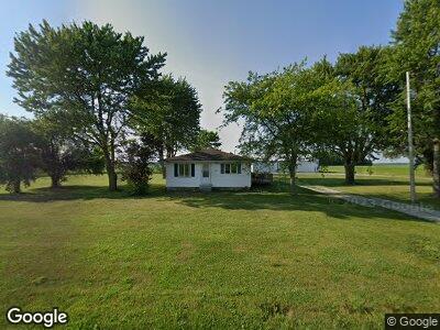
19717 State Route 114 Grover Hill, OH 45849
Estimated Value: $98,000 - $127,000
2
Beds
1
Bath
1,512
Sq Ft
$75/Sq Ft
Est. Value
About This Home
This home is located at 19717 State Route 114, Grover Hill, OH 45849 and is currently estimated at $113,236, approximately $74 per square foot. 19717 State Route 114 is a home with nearby schools including Wayne Trace High School.
Ownership History
Date
Name
Owned For
Owner Type
Purchase Details
Closed on
May 29, 2020
Sold by
Treece Dane A and Treece Brittany L
Bought by
Nickols Samuel R
Current Estimated Value
Home Financials for this Owner
Home Financials are based on the most recent Mortgage that was taken out on this home.
Original Mortgage
$66,300
Outstanding Balance
$59,769
Interest Rate
3.3%
Mortgage Type
New Conventional
Estimated Equity
$60,093
Create a Home Valuation Report for This Property
The Home Valuation Report is an in-depth analysis detailing your home's value as well as a comparison with similar homes in the area
Home Values in the Area
Average Home Value in this Area
Purchase History
| Date | Buyer | Sale Price | Title Company |
|---|---|---|---|
| Nickols Samuel R | $78,000 | None Available |
Source: Public Records
Mortgage History
| Date | Status | Borrower | Loan Amount |
|---|---|---|---|
| Open | Nickols Samuel R | $66,300 | |
| Previous Owner | Treece Dane A | $100,000 |
Source: Public Records
Tax History Compared to Growth
Tax History
| Year | Tax Paid | Tax Assessment Tax Assessment Total Assessment is a certain percentage of the fair market value that is determined by local assessors to be the total taxable value of land and additions on the property. | Land | Improvement |
|---|---|---|---|---|
| 2024 | $880 | $26,710 | $8,260 | $18,450 |
| 2023 | $880 | $26,710 | $8,260 | $18,450 |
| 2022 | $876 | $26,710 | $8,260 | $18,450 |
| 2021 | $1,254 | $33,780 | $8,120 | $25,660 |
| 2020 | $1,295 | $33,780 | $8,120 | $25,660 |
| 2019 | $1,302 | $30,100 | $8,120 | $21,980 |
| 2018 | $1,058 | $30,100 | $8,120 | $21,980 |
| 2017 | $1,060 | $30,100 | $8,120 | $21,980 |
| 2016 | $1,059 | $30,100 | $8,120 | $21,980 |
| 2015 | $999 | $28,280 | $7,630 | $20,650 |
| 2014 | $1,019 | $28,460 | $7,630 | $20,830 |
| 2013 | -- | $0 | $0 | $0 |
Source: Public Records
Map
Nearby Homes
- 18698 Road 48
- 301 E Wayne St
- 100 N Maple St
- 205 E Main
- 7841 Road 25
- 401 Main St
- 107 Superior St
- 20428 Road 120
- 23423 Road 104
- 7970 Broughton Pike
- 16325 Road 25p
- 106 Saint Clair St
- 5872 Road 24
- 12783 Road 82 Unit 10
- 12783 Road 82 Unit 8
- 12783 Road 82 Unit 1
- 172 S East Canal St
- 0 5th St Unit Lot 586 6112033
- 0 5th St Unit Lot 586 303234
- 23678 State Route 613
- 19717 State Route 114
- 19630 State Route 114
- 19502 State Route 114
- 19371 State Route 114
- 2740 Road 165
- 19275 State Route 114
- 19687 Road 30
- 20281 State Route 114
- 202 S Cleveland St
- 200 S Cleveland St
- 19898 Road 30
- 19100 State Route 114
- 2791 Rd
- 2791 Road 173
- tbd Oh-613 Road 151 Intersection
- 2391 Road 165
- 19028 State Route 114
- 19007 State Route 114
- 3091 Road 151
- 20492 State Route 114