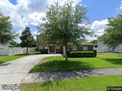
1972 Blackbird Dr Apopka, FL 32703
Estimated Value: $434,262 - $546,000
4
Beds
3
Baths
2,288
Sq Ft
$209/Sq Ft
Est. Value
About This Home
This home is located at 1972 Blackbird Dr, Apopka, FL 32703 and is currently estimated at $479,066, approximately $209 per square foot. 1972 Blackbird Dr is a home with nearby schools including Apopka Elementary School, Wolf Lake Middle School, and Apopka High School.
Ownership History
Date
Name
Owned For
Owner Type
Purchase Details
Closed on
Oct 17, 2011
Sold by
Nvr Inc
Bought by
Sargent Ronnie O
Current Estimated Value
Home Financials for this Owner
Home Financials are based on the most recent Mortgage that was taken out on this home.
Original Mortgage
$184,900
Interest Rate
4.4%
Mortgage Type
FHA
Purchase Details
Closed on
Oct 1, 2010
Sold by
Gk Maudehelen Lllp
Bought by
Nvr Inc
Create a Home Valuation Report for This Property
The Home Valuation Report is an in-depth analysis detailing your home's value as well as a comparison with similar homes in the area
Home Values in the Area
Average Home Value in this Area
Purchase History
| Date | Buyer | Sale Price | Title Company |
|---|---|---|---|
| Sargent Ronnie O | $189,800 | Stewart Approved Title In | |
| Nvr Inc | $61,000 | K Title Company Llc |
Source: Public Records
Mortgage History
| Date | Status | Borrower | Loan Amount |
|---|---|---|---|
| Open | Sargent Ronnie Owen | $70,000 | |
| Open | Sargent Ronnie O | $258,500 | |
| Closed | Sargent Ronnie O | $249,287 | |
| Closed | Sargent Ronnie O | $197,900 | |
| Closed | Sargent Ronnie O | $183,404 | |
| Closed | Sargent Ronnie O | $184,900 |
Source: Public Records
Tax History Compared to Growth
Tax History
| Year | Tax Paid | Tax Assessment Tax Assessment Total Assessment is a certain percentage of the fair market value that is determined by local assessors to be the total taxable value of land and additions on the property. | Land | Improvement |
|---|---|---|---|---|
| 2025 | $2,748 | $212,174 | -- | -- |
| 2024 | $2,563 | $212,174 | -- | -- |
| 2023 | $2,563 | $200,188 | $0 | $0 |
| 2022 | $2,447 | $194,357 | $0 | $0 |
| 2021 | $2,406 | $188,696 | $0 | $0 |
| 2020 | $2,303 | $186,091 | $0 | $0 |
| 2019 | $2,339 | $181,907 | $0 | $0 |
| 2018 | $2,315 | $178,515 | $0 | $0 |
| 2017 | $2,252 | $225,009 | $40,000 | $185,009 |
| 2016 | $2,245 | $204,324 | $25,000 | $179,324 |
| 2015 | $2,225 | $190,896 | $25,000 | $165,896 |
| 2014 | $2,242 | $172,987 | $25,000 | $147,987 |
Source: Public Records
Map
Nearby Homes
- 2005 Blackbird Dr
- 2024 Beardsley Dr
- 1480 Leitrim Loop
- 2178 White Bird Way
- 1407 Leitrim Loop
- 346 Willet Ave
- 1062 Lakeside Estates Dr
- 728 Longford Loop
- 1151 Lakeside Estates Dr
- 1467 Ridgeback Ln
- 1443 Ridgeback Ln
- 612 Doe Cove Place
- 1446 Ridgeback Ln
- 1593 Osprey View Dr
- 1991 Sanderlin Point Loop
- 566 Lake Doe Blvd
- 1832 Crowncrest Dr
- 1828 Crowncrest Dr
- 1691 Eaglehurst Ln
- 1121 Darity St
- 1972 Blackbird Dr
- 1966 Blackbird Dr
- 1978 Blackbird Dr
- 1973 Blackbird Dr
- 1960 Blackbird Dr
- 1967 Blackbird Dr
- 1979 Blackbird Dr
- 1984 Blackbird Dr
- 1961 Blackbird Dr
- 1985 Blackbird Dr
- 1969 Scrub Jay Rd
- 2004 Blackbird Dr
- 1975 Scrub Jay Rd
- 1957 Scrub Jay Rd
- 1981 Scrub Jay Rd
- 2010 Blackbird Dr
- 2011 Blackbird Dr
- 1951 Scrub Jay Rd
- 1970 Scrub Jay Rd
- 2009 Scrub Jay Rd