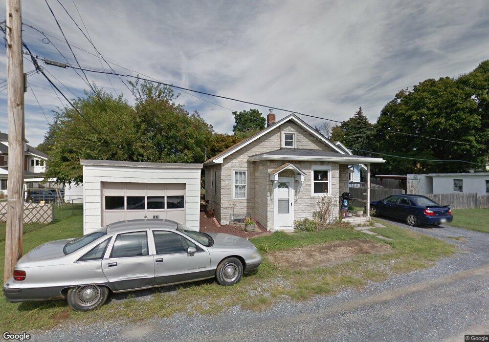
1972 Grove St Allentown, PA 18104
South Whitehall Township NeighborhoodEstimated Value: $255,000 - $268,000
2
Beds
2
Baths
884
Sq Ft
$297/Sq Ft
Est. Value
About This Home
This home is located at 1972 Grove St, Allentown, PA 18104 and is currently estimated at $262,664, approximately $297 per square foot. 1972 Grove St is a home located in Lehigh County with nearby schools including Tussing Elementary School, Kratzer Elementary School, and Cavelero Mid High School.
Ownership History
Date
Name
Owned For
Owner Type
Purchase Details
Closed on
Jul 12, 2001
Sold by
Williamson Norman K and Williamson Michelle C
Bought by
Schreiter Veronica M
Current Estimated Value
Purchase Details
Closed on
Jul 29, 1994
Sold by
Schwoyer William K and Schwoyer Darlene A
Bought by
Williamson Norman K and Williamson Michelle C
Purchase Details
Closed on
Mar 15, 1985
Sold by
Sulima Joseph E
Bought by
Schwoyer William K and Schwoyer Darlene A
Purchase Details
Closed on
Aug 9, 1983
Sold by
Digiacoma Joseph T
Bought by
Sulima Joseph E
Purchase Details
Closed on
Jun 22, 1982
Bought by
Digiacoma Joseph T
Create a Home Valuation Report for This Property
The Home Valuation Report is an in-depth analysis detailing your home's value as well as a comparison with similar homes in the area
Home Values in the Area
Average Home Value in this Area
Purchase History
| Date | Buyer | Sale Price | Title Company |
|---|---|---|---|
| Schreiter Veronica M | $90,000 | -- | |
| Williamson Norman K | $69,700 | -- | |
| Schwoyer William K | $47,000 | -- | |
| Sulima Joseph E | $40,000 | -- | |
| Digiacoma Joseph T | $40,000 | -- |
Source: Public Records
Tax History Compared to Growth
Tax History
| Year | Tax Paid | Tax Assessment Tax Assessment Total Assessment is a certain percentage of the fair market value that is determined by local assessors to be the total taxable value of land and additions on the property. | Land | Improvement |
|---|---|---|---|---|
| 2025 | $2,843 | $116,900 | $35,100 | $81,800 |
| 2024 | $2,747 | $116,900 | $35,100 | $81,800 |
| 2023 | $2,689 | $116,900 | $35,100 | $81,800 |
| 2022 | $2,678 | $116,900 | $81,800 | $35,100 |
| 2021 | $2,678 | $116,900 | $35,100 | $81,800 |
| 2020 | $2,678 | $116,900 | $35,100 | $81,800 |
| 2019 | $2,628 | $116,900 | $35,100 | $81,800 |
| 2018 | $2,541 | $116,900 | $35,100 | $81,800 |
| 2017 | $2,454 | $116,900 | $35,100 | $81,800 |
| 2016 | -- | $116,900 | $35,100 | $81,800 |
| 2015 | -- | $116,900 | $35,100 | $81,800 |
| 2014 | -- | $116,900 | $35,100 | $81,800 |
Source: Public Records
Map
Nearby Homes
- 1243 N 19th St
- 1246 N 22nd St
- 1818 W Jane St
- 2210 Grove St
- 1718 W Stanley St Unit 1722
- 2014 W Highland St
- 1135 N 23rd St
- 1017 N 21st St
- 1739 N 21st St
- 1613 W Congress St Unit 1619
- 2328 W Congress St
- 2150 W Livingston St
- 1221 N 25th St Unit 1225
- 2403 W Tremont St
- 1417 W Woodlawn St Unit 1431
- 1590 Abigail Ln Unit LOT 59
- 1573 Abigail Ln
- 2023 W Washington St
- 1717 W Cedar St
- 1802 W Washington St
- 1966 Grove St
- 2006 W Columbia St
- 2004 W Columbia St
- 1960 Grove St
- 2002 W Columbia St
- 2008 W Columbia St
- 2010 W Columbia St
- 1956 Grove St
- 1951 Grove St
- 1945 Grove St
- 2012 W Columbia St
- 1959 Grove St
- 2014 W Columbia St
- 1943 Grove St
- 2016 W Columbia St
- 1976 W Columbia St
- 1946 Grove St
- 2018 W Columbia St
- 1933 Grove St
- 2014 Grove St