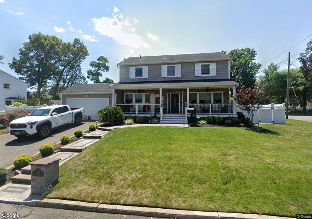
1972 Henry St North Bellmore, NY 11710
Estimated Value: $765,823 - $799,000
--
Bed
3
Baths
1,778
Sq Ft
$440/Sq Ft
Est. Value
About This Home
This home is located at 1972 Henry St, North Bellmore, NY 11710 and is currently estimated at $782,412, approximately $440 per square foot. 1972 Henry St is a home located in Nassau County with nearby schools including Weatherford West Elementary School, Lt. General Thomas P. Stafford Elementary School, and Grand Avenue Middle School.
Ownership History
Date
Name
Owned For
Owner Type
Purchase Details
Closed on
Mar 23, 2022
Sold by
Pellegrino Peter and Pellegrino Joseph
Bought by
Pellegrino Joseph G and Pellegrino Maria
Current Estimated Value
Home Financials for this Owner
Home Financials are based on the most recent Mortgage that was taken out on this home.
Original Mortgage
$385,850
Outstanding Balance
$361,469
Interest Rate
4.16%
Mortgage Type
New Conventional
Estimated Equity
$420,943
Purchase Details
Closed on
Jun 26, 2000
Create a Home Valuation Report for This Property
The Home Valuation Report is an in-depth analysis detailing your home's value as well as a comparison with similar homes in the area
Home Values in the Area
Average Home Value in this Area
Purchase History
| Date | Buyer | Sale Price | Title Company |
|---|---|---|---|
| Pellegrino Joseph G | $500,000 | Freedom Abstract | |
| -- | -- | -- |
Source: Public Records
Mortgage History
| Date | Status | Borrower | Loan Amount |
|---|---|---|---|
| Open | Pellegrino Joseph G | $385,850 |
Source: Public Records
Tax History Compared to Growth
Tax History
| Year | Tax Paid | Tax Assessment Tax Assessment Total Assessment is a certain percentage of the fair market value that is determined by local assessors to be the total taxable value of land and additions on the property. | Land | Improvement |
|---|---|---|---|---|
| 2025 | $16,076 | $560 | $239 | $321 |
| 2024 | $4,338 | $582 | $248 | $334 |
| 2023 | $17,593 | $582 | $248 | $334 |
| 2022 | $17,593 | $582 | $248 | $334 |
| 2021 | $7,190 | $558 | $238 | $320 |
| 2020 | $5,720 | $799 | $663 | $136 |
| 2019 | $5,377 | $799 | $663 | $136 |
| 2018 | $4,902 | $799 | $0 | $0 |
| 2017 | $1,409 | $799 | $663 | $136 |
| 2016 | $4,226 | $799 | $513 | $286 |
| 2015 | $3,438 | $843 | $542 | $301 |
| 2014 | $3,438 | $843 | $542 | $301 |
| 2013 | $3,952 | $1,032 | $663 | $369 |
Source: Public Records
Map
Nearby Homes
- 1708 Cornelius Ave
- 1680 Cornelius Ave
- 2780 Natta Blvd
- 1914 Bergen St
- 3019 Post Ave
- 17 Hannington Ave
- 2800 Pacific St
- 3056 Valentine Place
- 1773 Roland Ave
- 2693 Martin Ave
- 2806 Wilson Ave
- 2672 Martin Ave
- 2730 Court St
- 2728 Wilson Ave
- 1483 Crown St
- 1497 Carroll St
- 2595 Castle Ct
- 118 Linden St
- 2657 Wilson Ave
- 1787 Madison Ave