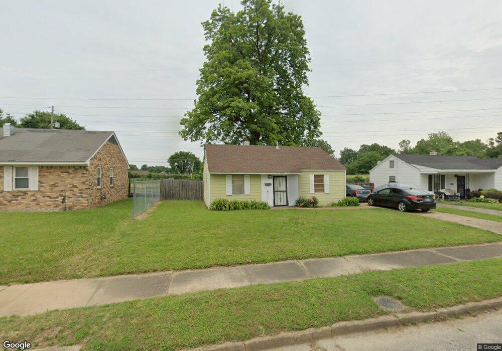
1972 Murley Ave Memphis, TN 38114
Southeast Memphis NeighborhoodEstimated Value: $57,000 - $84,000
2
Beds
1
Bath
768
Sq Ft
$84/Sq Ft
Est. Value
About This Home
This home is located at 1972 Murley Ave, Memphis, TN 38114 and is currently estimated at $64,205, approximately $83 per square foot. 1972 Murley Ave is a home located in Shelby County with nearby schools including Hamilton High School, Memphis College Preparatory, and Veritas College Preparatory.
Ownership History
Date
Name
Owned For
Owner Type
Purchase Details
Closed on
Nov 12, 2004
Sold by
Maclin Monika
Bought by
Hud
Current Estimated Value
Purchase Details
Closed on
Dec 23, 1998
Sold by
Fields Sonja R Jones
Bought by
Maclin Monika
Home Financials for this Owner
Home Financials are based on the most recent Mortgage that was taken out on this home.
Original Mortgage
$38,369
Interest Rate
6.77%
Mortgage Type
FHA
Purchase Details
Closed on
May 15, 1998
Sold by
Brown Pauline N
Bought by
Fields Sonja Jones
Home Financials for this Owner
Home Financials are based on the most recent Mortgage that was taken out on this home.
Original Mortgage
$11,900
Interest Rate
7.04%
Create a Home Valuation Report for This Property
The Home Valuation Report is an in-depth analysis detailing your home's value as well as a comparison with similar homes in the area
Home Values in the Area
Average Home Value in this Area
Purchase History
| Date | Buyer | Sale Price | Title Company |
|---|---|---|---|
| Hud | $47,704 | -- | |
| Maclin Monika | $38,000 | -- | |
| Fields Sonja Jones | $14,000 | -- |
Source: Public Records
Mortgage History
| Date | Status | Borrower | Loan Amount |
|---|---|---|---|
| Previous Owner | Maclin Monika | $38,369 | |
| Previous Owner | Fields Sonja Jones | $11,900 | |
| Closed | Maclin Monika | $2,478 |
Source: Public Records
Tax History Compared to Growth
Tax History
| Year | Tax Paid | Tax Assessment Tax Assessment Total Assessment is a certain percentage of the fair market value that is determined by local assessors to be the total taxable value of land and additions on the property. | Land | Improvement |
|---|---|---|---|---|
| 2025 | -- | $6,775 | $1,500 | $5,275 |
| 2024 | $137 | $4,050 | $1,000 | $3,050 |
| 2023 | $247 | $4,050 | $1,000 | $3,050 |
| 2022 | $247 | $4,050 | $1,000 | $3,050 |
| 2021 | $250 | $4,050 | $1,000 | $3,050 |
| 2020 | $261 | $3,600 | $1,000 | $2,600 |
| 2019 | $261 | $3,600 | $1,000 | $2,600 |
| 2018 | $261 | $3,600 | $1,000 | $2,600 |
| 2017 | $148 | $3,600 | $1,000 | $2,600 |
| 2016 | $185 | $4,225 | $0 | $0 |
| 2014 | $185 | $4,225 | $0 | $0 |
Source: Public Records
Map
Nearby Homes
- 1949 Lapaloma St
- 1817 S Barksdale St
- 1936 Frisco Ave
- 1971 Boyle Ave
- 1832 Rozelle St
- 1824 Rozelle St
- 0 Airways Blvd Unit 10199303
- 2151 Goff Ave
- 2149 Wabash Ave
- 1720 Airways Blvd
- 996 Rozelle St
- 1059 S Willett St S
- 1560 Cane Rd
- 0 Dublin Ave Unit LOTS 20 & 21 LAST TW
- 2400 Kimball Ave
- 1998 Cloverdale Dr
- 1698 Rayner St
- 1790 Westmore St
- 2383 Lowell Ave
- 1911 Quinn Ave
- 1978 Murley Ave
- 1966 Murley Ave
- 1984 Murley Ave
- 1960 Murley Ave
- 1971 Murley Ave
- 1977 Murley Ave
- 1965 Murley Ave
- 1954 Murley Ave
- 1983 Murley Ave
- 1959 Murley Ave
- 1992 Murley Ave
- 1953 Murley Ave
- 1948 Murley Ave
- 1987 Murley Ave
- 1949 Murley Ave
- 1995 Murley Ave
- 1970 Dunn Ave
- 1964 Dunn Ave
- 1976 Dunn Ave
- 1918 Lapaloma St