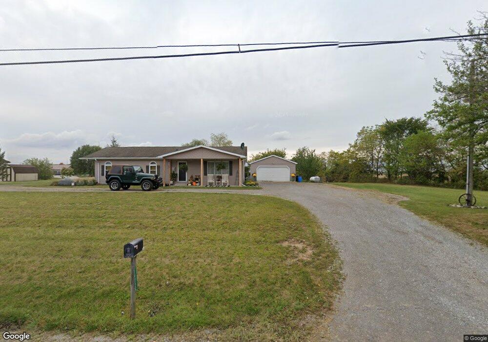
19725 State Route 196 Waynesfield, OH 45896
Estimated Value: $221,187 - $327,000
3
Beds
1
Bath
1,400
Sq Ft
$196/Sq Ft
Est. Value
About This Home
This home is located at 19725 State Route 196, Waynesfield, OH 45896 and is currently estimated at $273,797, approximately $195 per square foot. 19725 State Route 196 is a home located in Auglaize County with nearby schools including Waynesfield-Goshen Local Elementary School and Waynesfield-Goshen Local High School.
Ownership History
Date
Name
Owned For
Owner Type
Purchase Details
Closed on
Jun 20, 2016
Sold by
Boughan Billie J and Phalen Billie J
Bought by
Brooks Roy K and Brooks Monica R
Current Estimated Value
Home Financials for this Owner
Home Financials are based on the most recent Mortgage that was taken out on this home.
Original Mortgage
$129,000
Outstanding Balance
$102,803
Interest Rate
3.61%
Mortgage Type
New Conventional
Estimated Equity
$170,994
Purchase Details
Closed on
Sep 16, 1996
Sold by
Matteson David W
Bought by
Matteson David W
Purchase Details
Closed on
Apr 26, 1996
Sold by
Matteson David W and Matteson Christine
Bought by
Matteson David W
Purchase Details
Closed on
Oct 28, 1994
Bought by
Matteson David W and Matteson Christine
Create a Home Valuation Report for This Property
The Home Valuation Report is an in-depth analysis detailing your home's value as well as a comparison with similar homes in the area
Home Values in the Area
Average Home Value in this Area
Purchase History
| Date | Buyer | Sale Price | Title Company |
|---|---|---|---|
| Brooks Roy K | $169,000 | None Available | |
| Matteson David W | $54,000 | -- | |
| Matteson David W | $35,000 | -- | |
| Matteson David W | -- | -- |
Source: Public Records
Mortgage History
| Date | Status | Borrower | Loan Amount |
|---|---|---|---|
| Open | Brooks Roy K | $129,000 |
Source: Public Records
Tax History Compared to Growth
Tax History
| Year | Tax Paid | Tax Assessment Tax Assessment Total Assessment is a certain percentage of the fair market value that is determined by local assessors to be the total taxable value of land and additions on the property. | Land | Improvement |
|---|---|---|---|---|
| 2024 | $3,753 | $59,660 | $6,720 | $52,940 |
| 2023 | $2,124 | $59,660 | $6,720 | $52,940 |
| 2022 | $1,798 | $43,060 | $6,110 | $36,950 |
| 2021 | $1,792 | $43,060 | $6,110 | $36,950 |
| 2020 | $1,758 | $43,061 | $6,108 | $36,953 |
| 2019 | $1,433 | $35,882 | $5,089 | $30,793 |
| 2018 | $1,388 | $35,882 | $5,089 | $30,793 |
| 2017 | $1,376 | $35,882 | $5,089 | $30,793 |
| 2016 | $1,358 | $36,618 | $4,848 | $31,770 |
| 2015 | $1,391 | $36,618 | $4,848 | $31,770 |
| 2014 | $1,393 | $36,618 | $4,848 | $31,770 |
| 2013 | $1,548 | $36,618 | $4,848 | $31,770 |
Source: Public Records
Map
Nearby Homes
- 8150 Amherst Rd
- 5065 Amherst Rd
- 105 Guthrie St
- 202 W Mulberry St
- 25836 Ohio 67
- 22275 Buckland Holden Rd
- 7165 Faulkner Rd
- 6616 Bellefontaine Rd
- 6381 McPheron Rd
- E Hanthorn Rd
- 5600 E Hanthorn Rd
- 4160 E Hanthorn Rd
- 20630 State Route 67
- 1855 S Cool Rd
- 200 S Main St
- 3080 E Hanthorn Rd
- 4080 Bellefontaine Rd
- 0 Ohio 67
- 37 N Main St
- 17 E Walnut St
- 19707 State Route 196
- 19823 State Route 196
- 19625 State Route 196
- 19990 State Route 196
- 19425 State Route 196
- 6885 Auglaize County Line Rd
- 6935 Auglaize Rd
- 25212 Allen Union Wayne Rd
- 25254 Allen Union Wayne Rd
- 6597 Waynesfield Rd
- 25288 Allen Union Wayne Rd
- 7141 Auglaize Rd
- 6570 State Route 196
- 6565 State Route 196
- 6565 Waynesfield Rd
- 6535 State Route 196