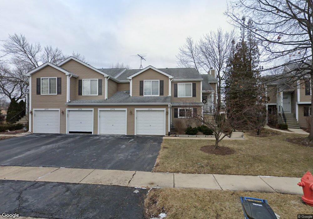
1973 Windsong Dr Unit 334E1 Schaumburg, IL 60194
West Schaumburg NeighborhoodEstimated Value: $235,375 - $282,000
2
Beds
--
Bath
1,200
Sq Ft
$218/Sq Ft
Est. Value
About This Home
This home is located at 1973 Windsong Dr Unit 334E1, Schaumburg, IL 60194 and is currently estimated at $262,094, approximately $218 per square foot. 1973 Windsong Dr Unit 334E1 is a home located in Cook County with nearby schools including Elizabeth Blackwell Elementary School, Dwight D Eisenhower Junior High School, and Hoffman Estates High School.
Ownership History
Date
Name
Owned For
Owner Type
Purchase Details
Closed on
Apr 25, 1997
Sold by
Myler Katherine
Bought by
Born Cynthia J
Current Estimated Value
Home Financials for this Owner
Home Financials are based on the most recent Mortgage that was taken out on this home.
Original Mortgage
$103,500
Outstanding Balance
$13,566
Interest Rate
7.5%
Estimated Equity
$248,528
Create a Home Valuation Report for This Property
The Home Valuation Report is an in-depth analysis detailing your home's value as well as a comparison with similar homes in the area
Home Values in the Area
Average Home Value in this Area
Purchase History
| Date | Buyer | Sale Price | Title Company |
|---|---|---|---|
| Born Cynthia J | $115,000 | -- |
Source: Public Records
Mortgage History
| Date | Status | Borrower | Loan Amount |
|---|---|---|---|
| Open | Born Cynthia J | $103,500 |
Source: Public Records
Tax History Compared to Growth
Tax History
| Year | Tax Paid | Tax Assessment Tax Assessment Total Assessment is a certain percentage of the fair market value that is determined by local assessors to be the total taxable value of land and additions on the property. | Land | Improvement |
|---|---|---|---|---|
| 2024 | $1,576 | $17,751 | $2,904 | $14,847 |
| 2023 | $3,133 | $17,751 | $2,904 | $14,847 |
| 2022 | $3,133 | $17,751 | $2,904 | $14,847 |
| 2021 | $1,714 | $13,040 | $4,574 | $8,466 |
| 2020 | $1,572 | $13,040 | $4,574 | $8,466 |
| 2019 | $1,562 | $14,562 | $4,574 | $9,988 |
| 2018 | $1,547 | $12,032 | $2,831 | $9,201 |
| 2017 | $2,553 | $12,032 | $2,831 | $9,201 |
| 2016 | $2,628 | $12,032 | $2,831 | $9,201 |
| 2015 | $2,420 | $10,734 | $2,468 | $8,266 |
| 2014 | $2,409 | $10,734 | $2,468 | $8,266 |
| 2013 | $2,330 | $10,734 | $2,468 | $8,266 |
Source: Public Records
Map
Nearby Homes
- 1020 Denham Place Unit 1
- 1912 Finchley Ct Unit 3
- 1375 Rebecca Dr Unit 318
- 1121 Southbridge Ln
- 1103 Southbridge Ln
- 1475 Rebecca Dr Unit 217
- 808 Bishop Ct Unit 2
- 1672 Cornell Dr
- 1685 Cornell Dr
- 1698 Pebble Beach Dr
- 2216 Andover Ct
- 775 Harmon Blvd
- 2342 Hamilton Place
- 2312 Hyde Ct
- 1901 Kingsley Dr
- 1763 Bristol Walk Unit 1763
- 1415 N Oakmont Rd
- 2201 Brittany Ct Unit 20
- 1808 Fayette Walk Unit H
- 1475 Crowfoot Cir S
- 1971 Windsong Dr Unit 332E1
- 1977 Windsong Dr Unit 331E1
- 1965 Windsong Dr Unit 323E1
- 1983 Windsong Dr Unit 344E1
- 1961 Windsong Dr Unit 322E1
- 1963 Windsong Dr Unit 324E1
- 1985 Windsong Dr Unit 343E1
- 1981 Windsong Dr Unit 34-2
- 1981 Windsong Dr Unit 342E1
- 1987 Windsong Dr Unit 341E1
- 1957 Windsong Dr Unit 311E1
- 1957 Windsong Dr Unit 31-1
- 1955 Windsong Dr Unit 313E1
- 1951 Windsong Dr Unit 312E1
- 1953 Windsong Dr Unit 2
- 1953 Windsong Dr Unit 314E1
- 1937 Windsong Dr Unit 301E1
- 1937 Windsong Dr Unit 30-1
- 1935 Windsong Dr Unit 303E1
- 1935 Windsong Dr Unit 1935