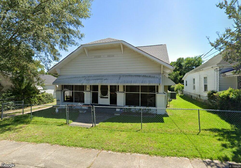
1974 Battle Row Augusta, GA 30904
Harrisburg NeighborhoodEstimated Value: $159,000 - $179,000
4
Beds
2
Baths
2,244
Sq Ft
$76/Sq Ft
Est. Value
About This Home
This home is located at 1974 Battle Row, Augusta, GA 30904 and is currently estimated at $169,763, approximately $75 per square foot. 1974 Battle Row is a home located in Richmond County with nearby schools including Lamar Elementary School, W.S. Hornsby Elementary School, and Johnson Magnet.
Ownership History
Date
Name
Owned For
Owner Type
Purchase Details
Closed on
Aug 17, 2001
Sold by
Vaughn James G and Vaughn Linda C
Bought by
Oliver Joyce Wright
Current Estimated Value
Home Financials for this Owner
Home Financials are based on the most recent Mortgage that was taken out on this home.
Original Mortgage
$66,374
Outstanding Balance
$25,467
Interest Rate
7.08%
Mortgage Type
FHA
Estimated Equity
$144,296
Purchase Details
Closed on
Nov 2, 1992
Sold by
Johnson William O
Bought by
Vaughn James G
Purchase Details
Closed on
Aug 1, 1987
Sold by
Mcmillan Georgia M
Bought by
Johnson William O
Create a Home Valuation Report for This Property
The Home Valuation Report is an in-depth analysis detailing your home's value as well as a comparison with similar homes in the area
Home Values in the Area
Average Home Value in this Area
Purchase History
| Date | Buyer | Sale Price | Title Company |
|---|---|---|---|
| Oliver Joyce Wright | $66,900 | -- | |
| Vaughn James G | $23,100 | -- | |
| Johnson William O | $23,100 | -- |
Source: Public Records
Mortgage History
| Date | Status | Borrower | Loan Amount |
|---|---|---|---|
| Open | Oliver Joyce Wright | $66,374 | |
| Closed | Oliver Joyce Wright | $4,174 |
Source: Public Records
Tax History
| Year | Tax Paid | Tax Assessment Tax Assessment Total Assessment is a certain percentage of the fair market value that is determined by local assessors to be the total taxable value of land and additions on the property. | Land | Improvement |
|---|---|---|---|---|
| 2025 | $1,997 | $60,752 | $3,472 | $57,280 |
| 2024 | $1,997 | $45,932 | $3,472 | $42,460 |
| 2023 | $1,501 | $72,040 | $3,472 | $68,568 |
| 2022 | $1,766 | $52,599 | $3,472 | $49,127 |
| 2021 | $1,474 | $39,651 | $3,472 | $36,179 |
| 2020 | $1,255 | $33,604 | $3,960 | $29,644 |
| 2019 | $1,323 | $33,604 | $3,960 | $29,644 |
| 2018 | $1,379 | $34,897 | $3,960 | $30,937 |
| 2017 | $1,378 | $35,056 | $3,960 | $31,096 |
| 2016 | $1,363 | $34,623 | $3,960 | $30,663 |
| 2015 | $1,371 | $34,623 | $3,960 | $30,663 |
| 2014 | $1,373 | $34,623 | $3,960 | $30,663 |
Source: Public Records
Map
Nearby Homes
- 1976 Battle Row
- 1970 Battle Row
- 1978 Battle Row
- 1972 Battle Row
- 1933 Watkins St
- 1968 Battle Row
- 1931 Watkins St
- 1935 Watkins St
- 1980 Battle Row
- 1937 Watkins St
- 1977 Batttle
- 1964 Battle Row
- 1975 Battle Row
- 1973 Battle Row
- 1977 Battle Row
- 1971 Battle Row
- 1979 Battle Row
- 1962 Battle Row
- 625 Metcalf St
- 621 Metcalf St
Your Personal Tour Guide
Ask me questions while you tour the home.