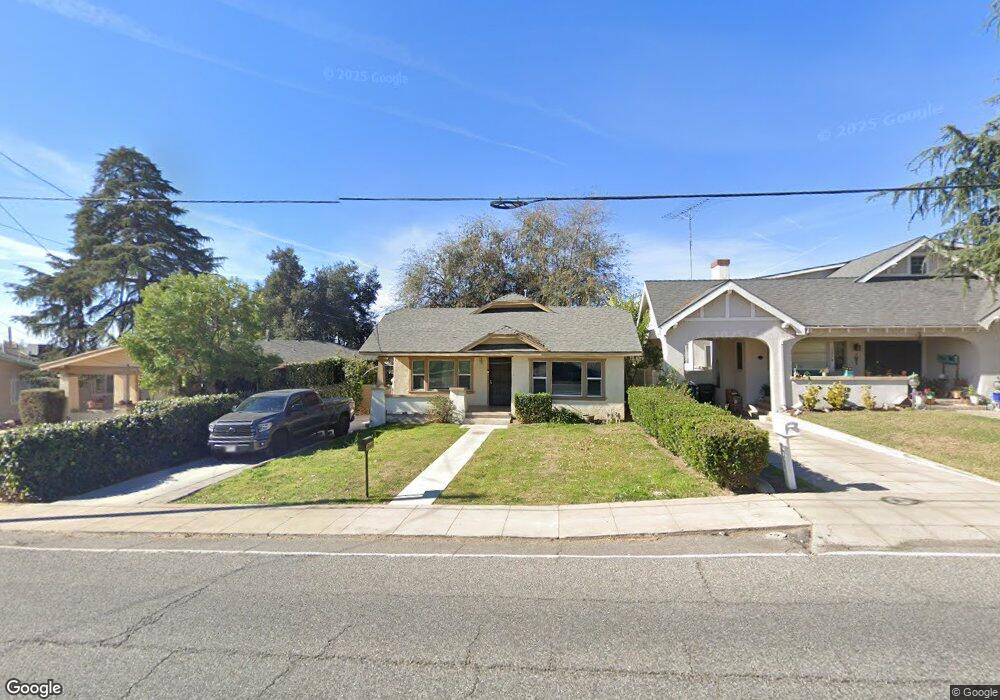
1974 Palm Ave Highland, CA 92346
San Andreas NeighborhoodEstimated Value: $364,237 - $425,000
2
Beds
1
Bath
1,136
Sq Ft
$342/Sq Ft
Est. Value
About This Home
This home is located at 1974 Palm Ave, Highland, CA 92346 and is currently estimated at $388,309, approximately $341 per square foot. 1974 Palm Ave is a home located in San Bernardino County with nearby schools including Bonnie Oehl Elementary School, Serrano Middle School, and San Gorgonio High School.
Ownership History
Date
Name
Owned For
Owner Type
Purchase Details
Closed on
Nov 7, 2022
Sold by
Black Larry M
Bought by
Larry Michael Black Living Trust
Current Estimated Value
Purchase Details
Closed on
Aug 7, 2001
Sold by
Hud
Bought by
Black Larry M
Home Financials for this Owner
Home Financials are based on the most recent Mortgage that was taken out on this home.
Original Mortgage
$56,800
Interest Rate
7.09%
Purchase Details
Closed on
May 14, 2001
Sold by
First Nationwide Mtg Corp
Bought by
Hud
Purchase Details
Closed on
May 12, 1999
Sold by
Eghbal Morteza
Bought by
Class Melinda
Home Financials for this Owner
Home Financials are based on the most recent Mortgage that was taken out on this home.
Original Mortgage
$68,894
Interest Rate
7.05%
Purchase Details
Closed on
Mar 12, 1999
Sold by
Bolton Charles and Bolton Jeannine
Bought by
Eghbal Morteza and 1974 Palm Ave Trust
Create a Home Valuation Report for This Property
The Home Valuation Report is an in-depth analysis detailing your home's value as well as a comparison with similar homes in the area
Home Values in the Area
Average Home Value in this Area
Purchase History
| Date | Buyer | Sale Price | Title Company |
|---|---|---|---|
| Larry Michael Black Living Trust | -- | Priority Title | |
| Black Larry M | $72,000 | Fidelity National Title | |
| Hud | -- | Stewart Title | |
| First Nationwide Mtg Corp | $74,879 | Stewart Title | |
| Class Melinda | $69,000 | Commonwealth Land Title Co | |
| Eghbal Morteza | $42,700 | Commonwealth Land Title Co |
Source: Public Records
Mortgage History
| Date | Status | Borrower | Loan Amount |
|---|---|---|---|
| Previous Owner | Black Larry M | $56,800 | |
| Previous Owner | Class Melinda | $68,894 |
Source: Public Records
Tax History Compared to Growth
Tax History
| Year | Tax Paid | Tax Assessment Tax Assessment Total Assessment is a certain percentage of the fair market value that is determined by local assessors to be the total taxable value of land and additions on the property. | Land | Improvement |
|---|---|---|---|---|
| 2025 | $1,476 | $106,366 | $22,160 | $84,206 |
| 2024 | $1,476 | $104,280 | $21,725 | $82,555 |
| 2023 | $1,439 | $102,235 | $21,299 | $80,936 |
| 2022 | $1,438 | $100,230 | $20,881 | $79,349 |
| 2021 | $1,437 | $98,265 | $20,472 | $77,793 |
| 2020 | $1,438 | $97,257 | $20,262 | $76,995 |
| 2019 | $1,399 | $95,350 | $19,865 | $75,485 |
| 2018 | $1,384 | $93,480 | $19,475 | $74,005 |
| 2017 | $1,342 | $91,647 | $19,093 | $72,554 |
| 2016 | $1,302 | $89,850 | $18,719 | $71,131 |
| 2015 | $1,175 | $88,501 | $18,438 | $70,063 |
| 2014 | $1,142 | $86,768 | $18,077 | $68,691 |
Source: Public Records
Map
Nearby Homes
- 2004 Palm Ave
- 2035 Reedy Ave
- 3545 20th St
- 3542 20th St
- 3532 Rainbow Ln Unit 2
- 3531 Rainbow Ln
- 3504 Rainbow Ln
- 3501 20th St
- 3500 20th St
- 3465 20th St
- 3441 20th St
- 3436 Rainbow Ln
- 2221 Baldridge Canyon Ct
- 2220 Baldridge Canyon Ct
- 2218 N Cole Ct
- 2227 Cole Ct
- 2226 N Cole Ct
- 2226 Cole Ct
- 2225 N Oleander Ct
- 2243 Cole Ct
- 1962 N Palm Ave
- 1978 Palm Ave
- 1982 Palm Ave
- 1957 Reedy Ave
- 1944 Palm Ave
- 1935 Reedy Ave Unit 4
- 1935 Reedy Ave
- 1979 Reedy Ave
- 1979 Reedy Ave Unit 1979
- 1979 Reedy Ave Unit 4
- 1979 Reedy Ave
- 1955 Reedy Ave Unit 3
- 1955 Reedy Ave
- 1931 Reedy Ave Unit 2
- 1977 Reedy Ave Unit 3
- 1933 Reedy Ave
- 1975 Reedy Ave Unit 2
- 1951 Reedy Ave
- 1929 Reedy Ave Unit 1
- 1986 Palm Ave