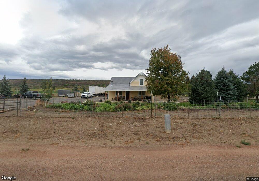
19741 S Highway 550 Montrose, CO 81403
Estimated Value: $472,089 - $580,000
4
Beds
1
Bath
1,574
Sq Ft
$332/Sq Ft
Est. Value
About This Home
This home is located at 19741 S Highway 550, Montrose, CO 81403 and is currently estimated at $522,772, approximately $332 per square foot. 19741 S Highway 550 is a home located in Montrose County with nearby schools including Cottonwood Elementary School, Columbine Middle School, and Montrose High School.
Ownership History
Date
Name
Owned For
Owner Type
Purchase Details
Closed on
Sep 10, 2024
Sold by
Department Of Transportation
Bought by
County Of Montrose
Current Estimated Value
Purchase Details
Closed on
Dec 24, 2014
Sold by
Head Sandra L
Bought by
Plumb Crystal Dawn
Home Financials for this Owner
Home Financials are based on the most recent Mortgage that was taken out on this home.
Original Mortgage
$128,250
Interest Rate
4.05%
Mortgage Type
New Conventional
Purchase Details
Closed on
May 14, 1982
Sold by
Ebbs Clara E
Bought by
Jankovich Ann J
Create a Home Valuation Report for This Property
The Home Valuation Report is an in-depth analysis detailing your home's value as well as a comparison with similar homes in the area
Home Values in the Area
Average Home Value in this Area
Purchase History
| Date | Buyer | Sale Price | Title Company |
|---|---|---|---|
| County Of Montrose | -- | None Listed On Document | |
| Plumb Crystal Dawn | $135,000 | Land Title Guarantee Company | |
| Jankovich Ann J | $55,000 | -- |
Source: Public Records
Mortgage History
| Date | Status | Borrower | Loan Amount |
|---|---|---|---|
| Previous Owner | Plumb Crystal Dawn | $128,250 |
Source: Public Records
Tax History Compared to Growth
Tax History
| Year | Tax Paid | Tax Assessment Tax Assessment Total Assessment is a certain percentage of the fair market value that is determined by local assessors to be the total taxable value of land and additions on the property. | Land | Improvement |
|---|---|---|---|---|
| 2024 | $1,482 | $20,810 | $7,400 | $13,410 |
| 2023 | $1,482 | $25,420 | $9,040 | $16,380 |
| 2022 | $1,181 | $17,160 | $6,090 | $11,070 |
| 2021 | $1,217 | $17,650 | $6,260 | $11,390 |
| 2020 | $1,021 | $15,220 | $5,860 | $9,360 |
| 2019 | $1,028 | $15,220 | $5,860 | $9,360 |
| 2018 | $865 | $12,490 | $4,210 | $8,280 |
| 2017 | $818 | $11,920 | $4,210 | $7,710 |
| 2016 | $804 | $11,900 | $4,230 | $7,670 |
| 2015 | $789 | $11,900 | $4,230 | $7,670 |
| 2014 | $686 | $11,070 | $4,230 | $6,840 |
Source: Public Records
Map
Nearby Homes
- 20124 6720 Ln
- 19063 U S 550
- Lot 2 Trout Rd
- Lot 3 Trout Rd
- 20547 Tulip Cir
- 20677 Tulip Cir
- 65536 Solar Rd
- 18563 U S 550
- 68053 Tumbleweed Rd
- 20866 Trophy Rd
- 68143 Tumbleweed Rd
- 65499 Solar Rd
- Lot 4 6785 Ct
- Lot 1 6785 Ct
- Lot 3 6785 Ct
- 21179 Highway 550
- 18512 6500 Rd
- Lot 3 Solar Rd
- 20849 Solitude Rd
- Lot 49 6840 Rd
- 19709 Highway 550
- 0 Trout Rd Rd
- 19665 S Highway 550
- 19825 S Highway 550
- 19755 U S 550
- 19755 Highway 550
- 19911 Highway 550
- 19573 Highway 550
- 19492 S Highway 550
- 67010 Sunflower Trail
- 67010 Sunflower
- 19501 & 19511 S Highway 550
- 19501 Highway 550
- 19685 Highway 550
- 19975 Highway 550
- 20001 Highway 550
- 19985 Highway 550
- 19385 Highway 550
- 67181 Trout Rd
- 676221 T