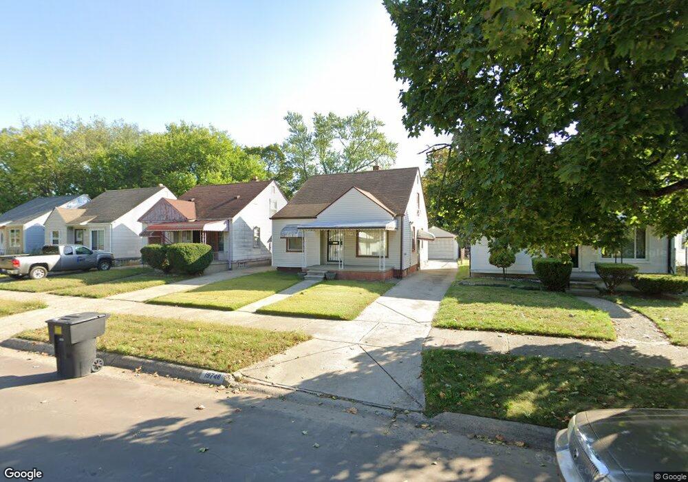
19746 Fenmore St Detroit, MI 48235
Greenfield NeighborhoodEstimated Value: $65,991 - $80,000
--
Bed
1
Bath
914
Sq Ft
$79/Sq Ft
Est. Value
About This Home
This home is located at 19746 Fenmore St, Detroit, MI 48235 and is currently estimated at $71,998, approximately $78 per square foot. 19746 Fenmore St is a home located in Wayne County with nearby schools including Bow Elementary-Middle School, Charles L. Spain Elementary-Middle School, and Edward 'Duke' Ellington Conservatory of Music and Art.
Ownership History
Date
Name
Owned For
Owner Type
Purchase Details
Closed on
Mar 30, 2005
Sold by
Moore Silver J
Bought by
Moore Silver J
Current Estimated Value
Home Financials for this Owner
Home Financials are based on the most recent Mortgage that was taken out on this home.
Original Mortgage
$80,000
Interest Rate
6.75%
Mortgage Type
Fannie Mae Freddie Mac
Create a Home Valuation Report for This Property
The Home Valuation Report is an in-depth analysis detailing your home's value as well as a comparison with similar homes in the area
Home Values in the Area
Average Home Value in this Area
Purchase History
| Date | Buyer | Sale Price | Title Company |
|---|---|---|---|
| Moore Silver J | -- | Commonwealth Land Title |
Source: Public Records
Mortgage History
| Date | Status | Borrower | Loan Amount |
|---|---|---|---|
| Closed | Moore Silver J | $80,000 |
Source: Public Records
Tax History Compared to Growth
Tax History
| Year | Tax Paid | Tax Assessment Tax Assessment Total Assessment is a certain percentage of the fair market value that is determined by local assessors to be the total taxable value of land and additions on the property. | Land | Improvement |
|---|---|---|---|---|
| 2025 | $687 | $27,800 | $0 | $0 |
| 2024 | $687 | $24,800 | $0 | $0 |
| 2023 | $666 | $19,700 | $0 | $0 |
| 2022 | $731 | $16,400 | $0 | $0 |
| 2021 | $712 | $13,000 | $0 | $0 |
| 2020 | $704 | $11,900 | $0 | $0 |
| 2019 | $693 | $9,700 | $0 | $0 |
| 2018 | $588 | $8,400 | $0 | $0 |
| 2017 | $148 | $7,800 | $0 | $0 |
| 2016 | $906 | $13,100 | $0 | $0 |
| 2015 | $1,310 | $13,100 | $0 | $0 |
| 2013 | $1,296 | $18,372 | $0 | $0 |
| 2010 | -- | $26,323 | $689 | $25,634 |
Source: Public Records
Map
Nearby Homes
- 19765 Archdale St
- 19731 Harlow St
- 19925 Archdale St
- 19751 Oakfield St
- 19781 Oakfield St
- 19433 Fenmore St
- 19425 Fenmore St
- 19780 Oakfield St
- 19786 Oakfield St
- 18231 Pembroke Ave
- 19377 Fenmore St
- 19950 Oakfield St
- 20004 Southfield Fwy
- 19400 Harlow St
- 20014 Southfield Rd
- 19365 Fenmore St
- 19345 Fenmore St
- 19379 Ashton Ave
- 19338 Fenmore St
- 20052 Archdale St
- 19738 Fenmore St
- 19750 Fenmore St
- 19758 Fenmore St
- 19730 Fenmore St
- 19724 Fenmore St
- 19766 Fenmore St
- 19745 Archdale St
- 19737 Archdale St
- 19751 Archdale St
- 19731 Archdale St
- 19757 Archdale St
- 19772 Fenmore St
- 19716 Fenmore St
- 19723 Archdale St
- 19745 Fenmore St
- 19751 Fenmore St
- 19737 Fenmore St
- 19710 Fenmore St
- 19780 Fenmore St
- 19759 Fenmore St