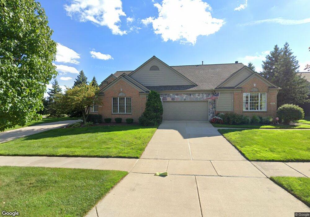
1976 Catlin Dr Unit 1 Rochester, MI 48306
Estimated Value: $526,000 - $552,000
3
Beds
3
Baths
2,237
Sq Ft
$240/Sq Ft
Est. Value
About This Home
This home is located at 1976 Catlin Dr Unit 1, Rochester, MI 48306 and is currently estimated at $536,498, approximately $239 per square foot. 1976 Catlin Dr Unit 1 is a home located in Oakland County with nearby schools including Hart Middle School, Hugger Elementary School, and Stoney Creek High School.
Ownership History
Date
Name
Owned For
Owner Type
Purchase Details
Closed on
Sep 3, 2013
Sold by
Demsky William F and Demsky Lynn K
Bought by
Kenley Byers Joyce L
Current Estimated Value
Home Financials for this Owner
Home Financials are based on the most recent Mortgage that was taken out on this home.
Original Mortgage
$90,000
Outstanding Balance
$67,108
Interest Rate
4.38%
Mortgage Type
New Conventional
Estimated Equity
$469,390
Purchase Details
Closed on
Jul 24, 1997
Sold by
Pulte Homes Mi
Bought by
Demsky William
Create a Home Valuation Report for This Property
The Home Valuation Report is an in-depth analysis detailing your home's value as well as a comparison with similar homes in the area
Home Values in the Area
Average Home Value in this Area
Purchase History
| Date | Buyer | Sale Price | Title Company |
|---|---|---|---|
| Kenley Byers Joyce L | $255,000 | Attorneys Title Agency Llc | |
| Demsky William | $255,010 | -- |
Source: Public Records
Mortgage History
| Date | Status | Borrower | Loan Amount |
|---|---|---|---|
| Open | Kenley Byers Joyce L | $90,000 |
Source: Public Records
Tax History Compared to Growth
Tax History
| Year | Tax Paid | Tax Assessment Tax Assessment Total Assessment is a certain percentage of the fair market value that is determined by local assessors to be the total taxable value of land and additions on the property. | Land | Improvement |
|---|---|---|---|---|
| 2024 | $4,636 | $212,030 | $0 | $0 |
| 2023 | $4,440 | $193,700 | $0 | $0 |
| 2022 | $4,723 | $184,810 | $0 | $0 |
| 2021 | $4,437 | $181,180 | $0 | $0 |
| 2020 | $4,166 | $175,050 | $0 | $0 |
| 2019 | $4,580 | $170,680 | $0 | $0 |
| 2018 | $4,574 | $167,360 | $0 | $0 |
| 2017 | $4,485 | $166,130 | $0 | $0 |
| 2016 | $4,342 | $161,090 | $0 | $0 |
| 2015 | -- | $143,350 | $0 | $0 |
| 2014 | -- | $125,480 | $0 | $0 |
| 2011 | -- | $105,140 | $0 | $0 |
Source: Public Records
Map
Nearby Homes
- 1322 Copper Cir Unit 26
- 1955 Clearwood Ct Unit 665
- 2156 Willow Cir
- 2113 Marissa Way Unit 99
- 1985 Monarch Dr Unit 7
- 54673 Marissa Way Unit 93
- 1983 Dunham Dr
- 2282 Kingscross Dr
- 2583 Barberry Dr
- 2423 Buckthorn Dr
- 628 Springview Dr Unit 120
- 54782 Whitby Way
- 54660 Whitby Way
- 2632 Hawthorne Dr S
- 2239 Regency Hills Dr
- 620 Appoline Ct
- 674 Springview Dr
- 54127 Salem Dr
- 54438 Carrington Dr Unit Lot 110
- 54464 Carrington Dr Unit Lot 111
- 1976 Catlin Dr
- 1328 Copper Cir Unit 25
- 1399 Copper Cir
- 1345 Copper Cir
- 1352 Copper Cir
- 1400 Copper Cir
- 1964 Catlin Dr
- 1315 Copper Cir Unit 30
- 869 Garnet Ct Unit 54
- 844 Garnet Ct Unit 20, 39
- 869 Garnet Ct
- 857 Garnet Ct Unit 52
- 821 Garnet Ct Unit 48
- 809 Garnet Ct
- 820 Garnet Ct Unit 43
- 832 Garnet Ct Unit 41
- 844 Garnet Ct
- 1385 Copper Cir Unit 36
- 1327 Copper Cir
- 1315 Copper Cir