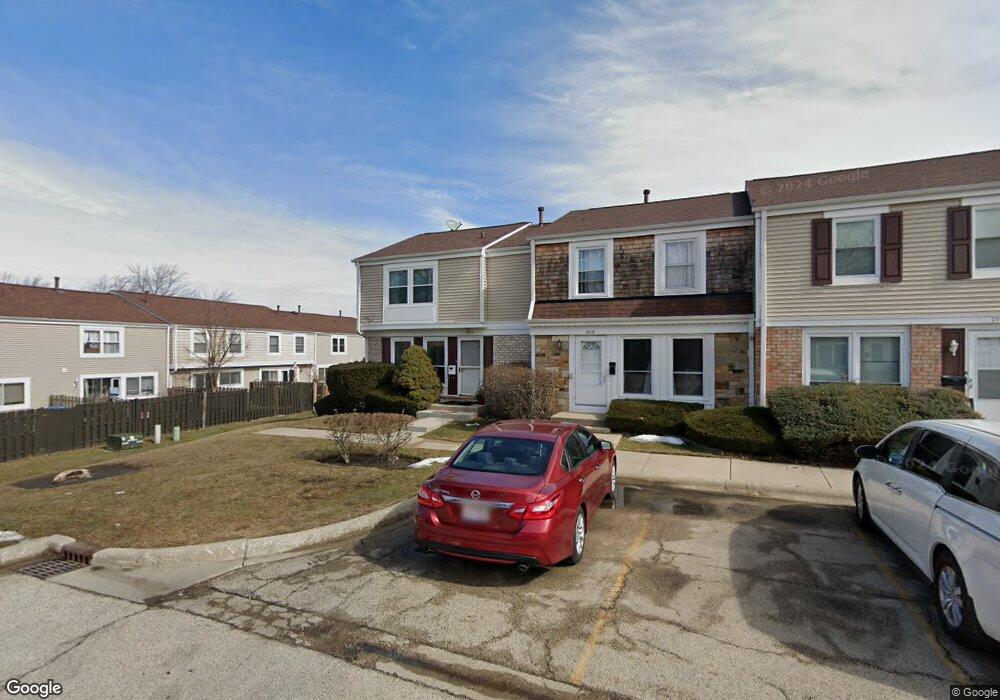
1977 Haddam Place Unit 2 Hoffman Estates, IL 60169
South Hoffman Estates NeighborhoodEstimated Value: $288,000 - $312,000
3
Beds
3
Baths
1,334
Sq Ft
$223/Sq Ft
Est. Value
About This Home
This home is located at 1977 Haddam Place Unit 2, Hoffman Estates, IL 60169 and is currently estimated at $297,468, approximately $222 per square foot. 1977 Haddam Place Unit 2 is a home located in Cook County with nearby schools including John Muir Literacy Academy, Dwight D Eisenhower Junior High School, and Hoffman Estates High School.
Ownership History
Date
Name
Owned For
Owner Type
Purchase Details
Closed on
Aug 1, 1994
Sold by
Wagner Stilwell Alba and Wagner Norma J
Bought by
Hill Gerard H and Hill Tanna L
Current Estimated Value
Home Financials for this Owner
Home Financials are based on the most recent Mortgage that was taken out on this home.
Original Mortgage
$95,000
Interest Rate
8.59%
Mortgage Type
VA
Create a Home Valuation Report for This Property
The Home Valuation Report is an in-depth analysis detailing your home's value as well as a comparison with similar homes in the area
Home Values in the Area
Average Home Value in this Area
Purchase History
| Date | Buyer | Sale Price | Title Company |
|---|---|---|---|
| Hill Gerard H | $95,000 | -- |
Source: Public Records
Mortgage History
| Date | Status | Borrower | Loan Amount |
|---|---|---|---|
| Closed | Hill Gerard H | $95,000 |
Source: Public Records
Tax History Compared to Growth
Tax History
| Year | Tax Paid | Tax Assessment Tax Assessment Total Assessment is a certain percentage of the fair market value that is determined by local assessors to be the total taxable value of land and additions on the property. | Land | Improvement |
|---|---|---|---|---|
| 2024 | $4,813 | $19,000 | $3,000 | $16,000 |
| 2023 | $4,627 | $19,000 | $3,000 | $16,000 |
| 2022 | $4,627 | $19,000 | $3,000 | $16,000 |
| 2021 | $3,660 | $14,254 | $2,508 | $11,746 |
| 2020 | $3,649 | $14,254 | $2,508 | $11,746 |
| 2019 | $3,633 | $15,838 | $2,508 | $13,330 |
| 2018 | $3,997 | $15,694 | $2,190 | $13,504 |
| 2017 | $3,945 | $15,694 | $2,190 | $13,504 |
| 2016 | $3,932 | $15,694 | $2,190 | $13,504 |
| 2015 | $3,443 | $13,344 | $1,911 | $11,433 |
| 2014 | $3,400 | $13,344 | $1,911 | $11,433 |
| 2013 | $3,294 | $13,344 | $1,911 | $11,433 |
Source: Public Records
Map
Nearby Homes
- 1956 Georgetown Ln Unit 4
- 1925 Georgetown Ln Unit 4
- 1886 Stockton Dr Unit 3253
- 1996 Blackberry Ln Unit 14
- 1862 Stockton Dr Unit 3283
- 2230 Stratham Place
- 1840 Huntington Blvd Unit 415
- 1840 Huntington Blvd Unit 412
- 1854 Huntington Blvd Unit C
- 1685 Cornell Dr
- 1672 Cornell Dr
- 1738 Ardwick Dr
- 1808 Fayette Walk Unit H
- 1800 Huntington Blvd Unit AE615
- 1977 Kenilworth Cir Unit D
- 1940 Kenilworth Cir Unit D
- 1704 Fayette Walk Unit B
- 1763 Bristol Walk Unit 1763
- 2004 E Parkview Cir
- 1475 Rebecca Dr Unit 217
- 1975 Haddam Place Unit 2
- 1975 Haddam Place
- 1973 Haddam Place
- 1971 Haddam Place Unit 2
- 2105 Kettering Rd Unit 2
- 2101 Kettering Rd Unit 2
- 1969 Haddam Place
- 2109 Kettering Rd Unit 2
- 2097 Kettering Rd
- 2111 Kettering Rd
- 2093 Kettering Rd Unit 2093
- 1976 Swindon Place
- 1967 Haddam Place Unit 2
- 2113 Kettering Rd Unit 2
- 2089 Kettering Rd Unit 2
- 1974 Swindon Place Unit 2
- 1974 Swindon Place Unit 1964
- 1972 Swindon Place Unit 2
- 1970 Swindon Place Unit 2
- 2085 Kettering Rd Unit 2