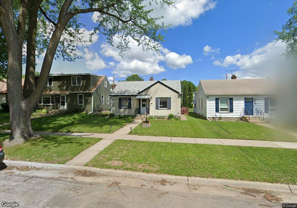
1977 Hawthorne Ave E Saint Paul, MN 55119
Southern Hayden Heights NeighborhoodEstimated Value: $219,000 - $248,000
2
Beds
1
Bath
1,380
Sq Ft
$170/Sq Ft
Est. Value
About This Home
This home is located at 1977 Hawthorne Ave E, Saint Paul, MN 55119 and is currently estimated at $235,256, approximately $170 per square foot. 1977 Hawthorne Ave E is a home located in Ramsey County with nearby schools including The Heights Community School, Battle Creek Middle School, and Johnson Senior High School.
Ownership History
Date
Name
Owned For
Owner Type
Purchase Details
Closed on
Oct 19, 2022
Sold by
City Of Saint Paul
Bought by
Independent School District No 625
Current Estimated Value
Purchase Details
Closed on
Mar 4, 2019
Sold by
J L James Investment Group Llc
Bought by
Carlson Cole and Valenziano Miranda
Home Financials for this Owner
Home Financials are based on the most recent Mortgage that was taken out on this home.
Original Mortgage
$173,630
Interest Rate
4.4%
Mortgage Type
New Conventional
Purchase Details
Closed on
Aug 6, 2018
Sold by
Hartjen Tracy Fausone
Bought by
J L James Investments Group Llc
Home Financials for this Owner
Home Financials are based on the most recent Mortgage that was taken out on this home.
Original Mortgage
$122,000
Interest Rate
4.5%
Mortgage Type
Commercial
Create a Home Valuation Report for This Property
The Home Valuation Report is an in-depth analysis detailing your home's value as well as a comparison with similar homes in the area
Home Values in the Area
Average Home Value in this Area
Purchase History
We collect this data history from publicly available records. To have your information removed, we recommend requesting removal directly through your county’s website.
| Date | Buyer | Sale Price | Title Company |
|---|---|---|---|
| Independent School District No 625 | -- | -- | |
| Carlson Cole | $179,000 | Titlesmart Inc | |
| J L James Investments Group Llc | $120,000 | Partners Title Llc | |
| Hartjen Tracy Fausone | -- | Partners Title Llc |
Source: Public Records
Mortgage History
We collect this data history from publicly available records. To have your information removed, we recommend requesting removal directly through your county’s website.
| Date | Status | Borrower | Loan Amount |
|---|---|---|---|
| Previous Owner | Carlson Cole | $173,630 | |
| Previous Owner | Hartjen Tracy Fausone | $122,000 |
Source: Public Records
Tax History
| Year | Tax Paid | Tax Assessment Tax Assessment Total Assessment is a certain percentage of the fair market value that is determined by local assessors to be the total taxable value of land and additions on the property. | Land | Improvement |
|---|---|---|---|---|
| 2025 | $3,036 | $219,900 | $30,000 | $189,900 |
| 2023 | $3,036 | $207,200 | $25,000 | $182,200 |
| 2022 | $2,844 | $222,400 | $25,000 | $197,400 |
| 2021 | $2,590 | $181,200 | $25,000 | $156,200 |
| 2020 | $2,264 | $171,800 | $19,400 | $152,400 |
| 2019 | $2,334 | $152,200 | $19,400 | $132,800 |
| 2018 | $1,948 | $151,200 | $19,400 | $131,800 |
| 2017 | $1,454 | $136,500 | $19,400 | $117,100 |
| 2016 | $1,458 | $0 | $0 | $0 |
| 2015 | $1,312 | $109,200 | $19,400 | $89,800 |
| 2014 | $870 | $0 | $0 | $0 |
Source: Public Records
Map
Nearby Homes
- 1885 Hawthorne Ave E
- 1871 Hyacinth Ave E
- 1856 Orange Ave E
- 2042 Cottage Ave E
- 1827 Maryland Ave E
- 2003 Cottage Ave E
- 2019 Cottage Ave E
- 1809 Hyacinth Ave E
- 2155 Ivy Ave E Unit 1
- 1776 Maryland Ave E Unit 201
- 1776 Maryland Ave E Unit 106
- 1360 Winthrop St N Unit 2
- 1771 Ivy Ave E
- 1806 Sherwood Ave
- 1809 Mechanic Ave
- 1112 Breen St
- 1381 White Bear Ave N
- 2210 Ivy Ave E
- 2099 Lacrosse Ave
- 1479 Winthrop St N
- 1971 Hawthorne Ave E
- 1981 Hawthorne Ave E
- 1967 Hawthorne Ave E
- 1985 Hawthorne Ave E
- 1963 Hawthorne Ave E
- 1989 Hawthorne Ave E
- 1974 Orange Ave E
- 1980 Orange Ave E
- 1980 1980 Orange-Avenue-e
- 1976 1976 Orange-Avenue-e
- 1959 Hawthorne Ave E
- 1970 Orange Ave E
- 1986 Orange Ave E
- 1966 Orange Ave E
- 1976 Hawthorne Ave E
- 1982 Hawthorne Ave E
- 1997 Hawthorne Ave E
- 1986 Hawthorne Ave E
- 1992 Orange Ave E
- 1968 Hawthorne Ave E
Your Personal Tour Guide
Ask me questions while you tour the home.