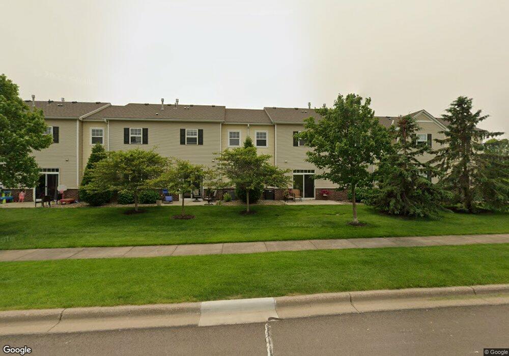
1977 Sierra Dr Unit 209 Hastings, MN 55033
Hastings-Marshan Township NeighborhoodEstimated Value: $249,004 - $276,000
2
Beds
2
Baths
1,445
Sq Ft
$183/Sq Ft
Est. Value
About This Home
This home is located at 1977 Sierra Dr Unit 209, Hastings, MN 55033 and is currently estimated at $263,751, approximately $182 per square foot. 1977 Sierra Dr Unit 209 is a home located in Dakota County with nearby schools including Christa Mcauliffe Elementary School, Hastings Middle School, and Hastings High School.
Ownership History
Date
Name
Owned For
Owner Type
Purchase Details
Closed on
Jun 15, 2017
Sold by
Staiger John and Staiger Margaret
Bought by
Staiger Jane
Current Estimated Value
Home Financials for this Owner
Home Financials are based on the most recent Mortgage that was taken out on this home.
Original Mortgage
$95,194
Outstanding Balance
$79,182
Interest Rate
4.02%
Mortgage Type
Future Advance Clause Open End Mortgage
Estimated Equity
$184,569
Purchase Details
Closed on
Feb 24, 2017
Sold by
Dehaan Derek D and Dehaan Shawna L
Bought by
Staiger John
Home Financials for this Owner
Home Financials are based on the most recent Mortgage that was taken out on this home.
Original Mortgage
$127,900
Interest Rate
4.19%
Mortgage Type
Future Advance Clause Open End Mortgage
Purchase Details
Closed on
Nov 8, 2007
Sold by
Centex Homes Minnesota Division
Bought by
Dehaan Derek D and Forschen Shawna L
Create a Home Valuation Report for This Property
The Home Valuation Report is an in-depth analysis detailing your home's value as well as a comparison with similar homes in the area
Home Values in the Area
Average Home Value in this Area
Purchase History
| Date | Buyer | Sale Price | Title Company |
|---|---|---|---|
| Staiger Jane | $127,900 | Executive Title | |
| Staiger John | $159,900 | Burnet Title | |
| Dehaan Derek D | $166,610 | -- |
Source: Public Records
Mortgage History
| Date | Status | Borrower | Loan Amount |
|---|---|---|---|
| Open | Staiger Jane | $95,194 | |
| Previous Owner | Staiger John | $127,900 |
Source: Public Records
Tax History Compared to Growth
Tax History
| Year | Tax Paid | Tax Assessment Tax Assessment Total Assessment is a certain percentage of the fair market value that is determined by local assessors to be the total taxable value of land and additions on the property. | Land | Improvement |
|---|---|---|---|---|
| 2024 | $2,594 | $237,100 | $45,700 | $191,400 |
| 2023 | $2,594 | $237,500 | $45,400 | $192,100 |
| 2022 | $2,110 | $225,500 | $45,300 | $180,200 |
| 2021 | $1,994 | $188,000 | $39,400 | $148,600 |
| 2020 | $1,988 | $178,000 | $37,600 | $140,400 |
| 2019 | $1,902 | $172,500 | $35,800 | $136,700 |
| 2018 | $1,893 | $159,000 | $34,100 | $124,900 |
| 2017 | $2,017 | $154,000 | $32,500 | $121,500 |
| 2016 | $1,943 | $143,300 | $30,400 | $112,900 |
| 2015 | $1,743 | $134,500 | $29,200 | $105,300 |
| 2014 | -- | $121,400 | $27,900 | $93,500 |
| 2013 | -- | $102,900 | $24,500 | $78,400 |
Source: Public Records
Map
Nearby Homes
- 1967 Sierra Dr Unit 303
- 1960 Rose Way
- 1924 Rose Way Unit 609
- 1726 14th Ct W
- 1478 Pringle Ct
- 2725 General Sieben Dr
- 1767 Carleton Place
- 2109 Westpointe Dr
- 2117 Westpointe Dr
- 1832 Ridgepointe N
- 2157 Westpointe Dr
- 2120 Ridge Pointe Dr
- 2173 Westpointe Dr
- 1817 Ridgepointe Ct
- 2160 Ridge Pointe Dr
- 1500 Brittany Rd
- 2189 Westpointe Dr
- 1824 Fallbrooke Dr
- 1821 Fallbrooke Dr
- Alley Plan at Heritage Ridge - Villas
- 1977 Sierra Dr
- 1987 Sierra Dr
- 1987 Sierra Dr Unit 202
- 1979 Sierra Dr
- 1975 Sierra Dr
- 1989 Sierra Dr
- 1989 Sierra Dr
- 1985 Sierra Dr
- 1973 Sierra Dr Unit 207
- 1973 Sierra Dr
- 1983 Sierra Dr
- 1967 Sierra Dr
- 1969 Sierra Dr
- 1965 Sierra Dr
- 1971 Sierra Dr
- 1981 Sierra Dr
- 1997 Sierra Dr
- 1999 Sierra Dr
- 1995 Sierra Dr
- 1963 Sierra Dr