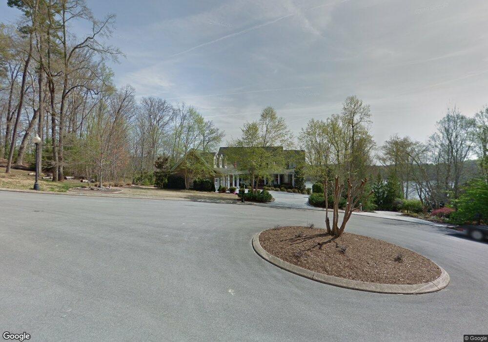
1979 Emerald Pointe Dr Unit LT 50 Soddy Daisy, TN 37379
Bakewell-Sale Creek NeighborhoodEstimated Value: $1,021,000 - $2,076,436
--
Bed
1
Bath
4,622
Sq Ft
$336/Sq Ft
Est. Value
About This Home
This home is located at 1979 Emerald Pointe Dr Unit LT 50, Soddy Daisy, TN 37379 and is currently estimated at $1,551,859, approximately $335 per square foot. 1979 Emerald Pointe Dr Unit LT 50 is a home located in Hamilton County with nearby schools including North Hamilton Elementary School.
Ownership History
Date
Name
Owned For
Owner Type
Purchase Details
Closed on
Jun 17, 2022
Sold by
Smith Patricia G
Bought by
William Bryan Peeples 2013 Irrevocable Trust
Current Estimated Value
Purchase Details
Closed on
Jan 21, 2014
Sold by
Smith Roger L
Bought by
Smith Patricia G
Purchase Details
Closed on
Dec 30, 2004
Sold by
Priest Don G and Priest Rosemary T
Bought by
Smith Roger L and Smith Patricia G
Purchase Details
Closed on
Aug 24, 2000
Sold by
Luttrell George W
Bought by
Priest Don W and Priest Rosemary T
Create a Home Valuation Report for This Property
The Home Valuation Report is an in-depth analysis detailing your home's value as well as a comparison with similar homes in the area
Home Values in the Area
Average Home Value in this Area
Purchase History
| Date | Buyer | Sale Price | Title Company |
|---|---|---|---|
| William Bryan Peeples 2013 Irrevocable Trust | $2,000,000 | Minor Firm | |
| Smith Patricia G | -- | None Available | |
| Smith Roger L | $299,000 | Northgate Title Escrow Inc | |
| Priest Don W | $270,000 | -- |
Source: Public Records
Tax History Compared to Growth
Tax History
| Year | Tax Paid | Tax Assessment Tax Assessment Total Assessment is a certain percentage of the fair market value that is determined by local assessors to be the total taxable value of land and additions on the property. | Land | Improvement |
|---|---|---|---|---|
| 2024 | $5,876 | $262,625 | $0 | $0 |
| 2023 | $5,885 | $262,625 | $0 | $0 |
| 2022 | $5,885 | $262,625 | $0 | $0 |
| 2021 | $5,885 | $262,625 | $0 | $0 |
| 2020 | $6,178 | $223,100 | $0 | $0 |
| 2019 | $6,178 | $223,100 | $0 | $0 |
| 2018 | $6,178 | $223,100 | $0 | $0 |
| 2017 | $6,178 | $223,100 | $0 | $0 |
| 2016 | $5,874 | $0 | $0 | $0 |
| 2015 | $5,874 | $212,100 | $0 | $0 |
| 2014 | $5,874 | $0 | $0 | $0 |
Source: Public Records
Map
Nearby Homes
- 1549 Leighton Dr
- 1444 Leighton Dr
- 1646 Ritz Way
- 13316 Bellacoola Rd
- 13300 Bellacoola Rd
- 12800 Blakeslee Dr
- 12733 Blakeslee Dr
- 1650 Criswell Ct
- 13652 Tonja Ln S
- 13670 Tonja Ln S
- 12951 Blakeslee Dr
- 13309 Blakeslee Dr
- 13114 Blakeslee Dr
- 13777 Tonja Ln S
- 13747 Lillard Rd
- 1344 Spitzy Ln
- 0 Bretton Dr Unit 1374141
- 13789 Bretton Dr
- 1053 Jonas Dr
- 13798 Tanoka Ct
- 1979 Emerald Pointe Dr
- 1965 Emerald Pointe Dr
- 1997 Emerald Pointe Dr
- 1943 Emerald Pointe Dr
- 1943 Emerald Pointe Dr Unit LT 48
- 1980 Emerald Pointe Dr
- 1919 Emerald Pointe Dr
- 1998 Emerald Pointe Dr
- 1934 Emerald Pointe Dr
- 1893 Emerald Pointe Dr
- 1912 Emerald Pointe Dr
- 1881 Emerald Pointe Dr
- 1869 Emerald Pointe Dr
- 1864 Emerald Pointe Dr
- 807 Brooke Stone Dr
- 819 Brooke Stone Dr
- 1855 Emerald Pointe Dr
- 1565 Native Trail
- 808 Brooke Stone Dr
- 1829 Emerald Pointe Dr