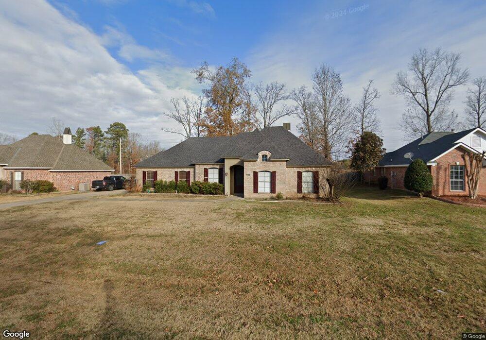
1979 Highpoint Place Haughton, LA 71037
Eastwood NeighborhoodEstimated Value: $352,539 - $374,000
4
Beds
2
Baths
2,038
Sq Ft
$178/Sq Ft
Est. Value
About This Home
This home is located at 1979 Highpoint Place, Haughton, LA 71037 and is currently estimated at $363,635, approximately $178 per square foot. 1979 Highpoint Place is a home located in Bossier Parish with nearby schools including T.L. Rodes Elementary School, Platt Elementary School, and Princeton Elementary School.
Ownership History
Date
Name
Owned For
Owner Type
Purchase Details
Closed on
Dec 9, 2005
Sold by
Jackson Home Builders Inc
Bought by
Gorman David Franklin and Gorman Brenda Gayle Brothers
Current Estimated Value
Home Financials for this Owner
Home Financials are based on the most recent Mortgage that was taken out on this home.
Original Mortgage
$50,000
Outstanding Balance
$17,306
Interest Rate
6.12%
Mortgage Type
Unknown
Estimated Equity
$346,329
Purchase Details
Closed on
Nov 8, 2005
Sold by
Jackson Home Builders Inc
Bought by
Gorman David Franklin and Gorman Brenda Gayle Brothers
Home Financials for this Owner
Home Financials are based on the most recent Mortgage that was taken out on this home.
Original Mortgage
$50,000
Outstanding Balance
$17,306
Interest Rate
6.12%
Mortgage Type
Unknown
Estimated Equity
$346,329
Create a Home Valuation Report for This Property
The Home Valuation Report is an in-depth analysis detailing your home's value as well as a comparison with similar homes in the area
Home Values in the Area
Average Home Value in this Area
Purchase History
| Date | Buyer | Sale Price | Title Company |
|---|---|---|---|
| Gorman David Franklin | $246,900 | None Available | |
| Gorman David Franklin | $246,900 | None Available |
Source: Public Records
Mortgage History
| Date | Status | Borrower | Loan Amount |
|---|---|---|---|
| Open | Gorman David Franklin | $50,000 | |
| Closed | Gorman David Franklin | $50,000 |
Source: Public Records
Tax History
| Year | Tax Paid | Tax Assessment Tax Assessment Total Assessment is a certain percentage of the fair market value that is determined by local assessors to be the total taxable value of land and additions on the property. | Land | Improvement |
|---|---|---|---|---|
| 2024 | $2,848 | $32,299 | $5,200 | $27,099 |
| 2023 | $2,364 | $26,525 | $3,950 | $22,575 |
| 2022 | $2,352 | $26,525 | $3,950 | $22,575 |
| 2021 | $2,352 | $26,525 | $3,950 | $22,575 |
| 2020 | $2,352 | $26,525 | $3,950 | $22,575 |
| 2019 | $2,258 | $25,530 | $2,950 | $22,580 |
| 2018 | $2,258 | $25,530 | $2,950 | $22,580 |
| 2017 | $2,230 | $25,530 | $2,950 | $22,580 |
| 2016 | $2,230 | $25,530 | $2,950 | $22,580 |
| 2015 | $2,116 | $25,650 | $2,950 | $22,700 |
| 2014 | $2,116 | $25,650 | $2,950 | $22,700 |
Source: Public Records
Map
Nearby Homes
- 1940 Honeytree Trail
- 3013 Sagefield Ln
- 2509 Bloomfield Ln
- 3028 Sagefield Ln
- 3034 Sagefield Ln
- 2104 Hollow Wood Way
- 2115 Hollow Wood Way
- 2816 Sunrise Point
- 109 Platt Dr
- 4705 Highway 80 Unit 1
- 109 Flagg Dr
- 15 Lee Ln
- 212 Sweetgum Dr
- 134 Crestwood Dr
- 0 Wafer Rd
- 207 Chimney Ln
- 2 Woodfern Ln
- 0 Bodcau Station Rd Unit 21132913
- 145 Elmview Ln
- 121 Casa Dr
- 1983 Highpoint Place
- 1975 Highpoint Place
- 1987 Highpoint Place
- 1971 Highpoint Place
- 1801 Sparrow Ridge
- 1900 Honeytree Trail
- 1991 Highpoint Place
- 1967 Highpoint Place
- 1805 Sparrow Ridge
- 1800 Sparrow Ridge
- 1904 Honeytree Trail
- 1995 Highpoint Place
- 1963 Highpoint Place
- 1901 Honeytree Trail
- 1804 Sparrow Ridge
- 1809 Sparrow Ridge
- 1908 Honeytree Trail
- 1905 Honeytree Trail
- 1701 Turning Leaf Trail
- 1959 Highpoint Place
Your Personal Tour Guide
Ask me questions while you tour the home.