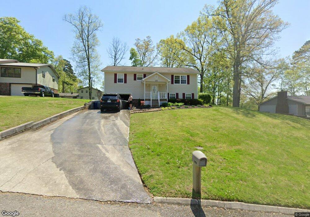
1979 Red Bird St Morristown, TN 37814
Estimated Value: $195,183 - $322,000
--
Bed
2
Baths
1,088
Sq Ft
$260/Sq Ft
Est. Value
About This Home
This home is located at 1979 Red Bird St, Morristown, TN 37814 and is currently estimated at $283,046, approximately $260 per square foot. 1979 Red Bird St is a home located in Hamblen County with nearby schools including Manley Elementary School, West View Middle School, and Morristown West High School.
Ownership History
Date
Name
Owned For
Owner Type
Purchase Details
Closed on
Sep 29, 1989
Bought by
Reed Ronnie L and Reed Kathryn S
Current Estimated Value
Purchase Details
Closed on
May 30, 1989
Bought by
Lanter Gregory Lyn
Purchase Details
Closed on
Apr 16, 1987
Bought by
Lanter Gregory L and Lanter Beverly I
Purchase Details
Closed on
Mar 18, 1987
Bought by
Admin Of Veterans Affairs
Purchase Details
Closed on
Dec 16, 1986
Bought by
Mortgage Corp Of The South
Create a Home Valuation Report for This Property
The Home Valuation Report is an in-depth analysis detailing your home's value as well as a comparison with similar homes in the area
Home Values in the Area
Average Home Value in this Area
Purchase History
| Date | Buyer | Sale Price | Title Company |
|---|---|---|---|
| Reed Ronnie L | $39,700 | -- | |
| Lanter Gregory Lyn | -- | -- | |
| Lanter Gregory L | -- | -- | |
| -- | $38,700 | -- | |
| Admin Of Veterans Affairs | $36,100 | -- | |
| Mortgage Corp Of The South | -- | -- |
Source: Public Records
Tax History Compared to Growth
Tax History
| Year | Tax Paid | Tax Assessment Tax Assessment Total Assessment is a certain percentage of the fair market value that is determined by local assessors to be the total taxable value of land and additions on the property. | Land | Improvement |
|---|---|---|---|---|
| 2024 | $556 | $28,200 | $6,025 | $22,175 |
| 2023 | $556 | $28,200 | $0 | $0 |
| 2022 | $556 | $28,200 | $6,025 | $22,175 |
| 2021 | $556 | $28,200 | $6,025 | $22,175 |
| 2020 | $556 | $28,200 | $6,025 | $22,175 |
| 2019 | $479 | $22,500 | $4,375 | $18,125 |
| 2018 | $479 | $22,500 | $4,375 | $18,125 |
| 2017 | $479 | $22,500 | $4,375 | $18,125 |
| 2016 | $448 | $22,500 | $4,375 | $18,125 |
| 2015 | $416 | $22,500 | $4,375 | $18,125 |
| 2014 | -- | $22,500 | $4,375 | $18,125 |
| 2013 | -- | $23,025 | $0 | $0 |
Source: Public Records
Map
Nearby Homes
- 1995 Bluebird Cir
- 1597 Kimberly Dr
- 1855 Joe Stephens Rd
- 1987 Joe Stephens Rd
- 1540 Kidwell Ridge Rd
- 1466 Dandelion Cir
- 3844 Isaac Ave
- 1406 Dandelion Cir
- 3245 Emerald Ave
- 3415 Emerald Ave
- 1701 Old Oak Ln
- 1465 Wind Crest Dr
- 3864 Apostle Rd
- 4229 Clear View Rd
- 1019 Ashley Ct
- 4193 Scarlett Dr
- 985 Kidwell Ridge Rd
- 1182 Murrell Rd
- 1121 Hickory View Dr
- 837 Foxglove Ln
- 1983 Red Bird St
- 1973 Red Bird St
- 1974 Dove St
- 1970 Dove St
- 1978 Dove St
- 1969 Red Bird St
- 1980 Red Bird St
- 1976 Red Bird St
- 1986 Red Bird St
- 1966 Dove St
- 1970 Red Bird St
- 1990 Red Bird St
- 1992 Dove St
- 1959 Red Bird St
- 1975 Dove St
- 1993 Quail Hollow Rd
- 1987 Quail Hollow Rd
- 1962 Dove St
- 1981 Dove St
- 1971 Dove St