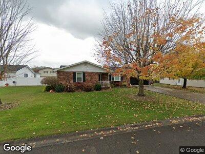
1979 Stivers Rd Aberdeen, OH 45101
Estimated Value: $162,000 - $245,000
2
Beds
2
Baths
1,388
Sq Ft
$145/Sq Ft
Est. Value
About This Home
This home is located at 1979 Stivers Rd, Aberdeen, OH 45101 and is currently estimated at $200,957, approximately $144 per square foot. 1979 Stivers Rd is a home located in Brown County with nearby schools including Ripley Union Lewis Huntington Elementary School, Ripley Union Lewis Huntington Middle School, and Ripley-Union-Lewis-Huntington High School.
Ownership History
Date
Name
Owned For
Owner Type
Purchase Details
Closed on
May 27, 2021
Sold by
Lancaster Kelly and Lancaster Teresa
Bought by
Mitchell Tracy W and Mitchell Glenda J
Current Estimated Value
Home Financials for this Owner
Home Financials are based on the most recent Mortgage that was taken out on this home.
Original Mortgage
$186,558
Interest Rate
2.93%
Mortgage Type
FHA
Create a Home Valuation Report for This Property
The Home Valuation Report is an in-depth analysis detailing your home's value as well as a comparison with similar homes in the area
Home Values in the Area
Average Home Value in this Area
Purchase History
| Date | Buyer | Sale Price | Title Company |
|---|---|---|---|
| Mitchell Tracy W | $190,000 | American Homeland Title Agcy |
Source: Public Records
Mortgage History
| Date | Status | Borrower | Loan Amount |
|---|---|---|---|
| Closed | Mitchell Tracy W | $186,558 |
Source: Public Records
Tax History Compared to Growth
Tax History
| Year | Tax Paid | Tax Assessment Tax Assessment Total Assessment is a certain percentage of the fair market value that is determined by local assessors to be the total taxable value of land and additions on the property. | Land | Improvement |
|---|---|---|---|---|
| 2024 | $1,851 | $52,240 | $4,650 | $47,590 |
| 2023 | $1,851 | $40,640 | $3,780 | $36,860 |
| 2022 | $1,627 | $40,640 | $3,780 | $36,860 |
| 2021 | $1,614 | $40,640 | $3,780 | $36,860 |
| 2020 | $1,480 | $35,340 | $3,280 | $32,060 |
| 2019 | $736 | $35,340 | $3,280 | $32,060 |
| 2018 | $1,284 | $35,340 | $3,280 | $32,060 |
| 2017 | $1,168 | $31,480 | $3,610 | $27,870 |
| 2016 | $1,167 | $31,480 | $3,610 | $27,870 |
| 2015 | $1,204 | $31,480 | $3,610 | $27,870 |
| 2014 | $1,204 | $31,150 | $3,280 | $27,870 |
| 2013 | $1,122 | $31,150 | $3,280 | $27,870 |
Source: Public Records
Map
Nearby Homes
- 1905 Stivers Rd
- Lot Stivers
- 0 Us Rt 52 Unit 1841882
- 1601 Friendship Rd
- 1876 River Rd
- 1783 River Rd
- 275 Barbour Dr
- 1109 Ash Point
- 1088 Ashwood Dr
- 0 Millston Dr
- 1189 Pennsylvania St
- 917 Jersey Ridge Rd
- 0 Clarence Ln Unit 43524
- 531 W 2nd St
- 456 W 3rd St
- 3027 Lake Charles Dr
- 448 W 2nd St
- 448 W 2nd St
- 315 W 3rd St
- 575 High St
- 1979 Stivers Rd
- 1979 Stivers Rd
- 1989 Stivers Rd
- 2010 Campbell Dr
- 2020 Campbell Dr
- 2000 Stivers Rd
- 1968 Stivers Rd
- 1968 Stivers Rd
- 2015 Stivers Rd
- 2001 Campbell Dr
- 1996 Campbell Dr
- 1981 Campbell Dr
- 1981 Campbell Dr
- 2015 Campbell Dr
- 2035 Campbell Dr
- 2026 Stivers Rd
- 1976 Campbell Dr
- 1971 Campbell Dr
- 2035 Stivers Rd
- 1925 Stivers Rd