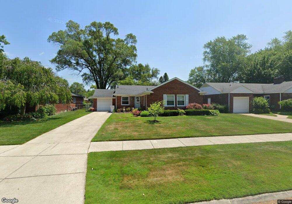
19792 Ida Ln W Grosse Pointe Woods, MI 48236
Estimated Value: $317,000 - $354,000
3
Beds
2
Baths
1,423
Sq Ft
$231/Sq Ft
Est. Value
About This Home
This home is located at 19792 Ida Ln W, Grosse Pointe Woods, MI 48236 and is currently estimated at $329,299, approximately $231 per square foot. 19792 Ida Ln W is a home located in Wayne County with nearby schools including John Monteith Elementary School, Brownell Middle School, and Grosse Pointe North High School.
Ownership History
Date
Name
Owned For
Owner Type
Purchase Details
Closed on
Aug 5, 2005
Sold by
Nardi James and Nardi Ann Marie
Bought by
Moulton Amy B
Current Estimated Value
Purchase Details
Closed on
Jul 28, 2004
Sold by
Nardi James L and Nardi Ann Marie
Bought by
Nardi James
Purchase Details
Closed on
Feb 26, 2004
Sold by
Hassigan Donald C
Bought by
Nardi James L
Purchase Details
Closed on
Nov 5, 2003
Sold by
Polsinelli Peggy and Hassigan Ruth A
Bought by
Hassigan Donald C
Create a Home Valuation Report for This Property
The Home Valuation Report is an in-depth analysis detailing your home's value as well as a comparison with similar homes in the area
Home Values in the Area
Average Home Value in this Area
Purchase History
| Date | Buyer | Sale Price | Title Company |
|---|---|---|---|
| Moulton Amy B | $230,000 | Metropolitan Title Company | |
| Nardi James | -- | Metro Title Corp | |
| Nardi James L | $175,000 | Metropolitan Title Company | |
| Hassigan Donald C | $50,000 | Chicago Title Insurance Comp |
Source: Public Records
Tax History Compared to Growth
Tax History
| Year | Tax Paid | Tax Assessment Tax Assessment Total Assessment is a certain percentage of the fair market value that is determined by local assessors to be the total taxable value of land and additions on the property. | Land | Improvement |
|---|---|---|---|---|
| 2025 | $3,045 | $144,700 | $0 | $0 |
| 2024 | $3,045 | $133,600 | $0 | $0 |
| 2023 | $2,928 | $126,100 | $0 | $0 |
| 2022 | $4,586 | $116,100 | $0 | $0 |
| 2021 | $4,372 | $107,600 | $0 | $0 |
| 2020 | $4,502 | $103,800 | $0 | $0 |
| 2019 | $2,666 | $99,200 | $0 | $0 |
| 2018 | $2,620 | $93,800 | $0 | $0 |
| 2017 | $3,044 | $88,200 | $0 | $0 |
| 2016 | $4,150 | $79,900 | $0 | $0 |
| 2015 | $7,193 | $73,400 | $0 | $0 |
| 2013 | $7,420 | $75,700 | $0 | $0 |
| 2012 | -- | $77,800 | $21,700 | $56,100 |
Source: Public Records
Map
Nearby Homes
- 19980 W Clairview Ct
- 463 Colonial Ct
- 809 Fairford Rd
- 410 Roland Ct
- 486 Bournemouth Rd
- 1597 Newcastle Rd
- 720 Fairford Rd
- 19299 Raymond St
- 450 Roland Rd
- 963 Lochmoor Blvd
- 1818 Norwood Dr
- 419 Maison Rd
- 19242 Eastborne St
- 19226 Eastborne St
- 1922 Oxford Rd
- 21602 Newcastle Rd
- 20363 Sunningdale Park
- 22200 Moross Rd
- 5228 Hillcrest St
- 21138 Huntington Ave