Estimated Value: $154,958 - $186,000
--
Bed
1
Bath
1,672
Sq Ft
$101/Sq Ft
Est. Value
About This Home
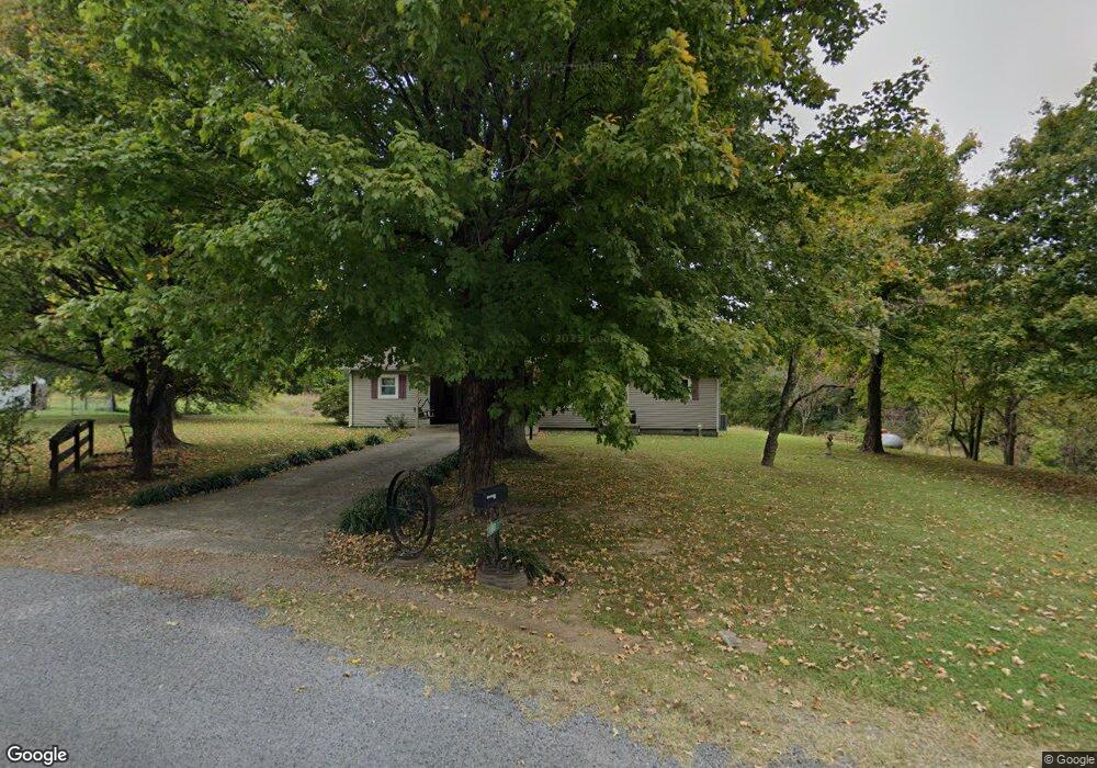
This home is located at 198 Flowers Rd, Troy, TN 38260 and is currently estimated at $168,653, approximately $100 per square foot. 198 Flowers Rd is a home located in Obion County.
Ownership History
Date
Name
Owned For
Owner Type
Purchase Details
Closed on
Apr 24, 2018
Sold by
Cook Tawanna
Bought by
Cook Tawanna and Cook Donald B
Current Estimated Value
Purchase Details
Closed on
Sep 16, 1991
Bought by
Flowers Lummie
Purchase Details
Closed on
Sep 1, 1989
Bought by
Flowers Lummie
Purchase Details
Closed on
Jul 30, 1987
Purchase Details
Closed on
Mar 18, 1964
Bought by
Flowers Lummie and Flowers Velma
Purchase Details
Closed on
Sep 28, 1960
Create a Home Valuation Report for This Property
The Home Valuation Report is an in-depth analysis detailing your home's value as well as a comparison with similar homes in the area
Home Values in the Area
Average Home Value in this Area
Purchase History
| Date | Buyer | Sale Price | Title Company |
|---|---|---|---|
| Cook Tawanna | -- | -- | |
| Flowers Lummie | -- | -- | |
| Flowers Lummie | -- | -- | |
| -- | -- | -- | |
| Flowers Lummie | -- | -- | |
| -- | -- | -- |
Source: Public Records
Tax History Compared to Growth
Tax History
| Year | Tax Paid | Tax Assessment Tax Assessment Total Assessment is a certain percentage of the fair market value that is determined by local assessors to be the total taxable value of land and additions on the property. | Land | Improvement |
|---|---|---|---|---|
| 2025 | $489 | $35,450 | $0 | $0 |
| 2024 | $489 | $35,450 | $4,125 | $31,325 |
| 2023 | $489 | $35,450 | $4,125 | $31,325 |
| 2022 | $297 | $15,650 | $3,700 | $11,950 |
| 2021 | $299 | $15,750 | $3,700 | $12,050 |
| 2020 | $299 | $15,750 | $3,700 | $12,050 |
| 2019 | $299 | $15,750 | $3,700 | $12,050 |
| 2018 | $420 | $22,025 | $4,375 | $17,650 |
| 2017 | $432 | $21,575 | $4,375 | $17,200 |
| 2016 | $287 | $14,300 | $4,375 | $9,925 |
| 2015 | $287 | $14,300 | $4,375 | $9,925 |
| 2014 | $287 | $14,300 | $4,375 | $9,925 |
Source: Public Records
Map
Nearby Homes
- 202 N Chestnut St
- 609 Westbrook St
- 307 N Maple St
- 0 Campground Rd Unit 241239
- 424 Mary Kay Dr
- 207 Main St
- 121 Easley St Unit 125 Easley
- 0 Cc Gurien Dr Unit RRA44568
- 1202 Hayes St
- 138 Virginia Dr
- 129 Virginia Dr
- 920 S Mary Jane St
- 608 Homestead Dr
- 614 Homestead Dr
- 622 Homestead Dr
- 713 Homestead Dr
- 533 Homestead Dr
- 525 Homestead Dr
- 523 Homestead Dr
- 619 Homestead Dr