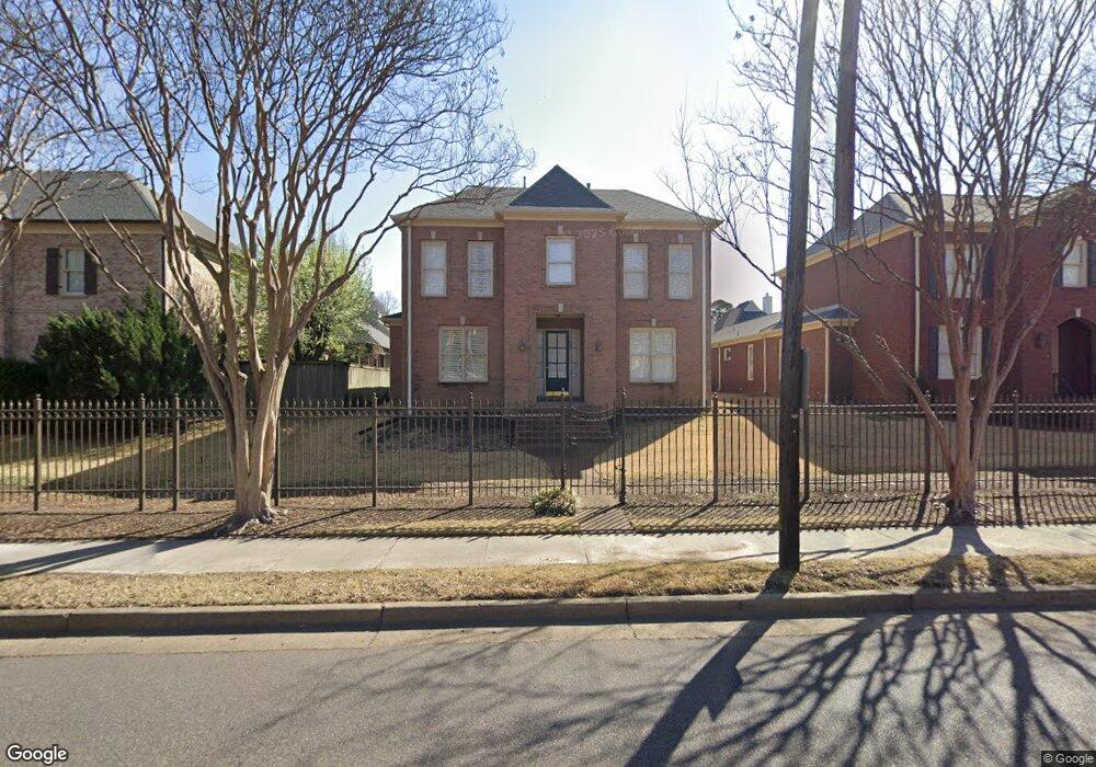
198 N White Station Rd Memphis, TN 38117
Audubon Park NeighborhoodEstimated Value: $501,000 - $565,000
3
Beds
3
Baths
3,346
Sq Ft
$158/Sq Ft
Est. Value
About This Home
This home is located at 198 N White Station Rd, Memphis, TN 38117 and is currently estimated at $530,193, approximately $158 per square foot. 198 N White Station Rd is a home located in Shelby County with nearby schools including Richland Elementary School, White Station Middle, and White Station High.
Ownership History
Date
Name
Owned For
Owner Type
Purchase Details
Closed on
Jul 26, 2022
Sold by
Joanne Thakkar Brenda
Bought by
Bdt Living Trust
Current Estimated Value
Purchase Details
Closed on
Jun 2, 2013
Sold by
Thakkar Pravin
Bought by
Thakkar Brenda
Purchase Details
Closed on
Mar 13, 2003
Sold by
Blackwood Francine E
Bought by
Thakkar Pilavin and Thakkar Brenda
Purchase Details
Closed on
Apr 27, 2001
Sold by
Mendelson Company Llc The
Bought by
Blackwood Francine E
Purchase Details
Closed on
Oct 20, 1999
Sold by
Justine Place L L C
Bought by
The Mendelson Company Llc
Home Financials for this Owner
Home Financials are based on the most recent Mortgage that was taken out on this home.
Original Mortgage
$73,500
Interest Rate
7.7%
Create a Home Valuation Report for This Property
The Home Valuation Report is an in-depth analysis detailing your home's value as well as a comparison with similar homes in the area
Home Values in the Area
Average Home Value in this Area
Purchase History
| Date | Buyer | Sale Price | Title Company |
|---|---|---|---|
| Bdt Living Trust | -- | Evans Petree Pc | |
| Thakkar Brenda | -- | None Available | |
| Thakkar Pilavin | $325,000 | Equity Title & Escrow Co | |
| Blackwood Francine E | $386,000 | -- | |
| The Mendelson Company Llc | $73,500 | -- |
Source: Public Records
Mortgage History
| Date | Status | Borrower | Loan Amount |
|---|---|---|---|
| Previous Owner | The Mendelson Company Llc | $73,500 |
Source: Public Records
Tax History Compared to Growth
Tax History
| Year | Tax Paid | Tax Assessment Tax Assessment Total Assessment is a certain percentage of the fair market value that is determined by local assessors to be the total taxable value of land and additions on the property. | Land | Improvement |
|---|---|---|---|---|
| 2025 | $3,931 | $125,725 | $19,250 | $106,475 |
| 2024 | $3,931 | $115,950 | $23,425 | $92,525 |
| 2023 | $7,063 | $115,950 | $23,425 | $92,525 |
| 2022 | $7,063 | $115,950 | $23,425 | $92,525 |
| 2021 | $3,146 | $115,950 | $23,425 | $92,525 |
| 2020 | $3,062 | $95,800 | $23,425 | $72,375 |
| 2019 | $3,062 | $95,800 | $23,425 | $72,375 |
| 2018 | $3,062 | $95,800 | $23,425 | $72,375 |
| 2017 | $3,134 | $95,800 | $23,425 | $72,375 |
| 2016 | $3,958 | $90,575 | $0 | $0 |
| 2014 | $3,958 | $90,575 | $0 | $0 |
Source: Public Records
Map
Nearby Homes
- 192 N White Station Rd
- 226 N White Station Rd
- 151 N White Station Rd
- 258 N White Station Rd
- 142 W Bendel Cir
- 5340 Rich Rd
- 125 W Bendel Cir
- 296 N White Station Rd
- 5238 Peg Ln
- 202 Betty jo Ln
- 5360 Normandy Ave
- 5103 Norich Ave
- 41 W Bendel Cir
- 5362 Wilton Ave
- 5081 Rich Rd
- 379 Mcelroy Rd
- 209 Leonora Dr
- 5429 Normandy Rd
- 5121 Lynbar Ave
- 346 Leonora Dr
- 204 N White Station Rd
- 212 N White Station Rd
- 186 N White Station Rd
- 197 Brenrich Cove S
- 191 Brenrich Cove S
- 180 N White Station Rd
- 185 Brenrich Cove S
- 211 Brenrich Cove S
- 5234 Mary Starnes Dr
- 179 Brenrich Cove S
- 5233 Mary Starnes Dr
- 172 N White Station Rd
- 219 Brenrich Cove N
- 5235 Heatherway Dr
- 173 Brenrich Cove S
- 175 N White Station Rd
- 196 Brenrich Cove S
- 204 Brenrich Cove S
- 190 Brenrich Cove S
- 227 Brenrich Cove N