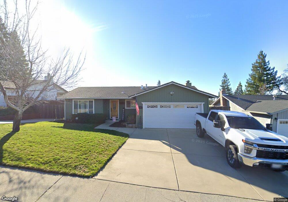
1980 Canal St Auburn, CA 95603
Country Club Estates NeighborhoodEstimated Value: $404,000 - $613,002
3
Beds
2
Baths
1,758
Sq Ft
$311/Sq Ft
Est. Value
About This Home
This home is located at 1980 Canal St, Auburn, CA 95603 and is currently estimated at $547,001, approximately $311 per square foot. 1980 Canal St is a home located in Placer County with nearby schools including Auburn Elementary School, Placer High School, and Bowman Charter School.
Ownership History
Date
Name
Owned For
Owner Type
Purchase Details
Closed on
Mar 12, 2020
Sold by
Mullenix James T and Mullenix Shemain L
Bought by
Mullenix James T and Mullenix Shemain L
Current Estimated Value
Home Financials for this Owner
Home Financials are based on the most recent Mortgage that was taken out on this home.
Original Mortgage
$340,454
Outstanding Balance
$300,946
Interest Rate
3.4%
Mortgage Type
New Conventional
Estimated Equity
$246,055
Purchase Details
Closed on
Jun 23, 2016
Sold by
Mullenix James T and Mullenix Shemain
Bought by
Mullenix Family Revocable Trust
Purchase Details
Closed on
Jan 23, 2007
Sold by
Perkins Martinez Ralph and Perkins Martinez Vicki M
Bought by
Perkins Vicki M and Mullenix James T
Purchase Details
Closed on
Feb 3, 2003
Sold by
Perkins Vickie M
Bought by
Perkins Martinez Ralph and Perkins Martinez Vicki M
Home Financials for this Owner
Home Financials are based on the most recent Mortgage that was taken out on this home.
Original Mortgage
$214,400
Interest Rate
5.76%
Purchase Details
Closed on
Jun 10, 2002
Sold by
Danzer Margaret G
Bought by
Dalpoggetto Andre B and Dalpoggetto Lisa Roberta
Home Financials for this Owner
Home Financials are based on the most recent Mortgage that was taken out on this home.
Original Mortgage
$238,500
Interest Rate
6.74%
Purchase Details
Closed on
Nov 5, 1999
Sold by
Lynn Wagnaar Jeffrey and Lynn Lorene Rebecca
Bought by
Danzer Margaret G
Home Financials for this Owner
Home Financials are based on the most recent Mortgage that was taken out on this home.
Original Mortgage
$144,800
Interest Rate
8%
Purchase Details
Closed on
Mar 25, 1994
Sold by
Mason Michael G and Mason Delicia B
Bought by
Wagnaar Jeffrey Lynn and Wagnaar Rebecca Lorene
Home Financials for this Owner
Home Financials are based on the most recent Mortgage that was taken out on this home.
Original Mortgage
$143,900
Interest Rate
7.15%
Create a Home Valuation Report for This Property
The Home Valuation Report is an in-depth analysis detailing your home's value as well as a comparison with similar homes in the area
Home Values in the Area
Average Home Value in this Area
Purchase History
| Date | Buyer | Sale Price | Title Company |
|---|---|---|---|
| Mullenix James T | -- | Fidelity Natl Ttl Co Of Ca | |
| Mullenix Family Revocable Trust | -- | None Available | |
| Perkins Vicki M | -- | Placer Title Company | |
| Perkins Martinez Ralph | -- | Placer Title Company | |
| Perkins Vickie M | -- | Placer Title | |
| Perkins Vickie M | $268,000 | Placer Title | |
| Dalpoggetto Andre B | $265,000 | North American Title Co | |
| Danzer Margaret G | $181,000 | North American Title Guarant | |
| Wagnaar Jeffrey Lynn | $160,000 | Sierra Valley Title Co |
Source: Public Records
Mortgage History
| Date | Status | Borrower | Loan Amount |
|---|---|---|---|
| Open | Mullenix James T | $340,454 | |
| Closed | Perkins Vickie M | $214,400 | |
| Previous Owner | Dalpoggetto Andre B | $238,500 | |
| Previous Owner | Danzer Margaret G | $144,800 | |
| Previous Owner | Wagnaar Jeffrey Lynn | $143,900 |
Source: Public Records
Tax History Compared to Growth
Tax History
| Year | Tax Paid | Tax Assessment Tax Assessment Total Assessment is a certain percentage of the fair market value that is determined by local assessors to be the total taxable value of land and additions on the property. | Land | Improvement |
|---|---|---|---|---|
| 2025 | $5,658 | $421,620 | $115,854 | $305,766 |
| 2023 | $5,658 | $405,250 | $111,356 | $293,894 |
| 2022 | $5,422 | $397,305 | $109,173 | $288,132 |
| 2021 | $5,269 | $389,516 | $107,033 | $282,483 |
| 2020 | $5,240 | $385,523 | $105,936 | $279,587 |
| 2019 | $5,164 | $377,964 | $103,859 | $274,105 |
| 2018 | $4,948 | $370,554 | $101,823 | $268,731 |
| 2017 | $4,880 | $363,289 | $99,827 | $263,462 |
| 2016 | $4,801 | $356,167 | $97,870 | $258,297 |
| 2015 | $4,713 | $350,818 | $96,400 | $254,418 |
| 2014 | $4,118 | $290,935 | $79,945 | $210,990 |
Source: Public Records
Map
Nearby Homes
- 1825 Calloway Cir
- 12318 Pepperwood Cir Unit 228
- 12366 Pepperwood Cir Unit 182
- 2415 Briar Meadow Cir
- 2425 Briar Meadow Cir
- 1624 Tulip Cir
- 2435 Briar Meadow Cir
- 1622 Spruce Ct
- 2505 Bramble Ct
- 2445 Briar Meadow Cir
- 1331 Wesley Ln
- 1333 Wesley Ln
- 2500 Bramble Ct
- 2510 Bramble Ct
- 1638 Alder Cir Unit 1638
- 12202 Hemlock Dr
- 1145 Sunny Creek Ct
- 0 Oak Ridge Way
- 12265 New Airport Rd
- 1130 Summer Ridge Ct
- 1960 Canal St
- 2010 Canal St
- 1845 Calloway Cir
- 1835 Calloway Cir
- 1855 Calloway Cir
- 2030 Canal St
- 2029 Canal St
- 1999 Canal St
- 1915 Bandos Ln
- 1865 Calloway Cir
- 1969 Canal St
- 1920 Canal St
- 2050 Canal St
- 1840 Calloway Cir
- 1939 Canal St
- 1850 Calloway Cir
- 1875 Calloway Cir
- 1815 Calloway Cir
- 12380 Krista Ln
- 12370 Krista Ln