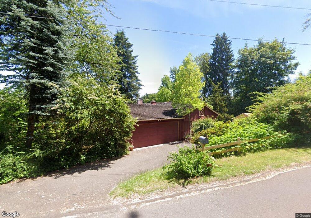
1980 Glenmorrie Dr Lake Oswego, OR 97034
Glenmorrie NeighborhoodEstimated Value: $1,255,000 - $1,478,000
3
Beds
3
Baths
3,232
Sq Ft
$421/Sq Ft
Est. Value
About This Home
This home is located at 1980 Glenmorrie Dr, Lake Oswego, OR 97034 and is currently estimated at $1,361,543, approximately $421 per square foot. 1980 Glenmorrie Dr is a home located in Clackamas County with nearby schools including Hallinan Elementary School, Lakeridge Middle School, and Lakeridge High School.
Ownership History
Date
Name
Owned For
Owner Type
Purchase Details
Closed on
Apr 22, 2016
Sold by
Silberbach G Michael and Welshons Paula R
Bought by
Welshons Silberbach G and Welshons Paula
Current Estimated Value
Purchase Details
Closed on
Oct 21, 1998
Sold by
Silberbach G Michael
Bought by
Silberbach G Michael and Welshons Paula R
Home Financials for this Owner
Home Financials are based on the most recent Mortgage that was taken out on this home.
Original Mortgage
$215,000
Outstanding Balance
$45,171
Interest Rate
6.71%
Estimated Equity
$1,316,372
Create a Home Valuation Report for This Property
The Home Valuation Report is an in-depth analysis detailing your home's value as well as a comparison with similar homes in the area
Home Values in the Area
Average Home Value in this Area
Purchase History
| Date | Buyer | Sale Price | Title Company |
|---|---|---|---|
| Welshons Silberbach G | -- | None Available | |
| Silberbach G Michael | -- | Fidelity National Title Co |
Source: Public Records
Mortgage History
| Date | Status | Borrower | Loan Amount |
|---|---|---|---|
| Open | Silberbach G Michael | $215,000 |
Source: Public Records
Tax History Compared to Growth
Tax History
| Year | Tax Paid | Tax Assessment Tax Assessment Total Assessment is a certain percentage of the fair market value that is determined by local assessors to be the total taxable value of land and additions on the property. | Land | Improvement |
|---|---|---|---|---|
| 2025 | $10,477 | $546,745 | -- | -- |
| 2024 | $10,198 | $530,821 | -- | -- |
| 2023 | $10,198 | $494,727 | $0 | $0 |
| 2022 | $9,220 | $480,318 | $0 | $0 |
| 2021 | $8,515 | $466,329 | $0 | $0 |
| 2020 | $8,301 | $452,747 | $0 | $0 |
| 2019 | $8,097 | $439,561 | $0 | $0 |
| 2018 | $7,699 | $426,758 | $0 | $0 |
| 2017 | $7,429 | $414,328 | $0 | $0 |
| 2016 | $6,762 | $402,260 | $0 | $0 |
| 2015 | $6,533 | $390,544 | $0 | $0 |
| 2014 | $6,259 | $368,030 | $0 | $0 |
Source: Public Records
Map
Nearby Homes
- 17514 Brookhurst Dr
- 17623 Brookhurst Dr
- 17634 Brookhurst Dr
- 1777 Skyland Dr
- 1354 Skye Pkwy
- 2147 Glenmorrie Ln
- 1384 Celtic Ct
- 2455 College Hill Place
- 17833 Marylcreek Dr
- 17900 Crestline Dr
- 17700 Upper Cherry Ln
- 1261 Wells St
- 777 Cherry Cir
- 1397 Skye Pkwy
- 2167 Marylwood Ct
- 200 Burnham Rd Unit 200
- 1060 Upper Devon Ln
- 990 Lund St
- 2636 Maria Ct
- 1321 Troon Dr
- 2066 Glenmorrie Dr
- 17442 Brookhurst Ct
- 17454 Brookhurst Ct
- 17430 Brookhurst Ct
- 2120 Glenmorrie Dr
- 17312 Chapin Way
- 17400 Brookhurst Dr
- 1920 Glenmorrie Dr
- 1925 Glenmorrie Dr
- 17395 Chapin Way
- 17406 Brookhurst Dr
- 2089 Glenmorrie Dr
- 17478 Brookhurst Dr
- 17250 Chapin Way
- 2111 Glenmorrie Dr
- 17433 Brookhurst Dr
- 1789 Glenmorrie Dr
- 17455 Brookhurst Dr
- 17403 Brookhurst Dr
- 2182 Glenmorrie Dr