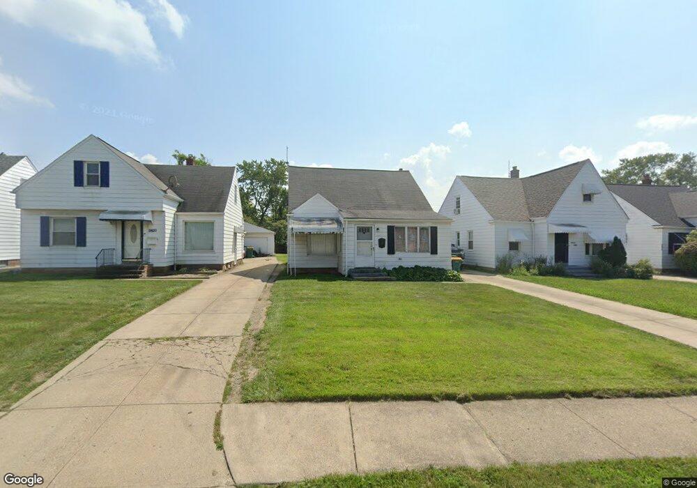
19808 Mccracken Rd Maple Heights, OH 44137
Estimated Value: $120,000 - $175,000
3
Beds
2
Baths
1,278
Sq Ft
$106/Sq Ft
Est. Value
About This Home
This home is located at 19808 Mccracken Rd, Maple Heights, OH 44137 and is currently estimated at $135,325, approximately $105 per square foot. 19808 Mccracken Rd is a home located in Cuyahoga County with nearby schools including Abraham Lincoln Elementary School, Rockside/ J.F. Kennedy School, and Italy High School.
Ownership History
Date
Name
Owned For
Owner Type
Purchase Details
Closed on
Jan 15, 2013
Sold by
Strozier Carla Renee
Bought by
Rosenberry Raymond
Current Estimated Value
Purchase Details
Closed on
Aug 20, 2001
Sold by
Bjel Gerald J and Bjel D M
Bought by
Strozier Carla Renee
Home Financials for this Owner
Home Financials are based on the most recent Mortgage that was taken out on this home.
Original Mortgage
$86,701
Interest Rate
7.28%
Mortgage Type
FHA
Purchase Details
Closed on
Jan 1, 1975
Bought by
Bjel Gerald J and D M
Create a Home Valuation Report for This Property
The Home Valuation Report is an in-depth analysis detailing your home's value as well as a comparison with similar homes in the area
Home Values in the Area
Average Home Value in this Area
Purchase History
| Date | Buyer | Sale Price | Title Company |
|---|---|---|---|
| Rosenberry Raymond | $47,600 | Attorney | |
| Strozier Carla Renee | $88,000 | Midland Title Security Inc | |
| Bjel Gerald J | -- | -- |
Source: Public Records
Mortgage History
| Date | Status | Borrower | Loan Amount |
|---|---|---|---|
| Previous Owner | Strozier Carla Renee | $86,701 | |
| Closed | Strozier Carla Renee | $3,468 |
Source: Public Records
Tax History Compared to Growth
Tax History
| Year | Tax Paid | Tax Assessment Tax Assessment Total Assessment is a certain percentage of the fair market value that is determined by local assessors to be the total taxable value of land and additions on the property. | Land | Improvement |
|---|---|---|---|---|
| 2024 | $3,389 | $37,835 | $6,545 | $31,290 |
| 2023 | $2,294 | $21,350 | $3,990 | $17,360 |
| 2022 | $2,286 | $21,350 | $3,990 | $17,360 |
| 2021 | $3,023 | $21,350 | $3,990 | $17,360 |
| 2020 | $2,083 | $16,170 | $3,010 | $13,160 |
| 2019 | $2,071 | $46,200 | $8,600 | $37,600 |
| 2018 | $1,950 | $16,170 | $3,010 | $13,160 |
| 2017 | $1,990 | $15,160 | $2,800 | $12,360 |
| 2016 | $1,925 | $15,160 | $2,800 | $12,360 |
| 2015 | $28,564 | $15,160 | $2,800 | $12,360 |
| 2014 | $28,564 | $16,660 | $3,080 | $13,580 |
Source: Public Records
Map
Nearby Homes
- 20120 Mccracken Rd
- 19309 Nitra Ave
- 20715 Watson Rd
- 5165 Camden Rd
- 19807 Gardenview Dr
- 20814 Watson Rd
- 19520 Maple Heights Blvd
- 20907 Watson Rd
- 19806 Mountville Dr
- 20107 Libby Rd
- 21102 Raymond St
- 20510 Mountville Dr
- 20701 Kenyon Dr
- 21207 Franklin Rd
- 5265 Bellview St
- 19812 Stockton Ave
- 20814 Kenyon Dr
- 19289 Stafford Ave
- 19221 Stafford Ave
- 18909 Maple Heights Blvd
- 19804 Mccracken Rd
- 19820 Mccracken Rd
- 19900 Mccracken Rd
- 19800 Mccracken Rd
- 19920 Mccracken Rd
- 19805 Fairway Ave
- 19809 Fairway Ave
- 19801 Fairway Ave
- 19813 Fairway Ave
- 19940 Mccracken Rd
- 19700 Mccracken Rd
- 19817 Fairway Ave
- 19960 Mccracken Rd
- 19690 Mccracken Rd
- 19901 Fairway Ave
- 19703 Fairway Ave
- 19980 Mccracken Rd
- 19670 Mccracken Rd
- 19617 Fairway Ave
- 19905 Fairway Ave