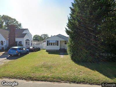
1981 Broadbridge Ave Stratford, CT 06614
Estimated Value: $306,000 - $403,000
3
Beds
1
Bath
1,052
Sq Ft
$339/Sq Ft
Est. Value
About This Home
This home is located at 1981 Broadbridge Ave, Stratford, CT 06614 and is currently estimated at $356,937, approximately $339 per square foot. 1981 Broadbridge Ave is a home located in Fairfield County with nearby schools including Nichols Elementary School, David Wooster Middle School, and Stratford High School.
Ownership History
Date
Name
Owned For
Owner Type
Purchase Details
Closed on
Oct 1, 2001
Sold by
Beauchemin Debra L
Bought by
Bourdeau Marie L
Current Estimated Value
Home Financials for this Owner
Home Financials are based on the most recent Mortgage that was taken out on this home.
Original Mortgage
$124,000
Interest Rate
8.8%
Purchase Details
Closed on
May 7, 1998
Sold by
Valovich Andre
Bought by
K-Beauchemin Debra
Create a Home Valuation Report for This Property
The Home Valuation Report is an in-depth analysis detailing your home's value as well as a comparison with similar homes in the area
Home Values in the Area
Average Home Value in this Area
Purchase History
| Date | Buyer | Sale Price | Title Company |
|---|---|---|---|
| Bourdeau Marie L | $155,000 | -- | |
| K-Beauchemin Debra | $108,000 | -- |
Source: Public Records
Mortgage History
| Date | Status | Borrower | Loan Amount |
|---|---|---|---|
| Open | Bourdeau Marie L | $50,473 | |
| Open | K-Beauchemin Debra | $183,831 | |
| Closed | K-Beauchemin Debra | $181,115 | |
| Closed | K-Beauchemin Debra | $10,000 | |
| Closed | K-Beauchemin Debra | $124,000 |
Source: Public Records
Tax History Compared to Growth
Tax History
| Year | Tax Paid | Tax Assessment Tax Assessment Total Assessment is a certain percentage of the fair market value that is determined by local assessors to be the total taxable value of land and additions on the property. | Land | Improvement |
|---|---|---|---|---|
| 2024 | $4,905 | $122,010 | $62,300 | $59,710 |
| 2023 | $4,905 | $122,010 | $62,300 | $59,710 |
| 2022 | $4,815 | $122,010 | $62,300 | $59,710 |
| 2021 | $4,816 | $122,010 | $62,300 | $59,710 |
| 2020 | $4,836 | $122,010 | $62,300 | $59,710 |
| 2019 | $4,689 | $117,600 | $54,180 | $63,420 |
| 2018 | $4,692 | $117,600 | $54,180 | $63,420 |
| 2017 | $4,700 | $117,600 | $54,180 | $63,420 |
| 2016 | $4,585 | $117,600 | $54,180 | $63,420 |
| 2015 | $4,349 | $117,600 | $54,180 | $63,420 |
| 2014 | $4,729 | $132,720 | $65,660 | $67,060 |
Source: Public Records
Map
Nearby Homes
- 68 Jesse Ave
- 1746 North Ave
- 59 Wiebe Ave
- 600 Barnum Terrace Extension
- 35 Leonard St
- 172 Mary Ave
- 97 Johnson Ave
- 1700 Broadbridge Ave Unit B17
- 1574 North Ave
- 83 Stonybrook Rd
- 52 Swanson Ave
- 93 Wyoming St
- 152 Stonybrook Rd
- 328 Henry Ave
- 598 Nichols Ave
- 1355 Hillside Ave
- 124 Light St
- 66 Edgewood St
- 0 Ct Unit 24025445
- 101 Nichols Terrace
- 1981 Broadbridge Ave
- 1971 Broadbridge Ave
- 1991 Broadbridge Ave
- 45 McQuillan St
- 1961 Broadbridge Ave
- 35 McQuillan St
- 28 McQuillan St
- 56 Klondike St
- 1976 Broadbridge Ave
- 1954 Broadbridge Ave
- 1935 Broadbridge Ave
- 1964 Broadbridge Ave
- 2008 Broadbridge Ave
- 1998 Broadbridge Ave
- 2027 Broadbridge Ave
- 76 Klondike St
- 2018 Broadbridge Ave
- 56 McQuillan St
- 44 Hortense St
- 50 Hortense St