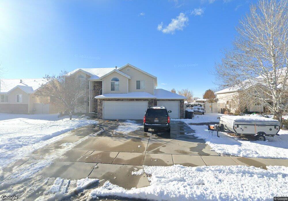
1981 N 2895 W Unit 27 Clearfield, UT 84015
Estimated Value: $542,329 - $670,000
4
Beds
3
Baths
2,296
Sq Ft
$261/Sq Ft
Est. Value
About This Home
This home is located at 1981 N 2895 W Unit 27, Clearfield, UT 84015 and is currently estimated at $599,082, approximately $260 per square foot. 1981 N 2895 W Unit 27 is a home located in Davis County with nearby schools including West Clinton Elementary School, West Point Junior High School, and Clearfield High School.
Ownership History
Date
Name
Owned For
Owner Type
Purchase Details
Closed on
Nov 30, 2020
Sold by
Lujan Dakota D and Lujan Hannah
Bought by
Lujan Dakota D and Lujan Hannah
Current Estimated Value
Home Financials for this Owner
Home Financials are based on the most recent Mortgage that was taken out on this home.
Original Mortgage
$264,400
Outstanding Balance
$235,278
Interest Rate
2.8%
Mortgage Type
New Conventional
Estimated Equity
$363,804
Purchase Details
Closed on
May 5, 2016
Sold by
Frye Jonathan C and Frye Angela R
Bought by
Lujan Dakota O and Lujan Hannah
Purchase Details
Closed on
Oct 22, 2012
Sold by
Frye Jonathan C
Bought by
Frye Jonathan C and Frye Angela R
Home Financials for this Owner
Home Financials are based on the most recent Mortgage that was taken out on this home.
Original Mortgage
$241,416
Interest Rate
3.25%
Mortgage Type
FHA
Purchase Details
Closed on
Apr 21, 2006
Sold by
Postel Raymond M
Bought by
Frye Jonathan C and Frye Angela R
Home Financials for this Owner
Home Financials are based on the most recent Mortgage that was taken out on this home.
Original Mortgage
$209,500
Interest Rate
8.35%
Mortgage Type
Fannie Mae Freddie Mac
Purchase Details
Closed on
Jan 26, 2004
Sold by
U S Development Inc and Postal Raymond M
Bought by
Postel Raymond M
Home Financials for this Owner
Home Financials are based on the most recent Mortgage that was taken out on this home.
Original Mortgage
$176,000
Interest Rate
5.86%
Mortgage Type
Purchase Money Mortgage
Purchase Details
Closed on
Dec 15, 2003
Sold by
U S Development Inc
Bought by
U S Development Inc and Postal Raymond M
Home Financials for this Owner
Home Financials are based on the most recent Mortgage that was taken out on this home.
Original Mortgage
$176,000
Interest Rate
5.86%
Mortgage Type
Purchase Money Mortgage
Create a Home Valuation Report for This Property
The Home Valuation Report is an in-depth analysis detailing your home's value as well as a comparison with similar homes in the area
Home Values in the Area
Average Home Value in this Area
Purchase History
| Date | Buyer | Sale Price | Title Company |
|---|---|---|---|
| Lujan Dakota D | -- | Hickman Land Title Co | |
| Lujan Dakota O | -- | Stewart Title | |
| Frye Jonathan C | -- | None Available | |
| Frye Jonathan C | -- | Hickman Land Title C | |
| Frye Jonathan C | -- | Inwest Title Services Inc | |
| Postel Raymond M | -- | Bonneville Title Company Inc | |
| U S Development Inc | -- | Bonneville Title Company Inc |
Source: Public Records
Mortgage History
| Date | Status | Borrower | Loan Amount |
|---|---|---|---|
| Open | Lujan Dakota D | $264,400 | |
| Previous Owner | Frye Jonathan C | $241,416 | |
| Previous Owner | Frye Jonathan C | $209,500 | |
| Previous Owner | Postel Raymond M | $176,000 |
Source: Public Records
Tax History Compared to Growth
Tax History
| Year | Tax Paid | Tax Assessment Tax Assessment Total Assessment is a certain percentage of the fair market value that is determined by local assessors to be the total taxable value of land and additions on the property. | Land | Improvement |
|---|---|---|---|---|
| 2025 | -- | $270,050 | $90,501 | $179,549 |
| 2024 | $2,606 | $272,800 | $99,465 | $173,335 |
| 2023 | $2,606 | $466,000 | $113,191 | $352,809 |
| 2022 | $2,819 | $278,850 | $69,209 | $209,641 |
| 2021 | $2,582 | $379,000 | $86,692 | $292,308 |
| 2020 | $2,238 | $325,000 | $73,690 | $251,310 |
| 2019 | $2,178 | $309,000 | $86,064 | $222,936 |
| 2018 | $2,001 | $279,000 | $72,686 | $206,314 |
| 2016 | $1,844 | $132,715 | $28,310 | $104,405 |
| 2015 | $1,750 | $119,790 | $28,310 | $91,480 |
| 2014 | $1,625 | $112,971 | $28,310 | $84,661 |
| 2013 | -- | $117,276 | $27,143 | $90,133 |
Source: Public Records
Map
Nearby Homes
- 1958 N 2750 W
- 3941 W 1800 N
- 339 N 3250 W Unit 12
- 3298 W 2300 N
- Harvard Plan at Summerfield - Enclave
- 2208 W 2615 N
- Linden Plan at Summerfield - Vista
- Yale Plan at Summerfield - Enclave
- Gambel Oak Plan at Summerfield - Vista
- Cedar Plan at Summerfield - Vista
- Elm Plan at Summerfield - Vista
- Princeton Plan at Summerfield - Enclave
- Cambridge Plan at Summerfield - Enclave
- Cornell Plan at Summerfield - Enclave
- Sycamore Plan at Summerfield - Vista
- Berkeley Plan at Summerfield - Enclave
- Birch Plan at Summerfield - Vista
- Stanford Plan at Summerfield - Enclave
- 2322 N 2500 W
- 2642 W 1500 N
- 1981 N 2895 W
- 1969 N 2895 W
- 1993 N 2895 W
- 1993 N 2895 W Unit 26
- 2918 W 1950 N Unit 28
- 2934 W 1950 N
- 2934 W 1950 N Unit 29
- 2017 N 2895 W
- 2937 W 2025 N
- 2937 W 2025 N Unit 24
- 2942 W 1950 N
- 2942 W 1950 N Unit 30
- 2913 W 2025 N
- 2913 W 2025 N Unit 25
- 1978 N 2895 W
- 1992 N 2895 W
- 1964 N 2895 W
- 2941 W 2025 N
- 2006 N 2895 W
- 2006 N 2895 W Unit 11