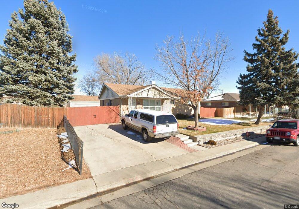
1981 Samuel Dr Denver, CO 80221
Twin Lakes NeighborhoodEstimated Value: $410,322 - $458,000
6
Beds
2
Baths
2,288
Sq Ft
$191/Sq Ft
Est. Value
About This Home
This home is located at 1981 Samuel Dr, Denver, CO 80221 and is currently estimated at $436,581, approximately $190 per square foot. 1981 Samuel Dr is a home located in Adams County with nearby schools including Orchard Park Academy, Colorado Sports Leadership Academy, and Westminster High School.
Ownership History
Date
Name
Owned For
Owner Type
Purchase Details
Closed on
Nov 21, 2008
Sold by
Deutsche Bank Trust Company Americas
Bought by
Maltos Leonel
Current Estimated Value
Home Financials for this Owner
Home Financials are based on the most recent Mortgage that was taken out on this home.
Original Mortgage
$113,502
Outstanding Balance
$74,803
Interest Rate
6.5%
Mortgage Type
FHA
Estimated Equity
$361,778
Purchase Details
Closed on
Aug 27, 2008
Sold by
Kunselman Barry
Bought by
Deutsche Bank Trust Co Americas
Purchase Details
Closed on
Dec 21, 2005
Sold by
Broomfield Lending Llc
Bought by
Kunselman Barry
Home Financials for this Owner
Home Financials are based on the most recent Mortgage that was taken out on this home.
Original Mortgage
$164,000
Interest Rate
6.75%
Mortgage Type
Fannie Mae Freddie Mac
Purchase Details
Closed on
Jun 9, 2005
Sold by
Owen Evelyn May and Owen Evelyn M
Bought by
Broomfield Lending Llc
Purchase Details
Closed on
Apr 30, 1993
Create a Home Valuation Report for This Property
The Home Valuation Report is an in-depth analysis detailing your home's value as well as a comparison with similar homes in the area
Home Values in the Area
Average Home Value in this Area
Purchase History
| Date | Buyer | Sale Price | Title Company |
|---|---|---|---|
| Maltos Leonel | $115,000 | Fahtco | |
| Deutsche Bank Trust Co Americas | -- | None Available | |
| Kunselman Barry | $205,000 | Northwest Title | |
| Broomfield Lending Llc | $45,000 | -- | |
| -- | -- | -- |
Source: Public Records
Mortgage History
| Date | Status | Borrower | Loan Amount |
|---|---|---|---|
| Open | Maltos Leonel | $113,502 | |
| Previous Owner | Kunselman Barry | $164,000 |
Source: Public Records
Tax History
| Year | Tax Paid | Tax Assessment Tax Assessment Total Assessment is a certain percentage of the fair market value that is determined by local assessors to be the total taxable value of land and additions on the property. | Land | Improvement |
|---|---|---|---|---|
| 2025 | $3,188 | $29,510 | $6,120 | $23,390 |
| 2024 | $3,188 | $27,130 | $5,630 | $21,500 |
| 2023 | $3,170 | $31,180 | $5,610 | $25,570 |
| 2022 | $3,030 | $24,740 | $5,770 | $18,970 |
| 2021 | $3,155 | $24,740 | $5,770 | $18,970 |
| 2020 | $2,896 | $23,570 | $5,790 | $17,780 |
| 2019 | $2,885 | $23,570 | $5,790 | $17,780 |
| 2018 | $2,177 | $17,580 | $5,620 | $11,960 |
| 2017 | $1,909 | $17,580 | $5,620 | $11,960 |
| 2016 | $1,522 | $13,240 | $2,710 | $10,530 |
| 2015 | $1,520 | $13,240 | $2,710 | $10,530 |
| 2014 | -- | $12,150 | $2,230 | $9,920 |
Source: Public Records
Map
Nearby Homes
- 7488 Quivas St
- 7426 Skyline Dr
- 2513 W 74th Ave
- 2500 Westchester Dr
- 2420 Cottonwood Dr
- 7820 Tejon St
- 7050 Alan Dr
- 7211 Bryant St
- 7051 Ruth Way
- 7836 Vallejo St
- 7831 Shoshone St
- 7798 Quivas St
- 7020 Avrum Dr
- 2612 Meadowbrook Dr
- 1665 Elmwood Ln
- 7350 Dale Ct
- 2785 Skyline Dr
- 2682 Meadowbrook Dr
- 1281 Mariposa Dr
- 7396 Decatur St
- 2001 Samuel Dr
- 1961 Samuel Dr
- 2021 Samuel Dr
- 1941 Samuel Dr
- 1980 Samuel Dr
- 1960 Samuel Dr
- 2020 Samuel Dr
- 1940 Samuel Dr
- 1921 Samuel Dr
- 2040 Samuel Dr
- 2041 Samuel Dr
- 1920 Samuel Dr
- 2041 W 74th Ave
- 7380 Alan Dr
- 2051 W 74th Ave
- 2060 Samuel Dr
- 1881 Samuel Dr
- 2061 Samuel Dr
- 7370 Alan Dr
- 1931 W 73rd Place
Your Personal Tour Guide
Ask me questions while you tour the home.