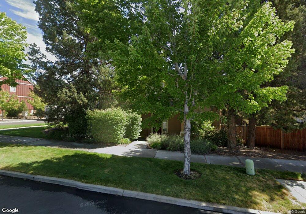
19815 Powers Rd Bend, OR 97702
Southwest Bend NeighborhoodEstimated Value: $797,214 - $861,000
4
Beds
3
Baths
3,000
Sq Ft
$272/Sq Ft
Est. Value
About This Home
This home is located at 19815 Powers Rd, Bend, OR 97702 and is currently estimated at $815,804, approximately $271 per square foot. 19815 Powers Rd is a home located in Deschutes County with nearby schools including Pine Ridge Elementary School, Cascade Middle School, and Bend Senior High School.
Ownership History
Date
Name
Owned For
Owner Type
Purchase Details
Closed on
Jul 3, 2023
Sold by
Burnett Eric James
Bought by
Burnett Beth Ann
Current Estimated Value
Purchase Details
Closed on
Jul 16, 2008
Sold by
Dmr Management Llc
Bought by
Burnett Eric and Burnett Beth
Home Financials for this Owner
Home Financials are based on the most recent Mortgage that was taken out on this home.
Original Mortgage
$284,665
Interest Rate
6.31%
Mortgage Type
Unknown
Purchase Details
Closed on
Oct 5, 2006
Sold by
Mt River Estates Llc
Bought by
Don Morissette Homes Inc
Home Financials for this Owner
Home Financials are based on the most recent Mortgage that was taken out on this home.
Original Mortgage
$37,500,000
Interest Rate
6.43%
Mortgage Type
Credit Line Revolving
Create a Home Valuation Report for This Property
The Home Valuation Report is an in-depth analysis detailing your home's value as well as a comparison with similar homes in the area
Home Values in the Area
Average Home Value in this Area
Purchase History
| Date | Buyer | Sale Price | Title Company |
|---|---|---|---|
| Burnett Beth Ann | -- | None Listed On Document | |
| Burnett Eric | $334,900 | First American Title | |
| Don Morissette Homes Inc | $1,440,000 | First Amer Title Ins Co Or |
Source: Public Records
Mortgage History
| Date | Status | Borrower | Loan Amount |
|---|---|---|---|
| Previous Owner | Burnett Eric | $284,665 | |
| Previous Owner | Don Morissette Homes Inc | $37,500,000 |
Source: Public Records
Tax History Compared to Growth
Tax History
| Year | Tax Paid | Tax Assessment Tax Assessment Total Assessment is a certain percentage of the fair market value that is determined by local assessors to be the total taxable value of land and additions on the property. | Land | Improvement |
|---|---|---|---|---|
| 2025 | $5,694 | $336,980 | -- | -- |
| 2024 | $5,478 | $327,170 | -- | -- |
| 2023 | $5,078 | $317,650 | $0 | $0 |
| 2022 | $4,738 | $299,420 | $0 | $0 |
| 2021 | $4,745 | $290,700 | $0 | $0 |
| 2020 | $4,502 | $290,700 | $0 | $0 |
| 2019 | $4,376 | $282,240 | $0 | $0 |
| 2018 | $4,253 | $274,020 | $0 | $0 |
| 2017 | $4,194 | $266,040 | $0 | $0 |
| 2016 | $4,003 | $258,300 | $0 | $0 |
| 2015 | $3,894 | $250,780 | $0 | $0 |
| 2014 | $3,781 | $243,480 | $0 | $0 |
Source: Public Records
Map
Nearby Homes
- 61257 Bronze Meadow Ln
- 61344 Elkhorn St
- 20050 Elizabeth Ln
- 61369 Elkhorn St
- 61193 Hitching Post Ln
- 20041 Voltera Place
- 61375 Huckleberry Place
- 19788 Chicory Ave
- 20076 Mount Hope Ln
- 61379 Sally Ln
- 61388 Elkhorn St
- 20082 Beth Ave
- 0 Pinebrook Blvd Unit 220199740
- 20085 Sally Ct
- 61279 Gorge View St
- 19779 Hollygrape St
- 19793 Astro Place
- 60915 SE Epic Place
- 20839 SE Caldera Dr
- 61040 S Queens Dr Unit 18
- 19811 Powers Rd
- 19926 Porcupine Dr
- 19823 Powers Rd
- 19807 Powers Rd
- 19938 Porcupine Dr
- 0 2 Lots- Powers Rd Unit 201010277
- 19816 Powers Rd
- 19820 SW Powers Rd
- 19812 SW Powers Rd
- 19824 Powers Rd
- 19808 Powers Rd
- 19808 SW Powers
- 19933 Brass Dr
- 19942 Porcupine Dr
- 19828 Powers Rd
- 19923 Cliffrose Dr
- 19927 Cliffrose Dr
- 19933 Porcupine Dr
- 19932 Brass Dr
- 19910 Porcupine Dr