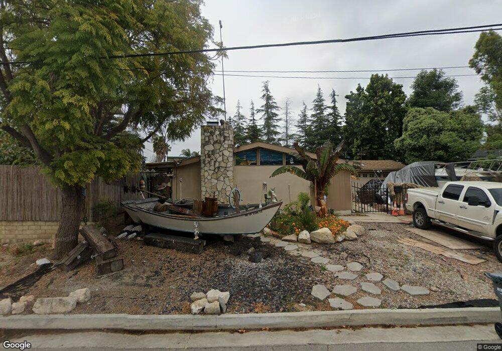
1982 W General St Rancho Palos Verdes, CA 90275
Estimated Value: $1,179,390 - $1,398,000
4
Beds
2
Baths
1,367
Sq Ft
$940/Sq Ft
Est. Value
About This Home
This home is located at 1982 W General St, Rancho Palos Verdes, CA 90275 and is currently estimated at $1,285,098, approximately $940 per square foot. 1982 W General St is a home located in Los Angeles County with nearby schools including Crestwood Street Elementary School, Park Western Place Elementary School, and Mira Catalina Elementary School.
Ownership History
Date
Name
Owned For
Owner Type
Purchase Details
Closed on
May 26, 2016
Sold by
Pountious Homer R
Bought by
Pountious Homer R and Homer R Pountious Family Trust
Current Estimated Value
Create a Home Valuation Report for This Property
The Home Valuation Report is an in-depth analysis detailing your home's value as well as a comparison with similar homes in the area
Home Values in the Area
Average Home Value in this Area
Purchase History
| Date | Buyer | Sale Price | Title Company |
|---|---|---|---|
| Pountious Homer R | -- | None Available |
Source: Public Records
Tax History Compared to Growth
Tax History
| Year | Tax Paid | Tax Assessment Tax Assessment Total Assessment is a certain percentage of the fair market value that is determined by local assessors to be the total taxable value of land and additions on the property. | Land | Improvement |
|---|---|---|---|---|
| 2025 | $11,593 | $947,126 | $757,701 | $189,425 |
| 2024 | $11,593 | $928,556 | $742,845 | $185,711 |
| 2023 | $11,290 | $910,350 | $728,280 | $182,070 |
| 2022 | $10,731 | $892,500 | $714,000 | $178,500 |
| 2021 | $1,771 | $118,627 | $60,897 | $57,730 |
| 2020 | $1,780 | $117,412 | $60,273 | $57,139 |
| 2019 | $1,719 | $115,111 | $59,092 | $56,019 |
| 2018 | $1,638 | $112,855 | $57,934 | $54,921 |
| 2016 | $1,571 | $108,476 | $55,686 | $52,790 |
| 2015 | $1,661 | $106,848 | $54,850 | $51,998 |
| 2014 | $1,672 | $104,756 | $53,776 | $50,980 |
Source: Public Records
Map
Nearby Homes
- 29641 S Western Ave Unit 213
- 29641 S Western Ave Unit 417
- 29641 S Western Ave Unit 411
- 29641 S Western Ave Unit 211
- 29641 S Western Ave Unit 310
- 2038 Noble View Dr
- 1721 W Santa Cruz St
- 226 N Western Ave
- 221 N Harbor View Ave
- 1522 W 1st St
- 303 N Trotwood Ave
- 1836 Jaybrook Dr
- 1971 W Santa Cruz St
- 378 S Miraleste Dr Unit 431
- 370 S Miraleste Dr Unit 390
- 396 S Miraleste Dr Unit 512
- 394 S Miraleste Dr Unit 496
- 372 S Miraleste Dr Unit 398
- 1311 W Capitol Dr Unit 182
- 1310 W Park Western Dr Unit 155
- 1988 W General St
- 1966 W General St
- 1994 W General St
- 29646 Bernice Dr
- 29640 Bernice Dr
- 2002 W General St
- 1909 W Summerland St
- 1954 W General St
- 29632 Bernice Dr
- 2008 W General St
- 1915 W Summerland St
- 29641 Bernice Dr
- 1946 W General St
- 2013 W General St
- 2016 W General St
- 29633 Bernice Dr
- 29628 Bernice Dr
- 1921 W Summerland St
- 1940 W General St
- 1912 W Summerland St