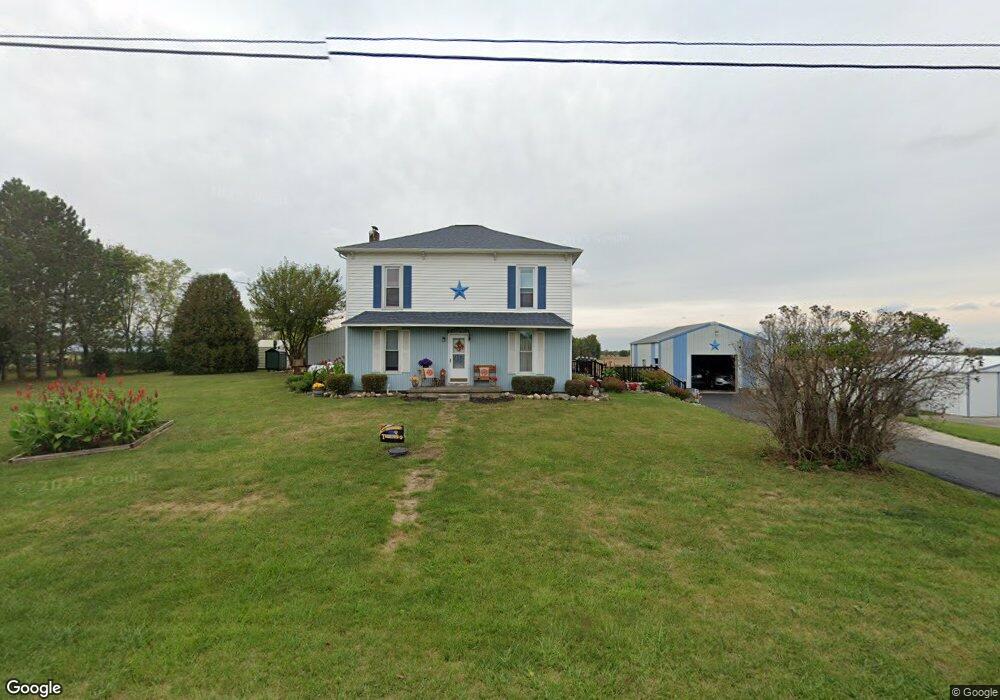
19823 State Route 196 Waynesfield, OH 45896
Estimated Value: $256,000 - $381,000
4
Beds
1
Bath
2,432
Sq Ft
$129/Sq Ft
Est. Value
About This Home
This home is located at 19823 State Route 196, Waynesfield, OH 45896 and is currently estimated at $312,573, approximately $128 per square foot. 19823 State Route 196 is a home located in Auglaize County with nearby schools including Waynesfield-Goshen Local Elementary School and Waynesfield-Goshen Local High School.
Ownership History
Date
Name
Owned For
Owner Type
Purchase Details
Closed on
Mar 14, 2006
Sold by
Mathews Mark A and Mathews Mary J
Bought by
Mathews Mark A and Mathews Mary J
Current Estimated Value
Create a Home Valuation Report for This Property
The Home Valuation Report is an in-depth analysis detailing your home's value as well as a comparison with similar homes in the area
Home Values in the Area
Average Home Value in this Area
Purchase History
| Date | Buyer | Sale Price | Title Company |
|---|---|---|---|
| Mathews Mark A | -- | None Available |
Source: Public Records
Tax History Compared to Growth
Tax History
| Year | Tax Paid | Tax Assessment Tax Assessment Total Assessment is a certain percentage of the fair market value that is determined by local assessors to be the total taxable value of land and additions on the property. | Land | Improvement |
|---|---|---|---|---|
| 2024 | $4,108 | $65,310 | $11,970 | $53,340 |
| 2023 | $2,328 | $65,310 | $11,970 | $53,340 |
| 2022 | $2,246 | $53,890 | $11,490 | $42,400 |
| 2021 | $2,160 | $52,030 | $11,490 | $40,540 |
| 2020 | $2,119 | $52,028 | $11,487 | $40,541 |
| 2019 | $1,726 | $43,359 | $9,573 | $33,786 |
| 2018 | $1,646 | $42,543 | $9,573 | $32,970 |
| 2017 | $1,633 | $42,543 | $9,573 | $32,970 |
| 2016 | $1,417 | $38,123 | $9,118 | $29,005 |
| 2015 | $1,418 | $38,123 | $9,118 | $29,005 |
| 2014 | $1,420 | $38,123 | $9,118 | $29,005 |
| 2013 | $1,486 | $35,942 | $9,118 | $26,824 |
Source: Public Records
Map
Nearby Homes
- 8150 Amherst Rd
- 5065 Amherst Rd
- 105 Guthrie St
- 202 W Mulberry St
- 22275 Buckland Holden Rd
- 25836 Ohio 67
- 7165 Faulkner Rd
- 6616 Bellefontaine Rd
- 6381 McPheron Rd
- E Hanthorn Rd
- 5600 E Hanthorn Rd
- 4160 E Hanthorn Rd
- 1855 S Cool Rd
- 20630 State Route 67
- 200 S Main St
- 3080 E Hanthorn Rd
- 4080 Bellefontaine Rd
- 0 Ohio 67
- 37 N Main St
- 17 E Walnut St
- 19725 State Route 196
- 19707 State Route 196
- 19625 State Route 196
- 19990 State Route 196
- 6885 Auglaize County Line Rd
- 6935 Auglaize Rd
- 25212 Allen Union Wayne Rd
- 6597 Waynesfield Rd
- 25254 Allen Union Wayne Rd
- 19425 State Route 196
- 25288 Allen Union Wayne Rd
- 7141 Auglaize Rd
- 6570 State Route 196
- 6565 State Route 196
- 6565 Waynesfield Rd
- 6535 State Route 196