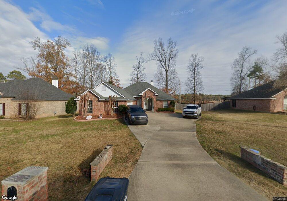
1983 Highpoint Place Haughton, LA 71037
Eastwood NeighborhoodEstimated Value: $297,000 - $332,000
3
Beds
2
Baths
1,788
Sq Ft
$177/Sq Ft
Est. Value
About This Home
This home is located at 1983 Highpoint Place, Haughton, LA 71037 and is currently estimated at $316,566, approximately $177 per square foot. 1983 Highpoint Place is a home located in Bossier Parish with nearby schools including T.L. Rodes Elementary School, Platt Elementary School, and Princeton Elementary School.
Ownership History
Date
Name
Owned For
Owner Type
Purchase Details
Closed on
Mar 19, 2008
Sold by
Marston Mary Ollette
Bought by
Sandchez Jason and Sandchez Ashley N
Current Estimated Value
Home Financials for this Owner
Home Financials are based on the most recent Mortgage that was taken out on this home.
Original Mortgage
$194,750
Outstanding Balance
$123,715
Interest Rate
6.11%
Mortgage Type
New Conventional
Estimated Equity
$192,851
Purchase Details
Closed on
Jan 31, 2005
Sold by
Willow Brook Homes Llc
Bought by
Marston Mary Ollette
Home Financials for this Owner
Home Financials are based on the most recent Mortgage that was taken out on this home.
Original Mortgage
$161,950
Interest Rate
7.84%
Mortgage Type
Unknown
Create a Home Valuation Report for This Property
The Home Valuation Report is an in-depth analysis detailing your home's value as well as a comparison with similar homes in the area
Home Values in the Area
Average Home Value in this Area
Purchase History
| Date | Buyer | Sale Price | Title Company |
|---|---|---|---|
| Sandchez Jason | $205,000 | None Available | |
| Marston Mary Ollette | $183,702 | None Available |
Source: Public Records
Mortgage History
| Date | Status | Borrower | Loan Amount |
|---|---|---|---|
| Open | Sandchez Jason | $194,750 | |
| Previous Owner | Marston Mary Ollette | $161,950 |
Source: Public Records
Tax History
| Year | Tax Paid | Tax Assessment Tax Assessment Total Assessment is a certain percentage of the fair market value that is determined by local assessors to be the total taxable value of land and additions on the property. | Land | Improvement |
|---|---|---|---|---|
| 2024 | $2,249 | $27,017 | $5,200 | $21,817 |
| 2023 | $1,800 | $21,913 | $3,950 | $17,963 |
| 2022 | $1,790 | $21,913 | $3,950 | $17,963 |
| 2021 | $1,790 | $21,913 | $3,950 | $17,963 |
| 2020 | $1,790 | $21,913 | $3,950 | $17,963 |
| 2019 | $1,634 | $20,470 | $2,400 | $18,070 |
| 2018 | $1,634 | $20,470 | $2,400 | $18,070 |
| 2017 | $1,614 | $20,470 | $2,400 | $18,070 |
| 2016 | $1,614 | $20,470 | $2,400 | $18,070 |
| 2015 | $1,509 | $20,350 | $2,400 | $17,950 |
| 2014 | $1,509 | $20,350 | $2,400 | $17,950 |
Source: Public Records
Map
Nearby Homes
- 1940 Honeytree Trail
- 3013 Sagefield Ln
- 2509 Bloomfield Ln
- 3028 Sagefield Ln
- 3034 Sagefield Ln
- 2104 Hollow Wood Way
- 2115 Hollow Wood Way
- 2816 Sunrise Point
- 109 Platt Dr
- 4705 Highway 80 Unit 1
- 4505 Pine Crest Dr
- 109 Flagg Dr
- 15 Lee Ln
- 212 Sweetgum Dr
- 134 Crestwood Dr
- 0 Wafer Rd
- 207 Chimney Ln
- 2 Woodfern Ln
- 0 Bodcau Station Rd Unit 21132913
- 145 Elmview Ln
- 1979 Highpoint Place
- 1987 Highpoint Place
- 1975 Highpoint Place
- 1991 Highpoint Place
- 1900 Honeytree Trail
- 1801 Sparrow Ridge
- 1971 Highpoint Place
- 1995 Highpoint Place
- 1904 Honeytree Trail
- 1901 Honeytree Trail
- 1805 Sparrow Ridge
- 1967 Highpoint Place
- 1800 Sparrow Ridge
- 1905 Honeytree Trail
- 1908 Honeytree Trail
- 2098 Forest Hills Blvd
- 1809 Sparrow Ridge
- 2090 Forest Hills Blvd
- 1804 Sparrow Ridge
- 2100 Forest Hills Blvd
Your Personal Tour Guide
Ask me questions while you tour the home.