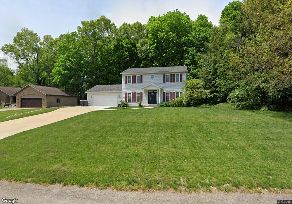
1983 Sandy Cove Dr Kalamazoo, MI 49048
Estimated Value: $319,000 - $404,000
3
Beds
3
Baths
2,016
Sq Ft
$172/Sq Ft
Est. Value
About This Home
This home is located at 1983 Sandy Cove Dr, Kalamazoo, MI 49048 and is currently estimated at $347,267, approximately $172 per square foot. 1983 Sandy Cove Dr is a home located in Kalamazoo County with nearby schools including Comstock Elementary School, Comstock Middle School, and Comstock High School.
Ownership History
Date
Name
Owned For
Owner Type
Purchase Details
Closed on
Feb 1, 2011
Sold by
Smith Tracy and Smith Kenneth
Bought by
Smith Tracy and Smith Kenneth
Current Estimated Value
Home Financials for this Owner
Home Financials are based on the most recent Mortgage that was taken out on this home.
Original Mortgage
$124,000
Outstanding Balance
$4,793
Interest Rate
4.84%
Mortgage Type
New Conventional
Estimated Equity
$342,474
Purchase Details
Closed on
Oct 29, 2002
Sold by
Reloaction
Bought by
Smith Kenneth and Hund Tracy
Home Financials for this Owner
Home Financials are based on the most recent Mortgage that was taken out on this home.
Original Mortgage
$151,500
Interest Rate
6.1%
Mortgage Type
Purchase Money Mortgage
Purchase Details
Closed on
Jun 14, 2002
Sold by
Kremer Joseph W and Kremer Sonja
Bought by
Reloaction
Create a Home Valuation Report for This Property
The Home Valuation Report is an in-depth analysis detailing your home's value as well as a comparison with similar homes in the area
Home Values in the Area
Average Home Value in this Area
Purchase History
| Date | Buyer | Sale Price | Title Company |
|---|---|---|---|
| Smith Tracy | -- | Chicago Title | |
| Smith Kenneth | $162,500 | -- | |
| Reloaction | $176,000 | Title Bond |
Source: Public Records
Mortgage History
| Date | Status | Borrower | Loan Amount |
|---|---|---|---|
| Open | Smith Tracy | $124,000 | |
| Closed | Smith Kenneth | $151,500 |
Source: Public Records
Tax History Compared to Growth
Tax History
| Year | Tax Paid | Tax Assessment Tax Assessment Total Assessment is a certain percentage of the fair market value that is determined by local assessors to be the total taxable value of land and additions on the property. | Land | Improvement |
|---|---|---|---|---|
| 2025 | $4,839 | $132,800 | $0 | $0 |
| 2024 | $2,633 | $150,900 | $0 | $0 |
| 2023 | $2,511 | $134,000 | $0 | $0 |
| 2022 | $4,338 | $107,700 | $0 | $0 |
| 2021 | $4,220 | $119,100 | $0 | $0 |
| 2020 | $3,961 | $109,000 | $0 | $0 |
| 2019 | $3,662 | $103,700 | $0 | $0 |
| 2018 | $3,533 | $99,600 | $0 | $0 |
| 2017 | $0 | $94,100 | $0 | $0 |
| 2016 | -- | $93,300 | $0 | $0 |
| 2015 | -- | $86,100 | $12,000 | $74,100 |
| 2014 | -- | $86,100 | $0 | $0 |
Source: Public Records
Map
Nearby Homes
- 5581 E Main St
- 5452 Lucerne Ave
- 5590 Elaine Ave
- 5570 Angelo Ave
- 2888 Clarice St
- 5159 E Main St
- 1226 Merry Brook St
- 1187 Merry Brook Dr
- 3016 Lyon Ave
- 3052 Clarice St
- 665 Shields St
- 5346 E H Ave
- 3101 Sunnycrest Dr
- 2612 Hunters Point
- 2680 Hunters Point
- 2626 Hunters Point
- 2648 Hunters Point
- 528 Leenhouts St
- 1516 Nazareth Rd
- 0 Collette Ave
- 1951 Sandy Cove Dr
- 2015 Sandy Cove Dr
- 1964 N 26th St
- 2016 N 26th St
- 1919 Sandy Cove Dr
- 1980 Sandy Cove Dr
- 1942 Sandy Cove Dr
- 2016 Sandy Cove Dr
- 2016 Sandy Cove Dr
- 2050 N 26th St
- 1904 Sandy Cove Dr
- 2048 Sandy Cove Dr
- 2077 Sandy Cove Dr
- 2084 N 26th St
- 2064 Sandy Cove Dr
- 1866 Sandy Cove Dr
- 1871 Sandy Cove Dr
- 2083 Sandy Cove Dr
- 5800 Forest Harbor Dr
- 1828 Sandy Cove Dr