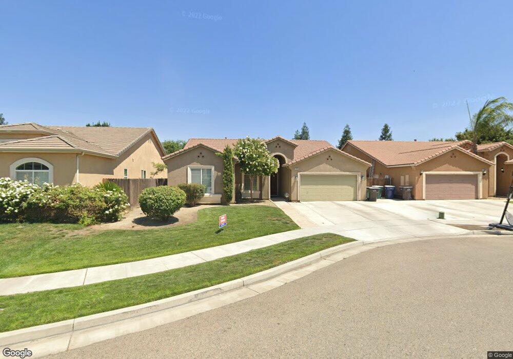
1984 Malvasia Ct Tulare, CA 93274
Northeast Tulare NeighborhoodEstimated Value: $438,163 - $471,000
3
Beds
2
Baths
2,027
Sq Ft
$226/Sq Ft
Est. Value
About This Home
This home is located at 1984 Malvasia Ct, Tulare, CA 93274 and is currently estimated at $457,291, approximately $225 per square foot. 1984 Malvasia Ct is a home located in Tulare County with nearby schools including Mission Valley Elementary School, Live Oak Middle School, and Tulare Union High School.
Ownership History
Date
Name
Owned For
Owner Type
Purchase Details
Closed on
Jun 13, 2008
Sold by
D R Horton Inc Fresno
Bought by
Vejvoda David
Current Estimated Value
Home Financials for this Owner
Home Financials are based on the most recent Mortgage that was taken out on this home.
Original Mortgage
$220,000
Outstanding Balance
$140,812
Interest Rate
6%
Mortgage Type
Purchase Money Mortgage
Estimated Equity
$316,479
Create a Home Valuation Report for This Property
The Home Valuation Report is an in-depth analysis detailing your home's value as well as a comparison with similar homes in the area
Home Values in the Area
Average Home Value in this Area
Purchase History
| Date | Buyer | Sale Price | Title Company |
|---|---|---|---|
| Vejvoda David | $275,000 | First American Title |
Source: Public Records
Mortgage History
| Date | Status | Borrower | Loan Amount |
|---|---|---|---|
| Open | Vejvoda David | $220,000 |
Source: Public Records
Tax History Compared to Growth
Tax History
| Year | Tax Paid | Tax Assessment Tax Assessment Total Assessment is a certain percentage of the fair market value that is determined by local assessors to be the total taxable value of land and additions on the property. | Land | Improvement |
|---|---|---|---|---|
| 2025 | $4,190 | $354,133 | $103,020 | $251,113 |
| 2024 | $4,190 | $347,190 | $101,000 | $246,190 |
| 2023 | $4,092 | $340,383 | $99,020 | $241,363 |
| 2022 | $3,983 | $333,710 | $97,079 | $236,631 |
| 2021 | $3,753 | $312,000 | $78,000 | $234,000 |
| 2020 | $3,329 | $268,000 | $67,000 | $201,000 |
| 2019 | $3,513 | $276,000 | $69,000 | $207,000 |
| 2018 | $3,427 | $272,000 | $68,000 | $204,000 |
| 2017 | $3,251 | $255,000 | $64,000 | $191,000 |
| 2016 | $3,129 | $251,000 | $63,000 | $188,000 |
| 2015 | $2,640 | $233,000 | $58,000 | $175,000 |
| 2014 | $2,640 | $209,000 | $52,000 | $157,000 |
Source: Public Records
Map
Nearby Homes
- 1579 Monsecco St
- 1734 Firestone Dr
- 1222 N Laspina St
- 1205 Jamestown St
- 1744 Maduro Ct
- 1160 N Laspina St
- 1917 Concord Ave
- 1768 Maduro Ct
- 1563 E Glenwood Ave
- 3068 Isleworth Ave
- 958 Hampton St Unit 567 Sft
- 958 Hampton St
- 3043 Isleworth Ave Unit 543 Sft
- 3021 Isleworth Ave Unit 542 Sft
- 2986 Isleworth Ave Unit 540 Sft
- 3065 Isleworth Ave Unit 544 Sft
- 3022 Isleworth Ave Unit 539 Sft
- 3068 Isleworth Ave Unit 537 Sft
- Monroe Plan at Santa Fe Trail
- Lincoln Plan at Santa Fe Trail
- 1970 Malvasia Ct
- 1998 Malvasia Ct
- 1956 Malvasia Ct
- 1967 Arneis Ave
- 1993 Arneis Ave
- 1981 Arneis Ave
- 1953 Arneis Ave
- 1942 Malvasia Ct
- 1979 Malvasia Ct
- 1983 Malvasia Ct
- 1995 Malvasia Ct
- 1939 Arneis Ave
- 1967 Malvasia Ct
- 1928 Malvasia Ct
- 1955 Malvasia Ct
- 1988 Arneis Ave
- 1996 Arneis Ave
- 1976 Arneis Ave
- 1925 Arneis Ave
- 1964 Arneis Ave