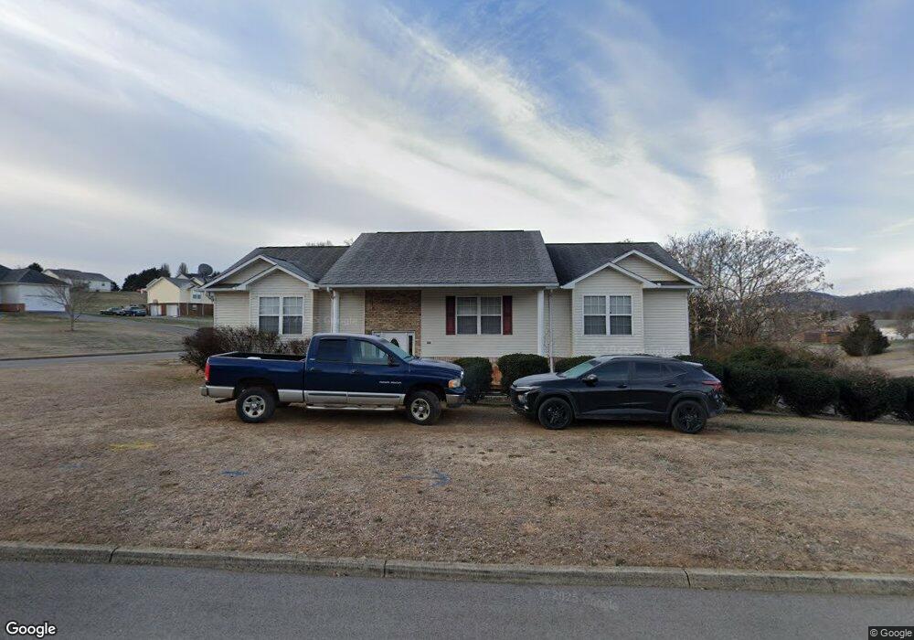
1984 River Vista Cir Sevierville, TN 37876
Estimated Value: $370,000 - $384,698
3
Beds
2
Baths
1,714
Sq Ft
$220/Sq Ft
Est. Value
About This Home
This home is located at 1984 River Vista Cir, Sevierville, TN 37876 and is currently estimated at $377,349, approximately $220 per square foot. 1984 River Vista Cir is a home located in Sevier County with nearby schools including Northview Elementary School, Catons Chapel Elementary School, and Jones Cove Elementary School.
Ownership History
Date
Name
Owned For
Owner Type
Purchase Details
Closed on
Aug 11, 2011
Sold by
Burns Scott C
Bought by
Burns S C and The Scott
Current Estimated Value
Purchase Details
Closed on
Aug 12, 2005
Sold by
Keene Darrell L
Bought by
Burns Scott C
Home Financials for this Owner
Home Financials are based on the most recent Mortgage that was taken out on this home.
Original Mortgage
$130,600
Interest Rate
7.5%
Purchase Details
Closed on
Oct 14, 2004
Sold by
James Gibson
Bought by
Keene Darrell L
Purchase Details
Closed on
Jun 5, 2004
Bought by
Gibson James and Gibson Mary
Create a Home Valuation Report for This Property
The Home Valuation Report is an in-depth analysis detailing your home's value as well as a comparison with similar homes in the area
Home Values in the Area
Average Home Value in this Area
Purchase History
| Date | Buyer | Sale Price | Title Company |
|---|---|---|---|
| Burns S C | -- | -- | |
| Burns Scott C | $137,500 | -- | |
| Keene Darrell L | $19,900 | -- | |
| Gibson James | $17,100 | -- |
Source: Public Records
Mortgage History
| Date | Status | Borrower | Loan Amount |
|---|---|---|---|
| Previous Owner | Gibson James | $130,600 |
Source: Public Records
Tax History Compared to Growth
Tax History
| Year | Tax Paid | Tax Assessment Tax Assessment Total Assessment is a certain percentage of the fair market value that is determined by local assessors to be the total taxable value of land and additions on the property. | Land | Improvement |
|---|---|---|---|---|
| 2025 | $653 | $44,150 | $6,750 | $37,400 |
| 2024 | $653 | $44,150 | $6,750 | $37,400 |
| 2023 | $653 | $44,150 | $0 | $0 |
| 2022 | $653 | $44,150 | $6,750 | $37,400 |
| 2021 | $653 | $44,150 | $6,750 | $37,400 |
| 2020 | $678 | $44,150 | $6,750 | $37,400 |
| 2019 | $678 | $36,475 | $6,750 | $29,725 |
| 2018 | $678 | $36,475 | $6,750 | $29,725 |
| 2017 | $678 | $36,475 | $6,750 | $29,725 |
| 2016 | $678 | $36,475 | $6,750 | $29,725 |
| 2015 | -- | $34,375 | $0 | $0 |
| 2014 | $560 | $34,379 | $0 | $0 |
Source: Public Records
Map
Nearby Homes
- 2017 Malibu Ct
- 1934 River Vista Cir
- 1924 River Vista Cir
- 1718 Watauga St
- 1826 Watauga St
- 1719 Tahoe Trail
- 0 Chances Ridge Dr
- 1843 River Vista Cir
- 1998 Tranquility Ln
- 1861 Big Buck Ln
- 1870 Big Buck Ln
- 2725 River Island Blvd
- 2067 Highpoint Ln
- 0 Highpoint Dr Unit 1250528
- 9624 Gunnies Dr
- 1520 Rosewood Dr
- 1761 Rays Gap Rd
- 1923 Big Chiefs Skyview Dr
- The Stratford Plan at The Farm at Riverbend - Craftsman
- The Winston Plan at The Farm at Riverbend - Craftsman
- 1985 River Vista Cir
- 2005 Malibu Ct
- 1989 River Vista Cir
- 2005 Malibu Ct
- 1149 Tranquility Hills Way
- 1149 Tranquility Ln
- 2009 Malibu Ct
- 1748 Tahoe
- 1784 Tahoe Trail
- 0 Malibu Ct Unit 873357
- 0 Malibu Ct Unit 998030
- 0 Malibu Ct Unit 1082458
- 0 Malibu Ct Unit 1082459
- Lot #74 Malibu Ct
- Lot 70 Malibu Ct
- 0 Malibu Ct Unit 206258
- 0 Malibu Ct Unit 206257
- Lot #70 Malibu Ct
- 0 Malibu Ct Unit 1005449
- 0 Malibu Ct Unit 1005445