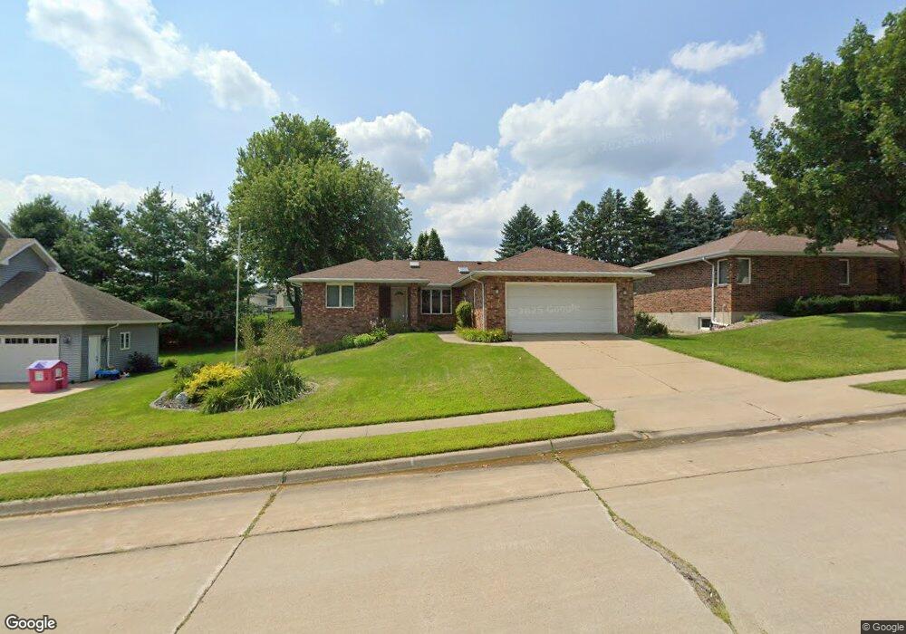
1985 Embassy West Dr Dubuque, IA 52002
Estimated Value: $315,000 - $339,000
3
Beds
2
Baths
1,836
Sq Ft
$179/Sq Ft
Est. Value
About This Home
This home is located at 1985 Embassy West Dr, Dubuque, IA 52002 and is currently estimated at $327,923, approximately $178 per square foot. 1985 Embassy West Dr is a home located in Dubuque County with nearby schools including Carver Elementary School, Eleanor Roosevelt Middle School, and Hempstead High School.
Ownership History
Date
Name
Owned For
Owner Type
Purchase Details
Closed on
Nov 4, 2013
Sold by
Hoffman Rebecca J
Bought by
Hoffman Kurtis J
Current Estimated Value
Purchase Details
Closed on
Mar 27, 2012
Sold by
Banwarth Thomas J and Banwarth Anne M
Bought by
Hoffman Kurtis J and Hoffman Rebecca J
Home Financials for this Owner
Home Financials are based on the most recent Mortgage that was taken out on this home.
Original Mortgage
$145,600
Outstanding Balance
$100,160
Interest Rate
3.9%
Mortgage Type
New Conventional
Estimated Equity
$227,763
Create a Home Valuation Report for This Property
The Home Valuation Report is an in-depth analysis detailing your home's value as well as a comparison with similar homes in the area
Home Values in the Area
Average Home Value in this Area
Purchase History
| Date | Buyer | Sale Price | Title Company |
|---|---|---|---|
| Hoffman Kurtis J | -- | None Available | |
| Hoffman Kurtis J | $182,000 | None Available |
Source: Public Records
Mortgage History
| Date | Status | Borrower | Loan Amount |
|---|---|---|---|
| Open | Hoffman Kurtis J | $145,600 |
Source: Public Records
Tax History Compared to Growth
Tax History
| Year | Tax Paid | Tax Assessment Tax Assessment Total Assessment is a certain percentage of the fair market value that is determined by local assessors to be the total taxable value of land and additions on the property. | Land | Improvement |
|---|---|---|---|---|
| 2025 | $4,014 | $307,100 | $47,800 | $259,300 |
| 2024 | $4,014 | $289,400 | $45,600 | $243,800 |
| 2023 | $3,894 | $289,400 | $45,600 | $243,800 |
| 2022 | $3,830 | $240,570 | $43,460 | $197,110 |
| 2021 | $3,830 | $240,570 | $43,460 | $197,110 |
| 2020 | $3,762 | $220,300 | $43,460 | $176,840 |
| 2019 | $3,760 | $220,300 | $43,460 | $176,840 |
| 2018 | $3,700 | $210,800 | $39,110 | $171,690 |
| 2017 | $3,492 | $210,800 | $39,110 | $171,690 |
| 2016 | $3,492 | $189,300 | $39,110 | $150,190 |
| 2015 | $3,416 | $189,300 | $39,110 | $150,190 |
| 2014 | $3,324 | $189,300 | $39,110 | $150,190 |
Source: Public Records
Map
Nearby Homes
- 1876 North Ct
- 4957 Twilight Dr
- 1555 Donovan Dr
- 2023 Clifford St
- Lot 6 Mill Ridge Rd
- 3695 Keystone Dr
- 2207 Eldie Dr
- Lot 3 Shagbark Plat 3 Ln Unit 4461 Barnwood Lane
- 0 Associates Dr
- 5133 Asbury Rd
- 3660 Hillcrest Rd
- 1754 Vizaleea Dr
- Lot Hillcrest Rd
- 3631 Keymeer Dr
- 1743 Lea Ln
- 2249 Antler Ridge Dr
- 2145 Saint John Dr
- 3519 Hillcrest Rd
- 3575 Lisa Ct
- 2969 Summer Dr
- 2005 Embassy West Dr
- 2005 Embassy Dr W
- 1965 Embassy West Dr
- 1974 Northstar Dr
- 1998 Northstar Dr
- 1974 N Star Dr
- 1962 Northstar Dr
- 2018 Northstar Dr
- 2025 Embassy West Dr
- 1945 Embassy West Dr
- 1970 Embassy West Dr
- 1956 Northstar Dr
- 2026 Northstar Dr
- 2020 Embassy West Dr
- 4884 Colonel Dr
- 2045 Embassy West Dr
- 1925 Embassy West Dr
- 1938 Northstar Dr
- 4841 Colonel Dr
- 2030 Embassy West Dr