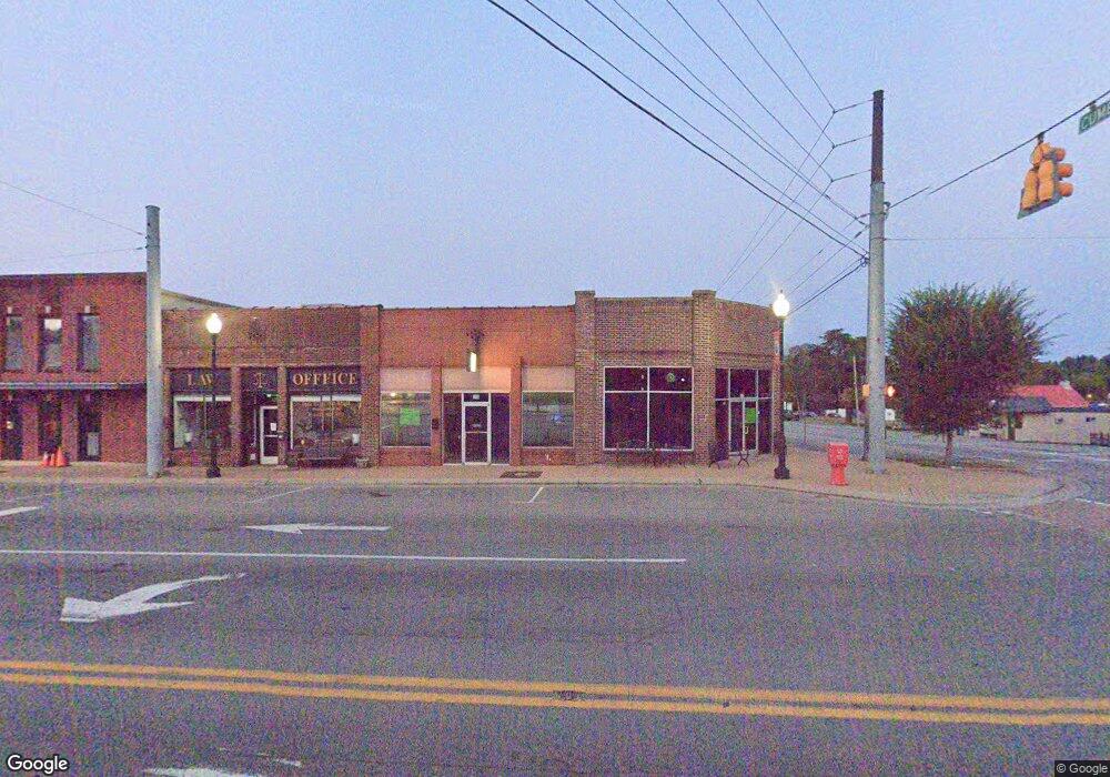
1985 Highway 49 E Ashland City, TN 37015
Estimated Value: $279,000 - $1,076,476
--
Bed
1
Bath
65,340
Sq Ft
$10/Sq Ft
Est. Value
About This Home
This home is located at 1985 Highway 49 E, Ashland City, TN 37015 and is currently estimated at $677,738, approximately $10 per square foot. 1985 Highway 49 E is a home located in Cheatham County with nearby schools including Ashland City Elementary School, Cheatham Middle School, and Cheatham County Central High School.
Ownership History
Date
Name
Owned For
Owner Type
Purchase Details
Closed on
Dec 15, 2021
Sold by
Krantz Carl D and Krantz Margaret K
Bought by
Randal Pleasant View Partners Llc
Current Estimated Value
Purchase Details
Closed on
Nov 25, 2020
Sold by
Tucker Dorothy and Masopust Emily
Bought by
Krantz Carl D and Krantz Margaret K
Purchase Details
Closed on
Jun 2, 2000
Sold by
Boyd L B
Bought by
Cheatham Co Board Of Educa
Purchase Details
Closed on
Sep 18, 1954
Bought by
Boyd L B
Purchase Details
Closed on
Feb 21, 1946
Create a Home Valuation Report for This Property
The Home Valuation Report is an in-depth analysis detailing your home's value as well as a comparison with similar homes in the area
Home Values in the Area
Average Home Value in this Area
Purchase History
| Date | Buyer | Sale Price | Title Company |
|---|---|---|---|
| Randal Pleasant View Partners Llc | $850,000 | Mccoy L Broner | |
| Krantz Carl D | $500,000 | None Available | |
| Cheatham Co Board Of Educa | $20,000 | -- | |
| Boyd L B | -- | -- | |
| -- | -- | -- |
Source: Public Records
Tax History Compared to Growth
Tax History
| Year | Tax Paid | Tax Assessment Tax Assessment Total Assessment is a certain percentage of the fair market value that is determined by local assessors to be the total taxable value of land and additions on the property. | Land | Improvement |
|---|---|---|---|---|
| 2024 | $1,178 | $74,040 | $74,040 | $0 |
| 2023 | $596 | $23,800 | $23,800 | $0 |
| 2022 | $596 | $24,080 | $23,800 | $280 |
| 2021 | $648 | $24,080 | $23,800 | $280 |
| 2020 | $1,469 | $54,575 | $12,750 | $41,825 |
| 2019 | $1,469 | $54,575 | $12,750 | $41,825 |
| 2018 | $1,427 | $45,475 | $12,750 | $32,725 |
| 2017 | $1,350 | $45,475 | $12,750 | $32,725 |
| 2016 | $1,284 | $45,475 | $12,750 | $32,725 |
| 2015 | $1,200 | $39,750 | $12,750 | $27,000 |
| 2014 | $1,200 | $39,750 | $12,750 | $27,000 |
Source: Public Records
Map
Nearby Homes
- 717 Jess Harris Rd
- 291 Bailey Ln
- 1248 Leaf Ln
- 302 Bailey Ln
- 1770 Filmore Harris Rd
- 233 Winfrey Ct
- 1021 Tulip Dr
- 1031 Leaf Ln
- 364 Dixie Ln
- 1641-MU Legacy Fields Plan at Legacy Fields
- 1612- Legacy Fields End Unit Plan at Legacy Fields
- 1567- Legacy Fields Plan at Legacy Fields
- 1464 Legacy Fields Plan at Legacy Fields
- 1612- Legacy Fields Interior Unit Plan at Legacy Fields
- 1641-MD Legacy Fields Plan at Legacy Fields
- 1815 Legacy Fields Plan at Legacy Fields
- 236 Glenda Ct
- 185 Plantation Dr
- 105 Coleson Ln
- 113 Coleson Ln
- 1981 Highway 49 E
- 3215A Old Clarksville Park
- 90 War Eagles Way
- 236 Warrior Dr
- 35 War Eagles Way
- 92 War Eagles Way
- 38 War Eagles Way
- 93 War Eagles Way
- 87 War Eagles Way
- 1985 Highway E
- 1985 Highway 49 E
- 304 Warrior Place
- 1990 Highway 49 E
- 86 War Eagles Way
- 94 War Eagles Way
- 3199 Old Clarksville Pike
- 1975 Highway 49 E
- 1 Highway 49e
- 2 Highway 49e
- 2002 Highway 49 E