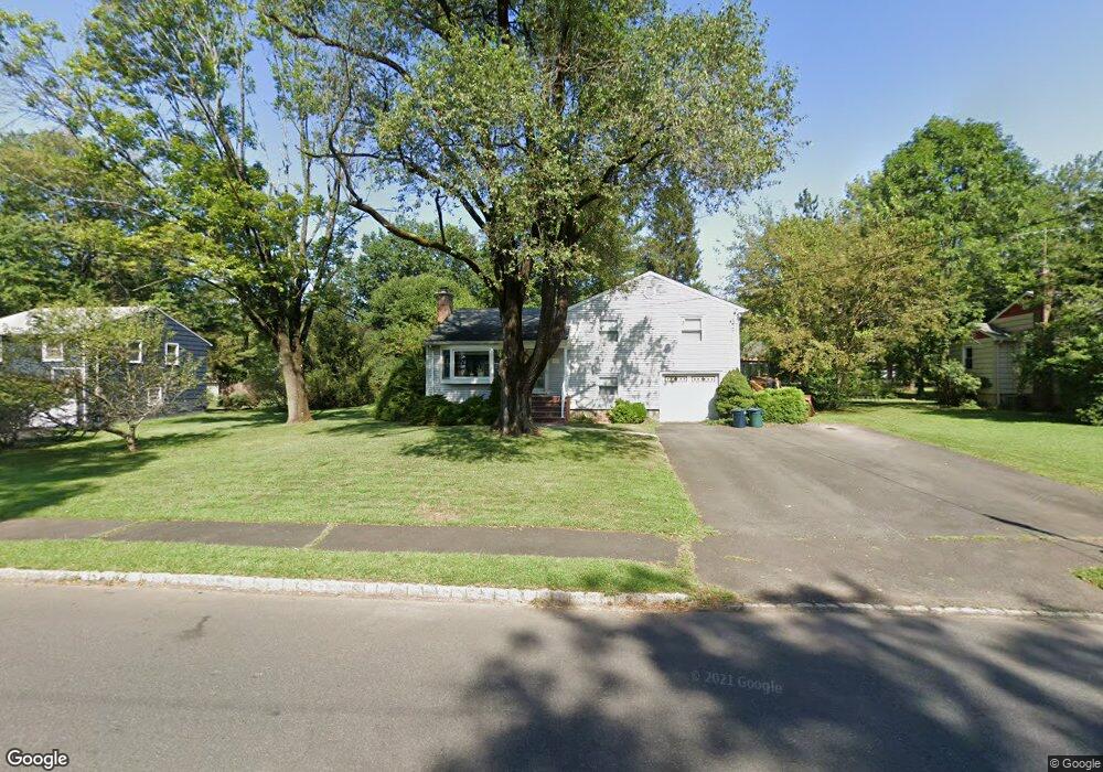
1985 W Broad St Scotch Plains, NJ 07076
Estimated Value: $710,415 - $1,018,000
--
Bed
--
Bath
2,112
Sq Ft
$418/Sq Ft
Est. Value
About This Home
This home is located at 1985 W Broad St, Scotch Plains, NJ 07076 and is currently estimated at $883,354, approximately $418 per square foot. 1985 W Broad St is a home located in Union County with nearby schools including William J. McGinn Elementary School, Terrill Middle School, and Scotch Plains-Fanwood High School.
Ownership History
Date
Name
Owned For
Owner Type
Purchase Details
Closed on
Apr 14, 1992
Bought by
Molnar Stephen and Molnar Linda
Current Estimated Value
Create a Home Valuation Report for This Property
The Home Valuation Report is an in-depth analysis detailing your home's value as well as a comparison with similar homes in the area
Home Values in the Area
Average Home Value in this Area
Purchase History
| Date | Buyer | Sale Price | Title Company |
|---|---|---|---|
| Molnar Stephen | $220,000 | -- |
Source: Public Records
Tax History Compared to Growth
Tax History
| Year | Tax Paid | Tax Assessment Tax Assessment Total Assessment is a certain percentage of the fair market value that is determined by local assessors to be the total taxable value of land and additions on the property. | Land | Improvement |
|---|---|---|---|---|
| 2025 | $15,640 | $132,900 | $41,600 | $91,300 |
| 2024 | $15,179 | $132,900 | $41,600 | $91,300 |
| 2023 | $15,179 | $132,900 | $41,600 | $91,300 |
| 2022 | $14,998 | $132,900 | $41,600 | $91,300 |
| 2021 | $14,973 | $132,900 | $41,600 | $91,300 |
| 2020 | $14,901 | $132,900 | $41,600 | $91,300 |
| 2019 | $14,790 | $132,900 | $41,600 | $91,300 |
| 2018 | $14,542 | $132,900 | $41,600 | $91,300 |
| 2017 | $14,219 | $132,900 | $41,600 | $91,300 |
| 2016 | $13,945 | $132,900 | $41,600 | $91,300 |
| 2015 | $13,717 | $132,900 | $41,600 | $91,300 |
| 2014 | $13,265 | $132,900 | $41,600 | $91,300 |
Source: Public Records
Map
Nearby Homes
- 1933 W Broad St
- 1933 Mary Ellen Ln
- 2 Brookside Ct
- 2154 W Broad St
- 2116 Newark Ave
- 119 Lamberts Mill Rd
- 187 King St
- 1466 Lamberts Mill Rd
- 57 Rambling Dr
- 314 Highgate Ave
- 5 Robin Rd
- 2212 Shady Ln
- 120 S Martine Ave
- 2 Dutch Ln
- 345 La Grande Ave
- 2219 North Ave Unit 6
- 2314 Longfellow Ave
- 40 1st St
- 1380 Terrill Rd
- 21 Old South Ave
- 1995 W Broad St
- 1975 W Broad St
- 1980 Mary Beth Ct
- 1990 Mary Beth Ct
- 1970 Mary Beth Ct
- 2005 W Broad St
- 1996 W Broad St
- 1988 W Broad St
- 1982 W Broad St
- 2000 W Broad St
- 1965 W Broad St
- 2000 Mary Beth Ct
- 1972 W Broad St
- 2009 W Broad St
- 2010 W Broad St
- 1282 Christine Cir
- 1278 White Oak Rd
- 1985 Mary Beth Ct
- 1957 W Broad St
- 1975 Mary Beth Ct