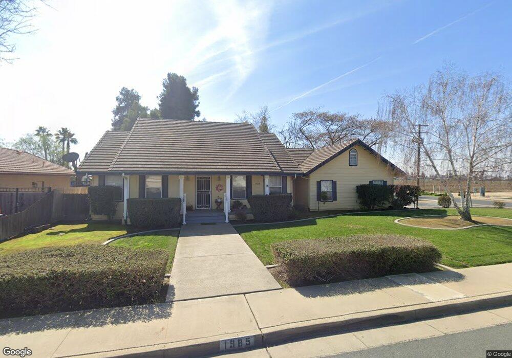
1985 W Mulberry Ave Porterville, CA 93257
Porterville Northwest NeighborhoodEstimated Value: $375,158 - $445,000
3
Beds
2
Baths
1,976
Sq Ft
$209/Sq Ft
Est. Value
About This Home
This home is located at 1985 W Mulberry Ave, Porterville, CA 93257 and is currently estimated at $412,040, approximately $208 per square foot. 1985 W Mulberry Ave is a home located in Tulare County with nearby schools including Oak Grove Elementary School, Burton Middle School, and Monache High School.
Ownership History
Date
Name
Owned For
Owner Type
Purchase Details
Closed on
Jun 12, 2025
Sold by
Fought Brian E
Bought by
Fought Brian E and Fought Sandra D
Current Estimated Value
Purchase Details
Closed on
Mar 13, 2014
Sold by
Miller Patricia Ann
Bought by
Miller Patricia A and 2014 Patricia A Miller Separate Property
Purchase Details
Closed on
Jul 28, 2010
Sold by
Reed Eva Marie June
Bought by
Beaver Allen Wayne
Create a Home Valuation Report for This Property
The Home Valuation Report is an in-depth analysis detailing your home's value as well as a comparison with similar homes in the area
Home Values in the Area
Average Home Value in this Area
Purchase History
| Date | Buyer | Sale Price | Title Company |
|---|---|---|---|
| Fought Brian E | -- | None Listed On Document | |
| Fought Brian E | -- | None Listed On Document | |
| Miller Patricia A | -- | None Available | |
| Beaver Allen Wayne | -- | None Available |
Source: Public Records
Tax History Compared to Growth
Tax History
| Year | Tax Paid | Tax Assessment Tax Assessment Total Assessment is a certain percentage of the fair market value that is determined by local assessors to be the total taxable value of land and additions on the property. | Land | Improvement |
|---|---|---|---|---|
| 2025 | $2,366 | $225,246 | $36,887 | $188,359 |
| 2024 | $2,366 | $220,830 | $36,164 | $184,666 |
| 2023 | $2,373 | $216,501 | $35,455 | $181,046 |
| 2022 | $2,240 | $212,257 | $34,760 | $177,497 |
| 2021 | $2,247 | $208,095 | $34,078 | $174,017 |
| 2020 | $2,205 | $205,962 | $33,729 | $172,233 |
| 2019 | $2,204 | $201,924 | $33,068 | $168,856 |
| 2018 | $2,107 | $197,965 | $32,420 | $165,545 |
| 2017 | $2,073 | $194,083 | $31,784 | $162,299 |
| 2016 | $1,975 | $190,278 | $31,161 | $159,117 |
| 2015 | $1,905 | $187,420 | $30,693 | $156,727 |
| 2014 | $1,905 | $183,749 | $30,092 | $153,657 |
Source: Public Records
Map
Nearby Homes
- 1857 W Westfield Ave
- 1750 W Terry Cir
- 2164 W San Lucia Ct
- 1926 W Nancy Ave
- 1691 Terry Ct
- 2219 W Theta Ave
- 1681 W Wall Ln
- 1041 Greenfield Dr
- 2261 W San Lucia Ct
- 1644 Mccomb Ave
- Sydney Plan at Laurelwood
- Carlton Plan at Laurelwood
- Carmel Plan at Laurelwood
- Aspen with Loft Plan at Laurelwood
- Aspen Plan at Laurelwood
- Hawthorne Plan at Brookside
- Walden Plan at Brookside
- Ashford Plan at Brookside
- Henley Plan at Brookside
- Kipling Plan at Brookside
- 1965 W Mulberry Ave
- 1980 W Mulberry Ave
- 1970 W Mulberry Ave
- 1945 W Mulberry Ave
- 952 Mathew St
- 1022 N Mathew St
- 1022 Mathew St
- 1910 W Mulberry Ave
- 1000 N Walch Way
- 1032 Mathew St
- 991 N Verdugo Dr
- 1010 N Walch Way
- 1020 N Walch Way
- 1001 N Verdugo Dr
- 0 N Mathew St
- 1987 Monache Ave
- 1997 W Monache Ave
- 1967 Monache Ave
- 1011 N Verdugo Dr
- 1997 Monache Ave