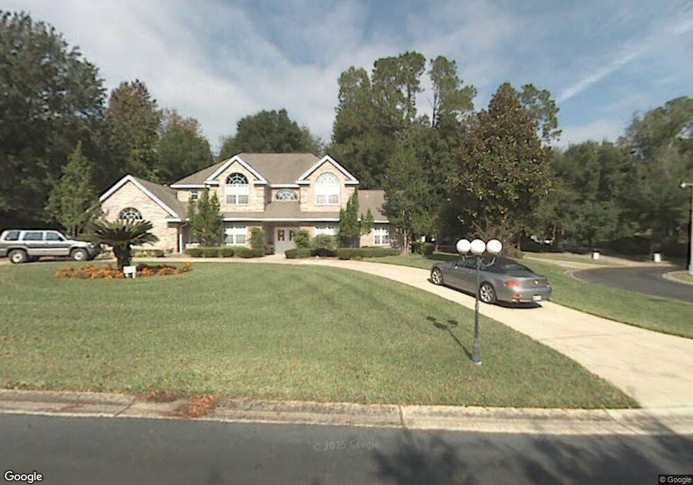
1985 Westbrook Ct Ocala, FL 34471
Southeast Ocala NeighborhoodEstimated Value: $717,000 - $840,000
4
Beds
4
Baths
3,044
Sq Ft
$247/Sq Ft
Est. Value
About This Home
This home is located at 1985 Westbrook Ct, Ocala, FL 34471 and is currently estimated at $752,693, approximately $247 per square foot. 1985 Westbrook Ct is a home located in Marion County with nearby schools including South Ocala Elementary School, Osceola Middle School, and Forest High School.
Ownership History
Date
Name
Owned For
Owner Type
Purchase Details
Closed on
Jul 14, 2021
Sold by
Mccall William M and Mccall Crystal S
Bought by
Mccall William M and Mccall Crystal
Current Estimated Value
Purchase Details
Closed on
Apr 7, 2021
Sold by
Davis William J and Davis Helen S
Bought by
Davis William J and Davis Helen S
Purchase Details
Closed on
Aug 12, 2020
Sold by
Davis Williams J and Davis Helen S
Bought by
Davis William J and Davis Helen S
Purchase Details
Closed on
Aug 11, 2011
Sold by
Davis William J and Davis Helen S
Bought by
Davis William J and Davis Helen S
Create a Home Valuation Report for This Property
The Home Valuation Report is an in-depth analysis detailing your home's value as well as a comparison with similar homes in the area
Home Values in the Area
Average Home Value in this Area
Purchase History
| Date | Buyer | Sale Price | Title Company |
|---|---|---|---|
| Mccall William M | -- | Accommodation | |
| Davis William J | -- | None Available | |
| Davis Family Revocable Trust | $100 | Bk File | |
| Davis William J | -- | Attorney | |
| Davis William J | -- | None Available |
Source: Public Records
Tax History
| Year | Tax Paid | Tax Assessment Tax Assessment Total Assessment is a certain percentage of the fair market value that is determined by local assessors to be the total taxable value of land and additions on the property. | Land | Improvement |
|---|---|---|---|---|
| 2025 | $6,952 | $420,475 | -- | -- |
| 2024 | $6,855 | $408,625 | -- | -- |
| 2023 | $6,691 | $396,723 | $0 | $0 |
| 2022 | $6,317 | $385,168 | $0 | $0 |
| 2021 | $6,311 | $373,950 | $0 | $0 |
| 2020 | $6,004 | $368,787 | $47,000 | $321,787 |
| 2019 | $5,933 | $361,606 | $0 | $0 |
| 2018 | $5,723 | $354,864 | $0 | $0 |
| 2017 | $5,685 | $347,565 | $0 | $0 |
| 2016 | $5,628 | $340,416 | $0 | $0 |
| 2015 | $5,675 | $338,050 | $0 | $0 |
| 2014 | $5,227 | $335,367 | $0 | $0 |
Source: Public Records
Map
Nearby Homes
- 1892 SE Clatter Bridge Rd
- 1962 Twin Bridge Cir
- 2021 Twin Bridge Cir
- 1731 SE Clatter Bridge Rd
- 2243 Laurel Run Dr
- 1810 SE 21st Place
- 1918 SE 17th St
- 2215 SE Spring Hill Ct
- 2310 SE 22nd Loop
- 2301 SE 22nd Loop
- 2303 SE 22nd Loop
- 0000 SE 20th Ave
- 2306 SE 19th Cir
- 2131 SE 25th St
- 2442 SE 18th Cir
- 1631 SE 17th St
- 2503 SE 18th Cir
- 1621 SE 17th St
- 2414 SE 17th Cir
- 2412 SE 17th Cir
- 1955 SE Westbrook Ct
- 1955 Westbrook Ct
- 1971 SE Laurel Run Dr
- 1953 Laurel Run Dr
- 2026 Laurel Run Dr
- 2026 SE Laurel Run Dr
- 1986 Laurel Run Dr
- 2023 Laurel Run Dr
- 2023 SE Laurel Run Dr
- 1956 Westbrook Ct
- 2131 Mill Creek Cir
- 2033 SE Laurel Run Dr
- 2144 Laurel Run Dr
- 2008 SE Twin Bridge Ct
- 2014 Twin Bridge Ct
- 2000 SE Twin Bridge Ct
- 2000 Twin Bridge Ct
- 2135 Mill Creek Cir
- 2135 SE Mill Creek Cir
- 2026 Twin Bridge Ct
Your Personal Tour Guide
Ask me questions while you tour the home.