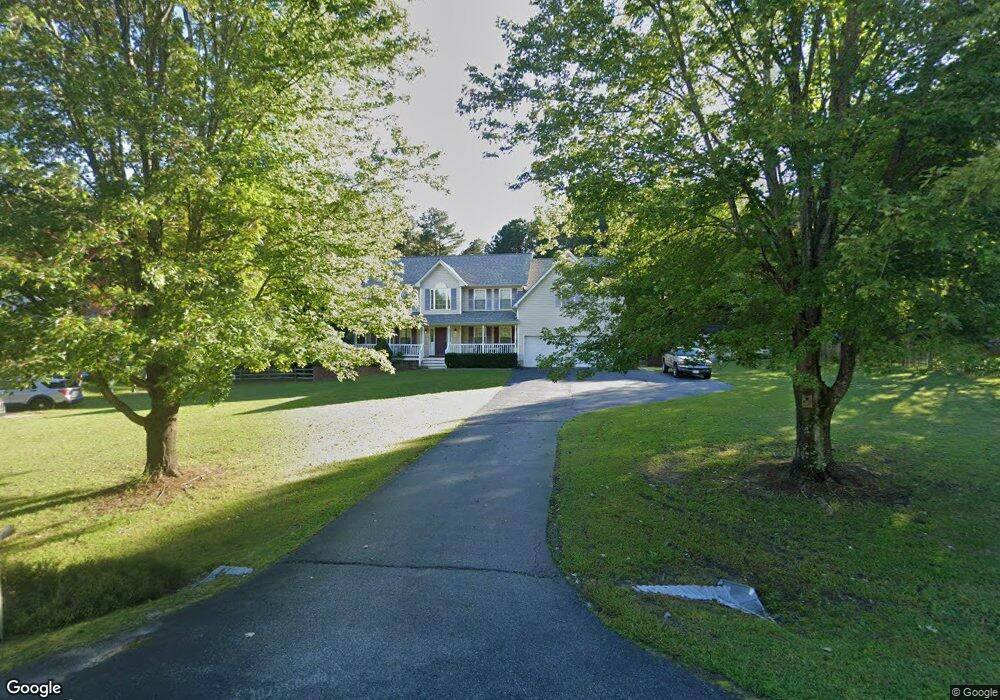
1986 Brigade Ct Saint Leonard, MD 20685
Saint Leonard NeighborhoodEstimated Value: $622,631 - $789,000
--
Bed
3
Baths
3,576
Sq Ft
$195/Sq Ft
Est. Value
About This Home
This home is located at 1986 Brigade Ct, Saint Leonard, MD 20685 and is currently estimated at $698,908, approximately $195 per square foot. 1986 Brigade Ct is a home located in Calvert County with nearby schools including Mutual Elementary School, Southern Middle School, and Calvert High School.
Ownership History
Date
Name
Owned For
Owner Type
Purchase Details
Closed on
Jul 1, 2003
Sold by
Clifford Paul M and Clifford Kelly A
Bought by
Kilbourne David Paul and Lynn Wendy
Current Estimated Value
Purchase Details
Closed on
Sep 13, 2001
Sold by
Quality Built Homes Inc
Bought by
Clifford Paul M and Clifford Kelly A
Create a Home Valuation Report for This Property
The Home Valuation Report is an in-depth analysis detailing your home's value as well as a comparison with similar homes in the area
Home Values in the Area
Average Home Value in this Area
Purchase History
| Date | Buyer | Sale Price | Title Company |
|---|---|---|---|
| Kilbourne David Paul | $335,000 | -- | |
| Clifford Paul M | $262,445 | -- |
Source: Public Records
Mortgage History
| Date | Status | Borrower | Loan Amount |
|---|---|---|---|
| Closed | Clifford Paul M | -- |
Source: Public Records
Tax History Compared to Growth
Tax History
| Year | Tax Paid | Tax Assessment Tax Assessment Total Assessment is a certain percentage of the fair market value that is determined by local assessors to be the total taxable value of land and additions on the property. | Land | Improvement |
|---|---|---|---|---|
| 2025 | $5,741 | $550,800 | $0 | $0 |
| 2024 | $5,741 | $512,000 | $0 | $0 |
| 2023 | $5,131 | $473,200 | $122,000 | $351,200 |
| 2022 | $4,994 | $460,333 | $0 | $0 |
| 2021 | $4,742 | $447,467 | $0 | $0 |
| 2020 | $4,742 | $434,600 | $122,000 | $312,600 |
| 2019 | $4,715 | $430,233 | $0 | $0 |
| 2018 | $4,656 | $425,867 | $0 | $0 |
| 2017 | $4,671 | $421,500 | $0 | $0 |
| 2016 | -- | $410,633 | $0 | $0 |
| 2015 | $5,066 | $399,767 | $0 | $0 |
| 2014 | $5,066 | $388,900 | $0 | $0 |
Source: Public Records
Map
Nearby Homes
- 5130 Turtle Creek Dr
- 6689 Mackall Rd
- 6675 Marshall Rd
- 4360 August Dr
- 2024 Yew Ct
- 5225 Mackall Rd
- 2980 Ross Rd
- 7270 Mackall Rd
- 7420 Mayflower Ct
- 220 Fountain Ln
- 4215 Broomes Island Rd
- 4820 Maryland Ave
- 4870 Calvert Dr
- 3235 Mills Pond Dr
- 6265 Parkers Wharf Rd
- 115 Austyn Ct
- 6310 Saint Leonard Rd
- 350 Madeline Dr
- 4025 Turkey Foot Rd
- 1146 Calvert Beach Rd
- 1982 Brigade Ct
- 1990 Constitution Dr
- 1978 Brigade Ct
- 1970 Brigade Ct
- 1966 Constitution Dr
- 1974 Brigade Ct
- 1969 Constitution Dr
- 5906 Oriole Way
- 1962 Constitution Dr
- 1965 Constitution Dr
- 1958 Constitution Dr
- 5895 Mackall Rd
- 1961 Constitution Dr
- 1987 Freedom Ln
- 1954 Constitution Dr
- 1959 Waterloo Ct
- 1946 Franklin Ln
- 1950 Constitution Dr
- 1973 Liberty Ct
- 1942 Franklin Ln