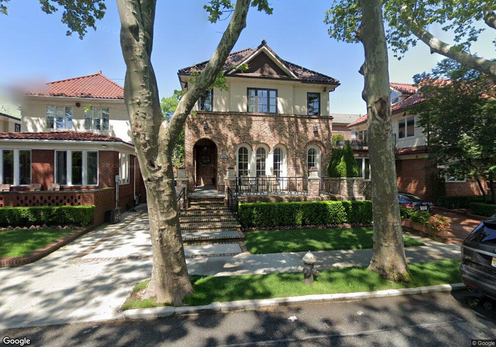
1986 E 3rd St Brooklyn, NY 11223
Gravesend NeighborhoodEstimated Value: $5,409,000 - $8,321,747
Studio
--
Bath
4,440
Sq Ft
$1,543/Sq Ft
Est. Value
About This Home
This home is located at 1986 E 3rd St, Brooklyn, NY 11223 and is currently estimated at $6,850,916, approximately $1,542 per square foot. 1986 E 3rd St is a home located in Kings County with nearby schools including P.S. 215 Morris H Weiss, Is 228 David A Boody, and Abraham Lincoln High School.
Ownership History
Date
Name
Owned For
Owner Type
Purchase Details
Closed on
Sep 20, 2010
Sold by
Aini Lucia
Bought by
1986 East 3Rd Street Llc
Current Estimated Value
Purchase Details
Closed on
May 10, 2010
Sold by
Aini Joey
Bought by
Aini Lucia
Purchase Details
Closed on
Sep 13, 2006
Sold by
Mann Isaac
Bought by
Aini Joey
Purchase Details
Closed on
Nov 18, 1997
Sold by
Cayre Jack J
Bought by
Mann Isaac and Mann Laurie
Purchase Details
Closed on
Jan 2, 1996
Sold by
Mahana Frieda
Bought by
Cayre Jack J
Create a Home Valuation Report for This Property
The Home Valuation Report is an in-depth analysis detailing your home's value as well as a comparison with similar homes in the area
Home Values in the Area
Average Home Value in this Area
Purchase History
| Date | Buyer | Sale Price | Title Company |
|---|---|---|---|
| 1986 East 3Rd Street Llc | $1,400,000 | -- | |
| Aini Lucia | -- | -- | |
| Aini Joey | $5,000,000 | -- | |
| Mann Isaac | $700,000 | -- | |
| Cayre Jack J | $700,000 | Transamerica Title Ins Compa |
Source: Public Records
Tax History
| Year | Tax Paid | Tax Assessment Tax Assessment Total Assessment is a certain percentage of the fair market value that is determined by local assessors to be the total taxable value of land and additions on the property. | Land | Improvement |
|---|---|---|---|---|
| 2025 | $25,278 | $324,540 | $31,140 | $293,400 |
| 2024 | $25,278 | $381,840 | $31,140 | $350,700 |
| 2023 | $24,113 | $366,240 | $31,140 | $335,100 |
| 2022 | $22,361 | $299,760 | $31,140 | $268,620 |
| 2021 | $23,573 | $231,420 | $31,140 | $200,280 |
| 2020 | $22,660 | $193,440 | $31,140 | $162,300 |
| 2019 | $21,940 | $153,780 | $31,140 | $122,640 |
| 2018 | $20,170 | $98,943 | $14,997 | $83,946 |
| 2017 | $19,028 | $93,343 | $16,631 | $76,712 |
| 2016 | $18,350 | $93,343 | $20,668 | $72,675 |
| 2015 | $5,622 | $89,729 | $29,823 | $59,906 |
| 2014 | $5,622 | $89,363 | $32,800 | $56,563 |
Source: Public Records
Map
Nearby Homes
- 388 Avenue S Unit 1B
- 388 Avenue S Unit 4F
- 388 Avenue S Unit 1A
- 367 Avenue S Unit 4A
- 367 Avenue S Unit 2E
- 393 Avenue S Unit 5H
- 393 Avenue S Unit 1G
- 393 Avenue S Unit 5D
- 393 Avenue S Unit 3G
- 393 Avenue S Unit 3H
- 157 Lake St
- 83 Van Sicklen St
- 15 Van Sicklen St
- 1800 Ocean Pkwy Unit E11
- 2196 McDonald Ave
- 602 Avenue T Unit 6D
- 602 Avenue T Unit 6A
- 1811 Ocean Pkwy Unit 6M
- 1811 Ocean Pkwy Unit 5L
- 2035 E 7th St Unit 3E
Your Personal Tour Guide
Ask me questions while you tour the home.