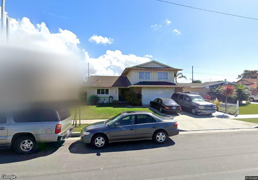
19862 Chesapeake Ln Huntington Beach, CA 92646
Estimated Value: $1,498,000 - $1,738,000
5
Beds
2
Baths
1,982
Sq Ft
$799/Sq Ft
Est. Value
About This Home
This home is located at 19862 Chesapeake Ln, Huntington Beach, CA 92646 and is currently estimated at $1,583,341, approximately $798 per square foot. 19862 Chesapeake Ln is a home located in Orange County with nearby schools including Isojiro Oka Elementary, Talbert Middle School, and Huntington Beach High School.
Ownership History
Date
Name
Owned For
Owner Type
Purchase Details
Closed on
Apr 8, 2005
Sold by
Spang Edward F and Spang Eleanor R
Bought by
Devalk Michael A and Devalk Christina M
Current Estimated Value
Home Financials for this Owner
Home Financials are based on the most recent Mortgage that was taken out on this home.
Original Mortgage
$628,200
Outstanding Balance
$337,126
Interest Rate
6.4%
Mortgage Type
Purchase Money Mortgage
Estimated Equity
$1,246,215
Create a Home Valuation Report for This Property
The Home Valuation Report is an in-depth analysis detailing your home's value as well as a comparison with similar homes in the area
Home Values in the Area
Average Home Value in this Area
Purchase History
| Date | Buyer | Sale Price | Title Company |
|---|---|---|---|
| Devalk Michael A | $698,000 | Ticor Title |
Source: Public Records
Mortgage History
| Date | Status | Borrower | Loan Amount |
|---|---|---|---|
| Open | Devalk Michael A | $628,200 |
Source: Public Records
Tax History Compared to Growth
Tax History
| Year | Tax Paid | Tax Assessment Tax Assessment Total Assessment is a certain percentage of the fair market value that is determined by local assessors to be the total taxable value of land and additions on the property. | Land | Improvement |
|---|---|---|---|---|
| 2025 | $10,815 | $972,944 | $827,682 | $145,262 |
| 2024 | $10,815 | $953,867 | $811,453 | $142,414 |
| 2023 | $10,565 | $935,164 | $795,542 | $139,622 |
| 2022 | $10,414 | $916,828 | $779,943 | $136,885 |
| 2021 | $10,213 | $898,851 | $764,650 | $134,201 |
| 2020 | $10,154 | $889,635 | $756,810 | $132,825 |
| 2019 | $9,943 | $872,192 | $741,971 | $130,221 |
| 2018 | $9,752 | $855,091 | $727,423 | $127,668 |
| 2017 | $9,598 | $838,325 | $713,160 | $125,165 |
| 2016 | $8,452 | $754,000 | $645,572 | $108,428 |
| 2015 | $7,865 | $700,000 | $591,572 | $108,428 |
| 2014 | $7,433 | $660,422 | $551,994 | $108,428 |
Source: Public Records
Map
Nearby Homes
- 20071 Moontide Cir
- 20111 Marina Ln
- 19846 Lures Ln
- 9121 Madeline Dr
- 9594 Pettswood Dr Unit 4
- 19901 Burnley Ln
- 9172 Veronica Dr
- 9667 Durham Dr
- 19854 Leighton Ln
- 9695 Adams Ave
- 9331 Grand Dr
- 9522 Yellowstone Dr
- 20258 Lantana Dr
- 9745 Cornwall Dr
- 19843 Coventry Ln
- 19860 Claremont Ln
- 9831 Continental Dr
- 19774 Cambridge Ln
- 19880 Berkshire Ln
- 20131 Crown Reef Ln
- 19872 Chesapeake Ln
- 19852 Chesapeake Ln
- 19861 Potomac Ln
- 19882 Chesapeake Ln
- 19842 Chesapeake Ln
- 19871 Potomac Ln
- 19851 Potomac Ln
- 19881 Potomac Ln
- 19841 Potomac Ln
- 19861 Chesapeake Ln
- 19871 Chesapeake Ln
- 19892 Chesapeake Ln
- 19832 Chesapeake Ln
- 19841 Chesapeake Ln
- 19881 Chesapeake Ln
- 19891 Potomac Ln
- 19831 Potomac Ln
- 19831 Chesapeake Ln
- 19891 Chesapeake Ln
- 19912 Chesapeake Ln