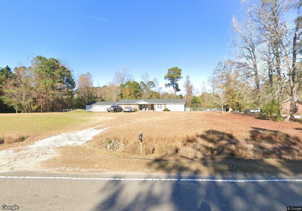
1988 Maco Rd NE Leland, NC 28451
Estimated Value: $206,829 - $259,000
3
Beds
1
Bath
1,000
Sq Ft
$237/Sq Ft
Est. Value
About This Home
This home is located at 1988 Maco Rd NE, Leland, NC 28451 and is currently estimated at $237,207, approximately $237 per square foot. 1988 Maco Rd NE is a home located in Brunswick County with nearby schools including Town Creek Elementary School and North Brunswick High School.
Ownership History
Date
Name
Owned For
Owner Type
Purchase Details
Closed on
May 21, 2007
Sold by
Malpass Mary Frances and Chatrette Mary Frances
Bought by
Malpass Thomas Edward and Malpass Mary Frances
Current Estimated Value
Home Financials for this Owner
Home Financials are based on the most recent Mortgage that was taken out on this home.
Original Mortgage
$115,000
Interest Rate
5.75%
Mortgage Type
Adjustable Rate Mortgage/ARM
Create a Home Valuation Report for This Property
The Home Valuation Report is an in-depth analysis detailing your home's value as well as a comparison with similar homes in the area
Home Values in the Area
Average Home Value in this Area
Purchase History
| Date | Buyer | Sale Price | Title Company |
|---|---|---|---|
| Malpass Thomas Edward | -- | None Available |
Source: Public Records
Mortgage History
| Date | Status | Borrower | Loan Amount |
|---|---|---|---|
| Closed | Malpass Thomas Edward | $115,000 |
Source: Public Records
Tax History Compared to Growth
Tax History
| Year | Tax Paid | Tax Assessment Tax Assessment Total Assessment is a certain percentage of the fair market value that is determined by local assessors to be the total taxable value of land and additions on the property. | Land | Improvement |
|---|---|---|---|---|
| 2025 | $593 | $146,160 | $15,760 | $130,400 |
| 2024 | $593 | $146,160 | $15,760 | $130,400 |
| 2023 | $624 | $146,160 | $15,760 | $130,400 |
| 2022 | $624 | $110,640 | $12,610 | $98,030 |
| 2021 | $624 | $110,640 | $12,610 | $98,030 |
| 2020 | $624 | $110,640 | $12,610 | $98,030 |
| 2019 | $615 | $53,110 | $12,610 | $40,500 |
| 2018 | $641 | $55,460 | $12,610 | $42,850 |
| 2017 | $626 | $55,460 | $12,610 | $42,850 |
| 2016 | $613 | $55,460 | $12,610 | $42,850 |
| 2015 | $613 | $116,090 | $12,610 | $103,480 |
| 2014 | $681 | $131,227 | $23,630 | $107,597 |
Source: Public Records
Map
Nearby Homes
- 6681 Mossey Run Dr NE
- 2128 Maco Rd NE
- 80.35ac Maco Rd NE
- 6570 New Ground Trail NE
- 7054 Healy Haven Ln NE
- 7077 Healy Haven NE
- 7077 Healy Haven Ln
- 7058 Healy Haven Ln NE
- 1106 Hanson Dr
- 1091 Hanson Dr
- 1103 Hanson Dr
- Walker Plan at East Lake
- Givens Plan at East Lake
- Garrett Plan at East Lake
- Tucker Plan at East Lake
- Nest Plan at East Lake
- 1087 Hanson Dr
- McKimmon Plan at Terrapin
- Biltmore Plan at Terrapin
- Nelson Plan at Terrapin
- 1974 Maco Rd NE
- 2004 Maco Rd NE
- 1991 Maco Rd NE
- 2010 Maco Rd NE
- 6590 Farm Meadows Dr
- 1959 Maco Rd NE
- 1955 Maco Rd NE
- 2027 Maco Rd NE
- 1930 Maco Rd NE
- 2012 Beasley Rd NE
- 1920 Maco Rd NE
- 1981 Beasley Rd NE
- 6581 Angels Gift Trail NE
- 2059 Maco Rd NE
- 6656 Mossy Run Dr
- 2078 Maco Rd NE
- 0 Farm Meadows Dr NE
- 2077 Maco Rd NE
- 6585 Angels Gift Trail NE