Estimated Value: $387,000 - $446,000
4
Beds
3
Baths
2,145
Sq Ft
$192/Sq Ft
Est. Value
About This Home
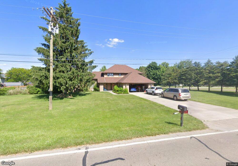
This home is located at 1989 Barnhart Rd, Troy, OH 45373 and is currently estimated at $412,704, approximately $192 per square foot. 1989 Barnhart Rd is a home located in Miami County with nearby schools including Concord Elementary School, Van Cleve Elementary School, and Troy Junior High School.
Ownership History
Date
Name
Owned For
Owner Type
Purchase Details
Closed on
Jun 28, 2019
Sold by
Bailey Nicholas
Bought by
Bailey Shannon D
Current Estimated Value
Home Financials for this Owner
Home Financials are based on the most recent Mortgage that was taken out on this home.
Original Mortgage
$209,299
Outstanding Balance
$185,489
Interest Rate
4.4%
Mortgage Type
FHA
Estimated Equity
$227,215
Purchase Details
Closed on
Feb 27, 2003
Sold by
Relocation Resources International Inc
Bought by
Steinmetz Cody M
Home Financials for this Owner
Home Financials are based on the most recent Mortgage that was taken out on this home.
Original Mortgage
$170,050
Interest Rate
6.07%
Mortgage Type
New Conventional
Purchase Details
Closed on
Jul 12, 1999
Sold by
Gale Edgar T and Gale Laura R
Bought by
Corlett Craig and Corlett Jill
Purchase Details
Closed on
Aug 20, 1993
Bought by
Gale Edgar T
Create a Home Valuation Report for This Property
The Home Valuation Report is an in-depth analysis detailing your home's value as well as a comparison with similar homes in the area
Home Values in the Area
Average Home Value in this Area
Purchase History
| Date | Buyer | Sale Price | Title Company |
|---|---|---|---|
| Bailey Shannon D | -- | None Available | |
| Steinmetz Cody M | $179,000 | -- | |
| Corlett Craig | $187,000 | -- | |
| Gale Edgar T | $176,500 | -- |
Source: Public Records
Mortgage History
| Date | Status | Borrower | Loan Amount |
|---|---|---|---|
| Open | Bailey Shannon D | $209,299 | |
| Closed | Corlett Craig | $170,050 |
Source: Public Records
Tax History Compared to Growth
Tax History
| Year | Tax Paid | Tax Assessment Tax Assessment Total Assessment is a certain percentage of the fair market value that is determined by local assessors to be the total taxable value of land and additions on the property. | Land | Improvement |
|---|---|---|---|---|
| 2024 | $3,749 | $96,360 | $17,150 | $79,210 |
| 2023 | $3,749 | $96,360 | $17,150 | $79,210 |
| 2022 | $3,141 | $96,360 | $17,150 | $79,210 |
| 2021 | $2,676 | $77,070 | $13,720 | $63,350 |
| 2020 | $2,679 | $77,070 | $13,720 | $63,350 |
| 2019 | $2,704 | $77,070 | $13,720 | $63,350 |
| 2018 | $2,316 | $62,860 | $12,670 | $50,190 |
| 2017 | $2,338 | $62,860 | $12,670 | $50,190 |
| 2016 | $2,305 | $62,860 | $12,670 | $50,190 |
| 2015 | $2,220 | $58,210 | $11,730 | $46,480 |
| 2014 | $2,220 | $58,210 | $11,730 | $46,480 |
| 2013 | $2,235 | $58,210 | $11,730 | $46,480 |
Source: Public Records
Map
Nearby Homes
- 1985 Fox Run
- 2206 Northbridge Trail
- 1965 Quail Nest Ct
- 2537 Huntington Dr
- 2295 Shenandoah Dr
- 1350 Winchester Dr
- 1118 Winchester Dr
- 00 W
- Holcombe Plan at Reserve at Cliff Oaks
- Chatham Plan at Reserve at Cliff Oaks
- Bridgeport Plan at Reserve at Cliff Oaks
- Newcastle Plan at Reserve at Cliff Oaks
- 2936 Hoying Dr
- 2944 Hoying Dr
- 2952 Hoying Dr
- 2960 Hoying Dr
- 2968 Hoying Dr
- 1550 Creekwood Dr
- 650 Swailes Rd
- 1209 Spruce St
- 2211 Swailes Rd
- 2195 Swailes Rd
- 1955 Fox Run
- 2255 Swailes Rd
- 2182 Swailes Rd
- 2246 Swailes Rd
- 2210 Swailes Rd
- 2175 Swailes Rd
- 1933 Fox Run
- 1952 Barnhart Rd
- 2264 Swailes Rd
- 1970 Fox Run
- 1970 Barnhart Rd
- 1940 Barnhart Rd
- 1940 Fox Run
- 1911 Fox Run
- 1917 Barnhart Rd
- 1900 Normandy Ln
- 2300 Swailes Rd
- 1905 Barnhart Rd