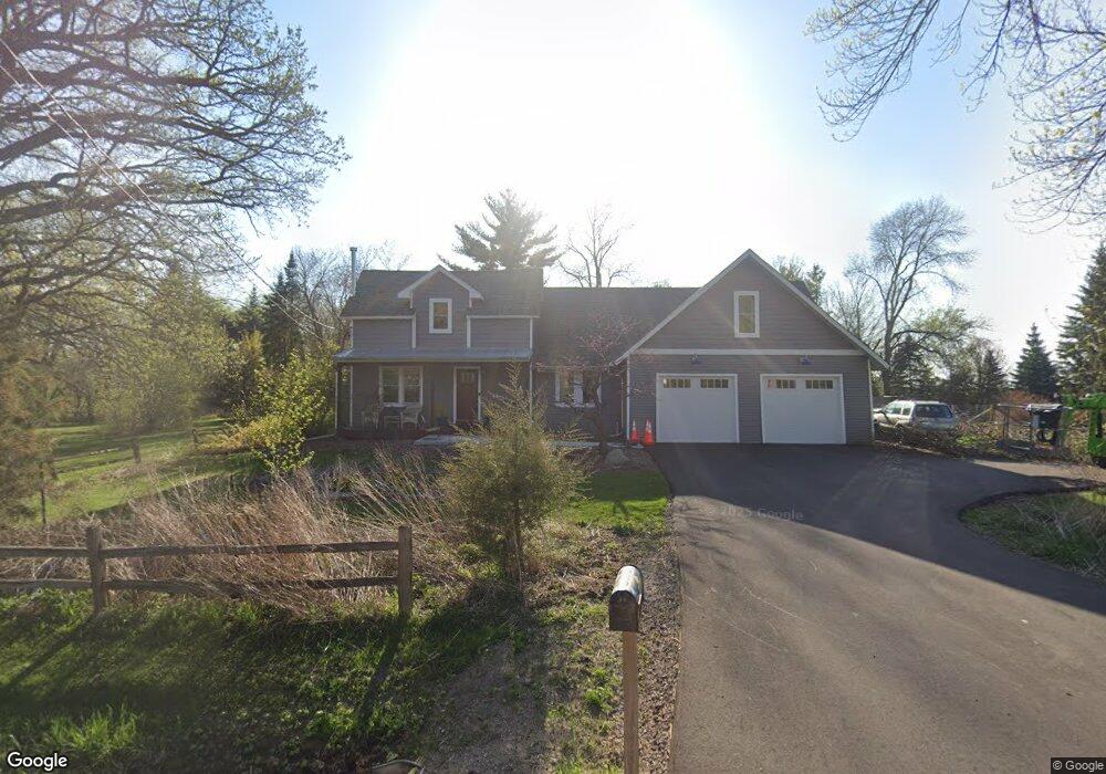
1989 Budd Ave Independence, MN 55359
Estimated Value: $524,000 - $753,000
3
Beds
2
Baths
2,476
Sq Ft
$251/Sq Ft
Est. Value
About This Home
This home is located at 1989 Budd Ave, Independence, MN 55359 and is currently estimated at $620,875, approximately $250 per square foot. 1989 Budd Ave is a home located in Hennepin County with nearby schools including Schumann Elementary School, Orono Intermediate Elementary School, and Orono Middle School.
Ownership History
Date
Name
Owned For
Owner Type
Purchase Details
Closed on
Sep 20, 2010
Sold by
Brandt Todd M
Bought by
Cooper Benjamin K and Cooper Maria K
Current Estimated Value
Create a Home Valuation Report for This Property
The Home Valuation Report is an in-depth analysis detailing your home's value as well as a comparison with similar homes in the area
Home Values in the Area
Average Home Value in this Area
Purchase History
| Date | Buyer | Sale Price | Title Company |
|---|---|---|---|
| Cooper Benjamin K | $200,000 | -- |
Source: Public Records
Tax History
| Year | Tax Paid | Tax Assessment Tax Assessment Total Assessment is a certain percentage of the fair market value that is determined by local assessors to be the total taxable value of land and additions on the property. | Land | Improvement |
|---|---|---|---|---|
| 2024 | $6,041 | $532,500 | $166,300 | $366,200 |
| 2023 | $5,807 | $527,500 | $159,600 | $367,900 |
| 2022 | $4,557 | $478,000 | $130,000 | $348,000 |
| 2021 | $3,682 | $361,000 | $114,000 | $247,000 |
| 2020 | $3,555 | $295,000 | $117,000 | $178,000 |
| 2019 | $3,600 | $277,000 | $114,000 | $163,000 |
| 2018 | $3,302 | $276,000 | $114,000 | $162,000 |
| 2017 | $3,154 | $241,000 | $109,000 | $132,000 |
| 2016 | $3,128 | $241,000 | $109,000 | $132,000 |
| 2015 | $2,848 | $224,000 | $102,000 | $122,000 |
| 2014 | -- | $199,000 | $87,000 | $112,000 |
Source: Public Records
Map
Nearby Homes
- 2017 Bridgevine Ct
- 2045 Bridgevine Ct
- 5183 Independence St
- 2101 Bridgevine Ct
- 1635 Delano Ave
- 2073 Bridgevine Ct
- 5340 Main St E
- 2084 Bridgevine Ct
- 5249 Main St E
- 4894 Bridgevine Way
- 4835 Drake St
- 2224 Bridgevine Ct
- 4819 Baker Reserve Ln
- 4801 Baker Reserve Ln
- 4842 Baker Reserve Ln
- 5245 Clayton Dr
- 5112 S Lakeshore Dr
- 5540 Timber Trail
- 2211 Heritage Trail
- 5901 Drake Dr
- 1989 Budd Ave
- 2025 Budd Ave
- 1935 Budd Ave
- 2112 2112 Budd-Street-n
- 5161 Perkinsville Rd
- 1950 Budd Ave
- 5160 Perkinsville Rd
- 5160 Perkinsville Rd
- 5160 Perkinsville Rd
- 2040 Budd Ave
- 1911 Budd Ave
- 5134 Perkinsville Rd
- 2015 Budd Ave
- 1918 Budd Ave
- 2060 Budd Ave
- 1886 Budd Ave
- 5112 Perkinsville Rd
- 2095 Budd Ave
- 2090 Budd Ave
- 2090 Budd Ave
Your Personal Tour Guide
Ask me questions while you tour the home.