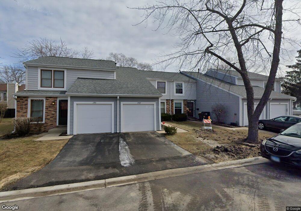
1989 Georgetown Ln Unit 4 Hoffman Estates, IL 60169
South Hoffman Estates NeighborhoodEstimated Value: $252,000 - $302,000
3
Beds
2
Baths
1,350
Sq Ft
$209/Sq Ft
Est. Value
About This Home
This home is located at 1989 Georgetown Ln Unit 4, Hoffman Estates, IL 60169 and is currently estimated at $281,690, approximately $208 per square foot. 1989 Georgetown Ln Unit 4 is a home located in Cook County with nearby schools including John Muir Literacy Academy, Dwight D Eisenhower Junior High School, and Hoffman Estates High School.
Ownership History
Date
Name
Owned For
Owner Type
Purchase Details
Closed on
Feb 18, 2022
Sold by
Sims Tanya V and Sims Y
Bought by
The Tanya V Sims Living Trust
Current Estimated Value
Purchase Details
Closed on
Jan 22, 2022
Sold by
Sims Tanya V and Sims Y
Bought by
The Tanya V Sims Living Trust
Purchase Details
Closed on
Jun 15, 1999
Sold by
Hansen Michaeleen
Bought by
Sims Tanya V
Home Financials for this Owner
Home Financials are based on the most recent Mortgage that was taken out on this home.
Original Mortgage
$114,950
Interest Rate
7.15%
Create a Home Valuation Report for This Property
The Home Valuation Report is an in-depth analysis detailing your home's value as well as a comparison with similar homes in the area
Home Values in the Area
Average Home Value in this Area
Purchase History
| Date | Buyer | Sale Price | Title Company |
|---|---|---|---|
| The Tanya V Sims Living Trust | -- | -- | |
| The Tanya V Sims Living Trust | -- | -- | |
| Sims Tanya V | $121,000 | -- |
Source: Public Records
Mortgage History
| Date | Status | Borrower | Loan Amount |
|---|---|---|---|
| Previous Owner | Sims Tanya V | $114,950 |
Source: Public Records
Tax History
| Year | Tax Paid | Tax Assessment Tax Assessment Total Assessment is a certain percentage of the fair market value that is determined by local assessors to be the total taxable value of land and additions on the property. | Land | Improvement |
|---|---|---|---|---|
| 2025 | $4,303 | $25,000 | $3,504 | $21,496 |
| 2024 | $4,303 | $18,000 | $3,000 | $15,000 |
| 2023 | $4,127 | $18,000 | $3,000 | $15,000 |
| 2022 | $4,127 | $18,000 | $3,000 | $15,000 |
| 2021 | $3,261 | $13,729 | $2,759 | $10,970 |
| 2020 | $3,274 | $13,729 | $2,759 | $10,970 |
| 2019 | $3,602 | $16,418 | $2,759 | $13,659 |
| 2018 | $3,495 | $14,154 | $2,409 | $11,745 |
| 2017 | $3,452 | $14,154 | $2,409 | $11,745 |
| 2016 | $3,671 | $14,818 | $2,409 | $12,409 |
| 2015 | $3,072 | $12,187 | $2,102 | $10,085 |
| 2014 | $3,035 | $12,187 | $2,102 | $10,085 |
| 2013 | $3,316 | $13,415 | $2,102 | $11,313 |
Source: Public Records
Map
Nearby Homes
- 2051 Kettering Rd Unit 2
- 1986 Brighton Ln Unit 2
- 2021 Kensington Ln Unit 3004
- 2027 Kensington Ln Unit 3001
- 2025 Kensington Ln Unit 3002
- 2023 Kensington Ln Unit 3003
- 1933 Williamsburg Dr Unit 1
- 1834 Jamestown Cir Unit 3114
- 2267 Briar Ct Unit 65
- 1792 Williamsburg Dr
- 1659 Islandview Ct
- 1930 Kenilworth Cir Unit E
- 1724 Fayette Walk Unit J
- 1769 Sessions Walk Unit C
- 1712 Fayette Walk Unit D
- 1587 Brookside Dr
- 1880 Bonnie Ln Unit 416
- 1880 Bonnie Ln Unit 112
- 2222 Seaver Ln
- 1410 Nottingham Ln
- 1987 Georgetown Ln Unit 4
- 1991 Georgetown Ln
- 1985 Georgetown Ln Unit 4
- 1993 Georgetown Ln
- 1986 Erie Ln Unit 4
- 1988 Erie Ln Unit 4
- 1984 Erie Ln Unit 4
- 1990 Erie Ln Unit 4
- 1995 Georgetown Ln
- 1982 Erie Ln
- 1992 Erie Ln Unit 4
- 1997 Georgetown Ln Unit 4
- 1980 Erie Ln Unit 4
- 1988 Georgetown Ln
- 1994 Erie Ln
- 1986 Georgetown Ln
- 1990 Georgetown Ln Unit 4
- 1984 Georgetown Ln
- 1984 Georgetown Ln Unit 461
- 1992 Georgetown Ln
Your Personal Tour Guide
Ask me questions while you tour the home.