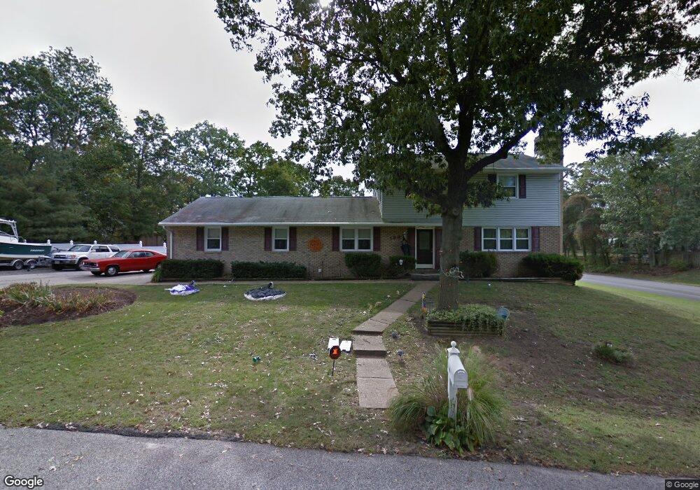
199 Falcon Dr Pasadena, MD 21122
Estimated Value: $594,606 - $665,000
Studio
3
Baths
1,820
Sq Ft
$338/Sq Ft
Est. Value
About This Home
This home is located at 199 Falcon Dr, Pasadena, MD 21122 and is currently estimated at $614,652, approximately $337 per square foot. 199 Falcon Dr is a home located in Anne Arundel County with nearby schools including Bodkin Elementary School, Chesapeake Bay Middle School, and Chesapeake High School.
Ownership History
Date
Name
Owned For
Owner Type
Purchase Details
Closed on
Oct 4, 2004
Sold by
Albright Edward H
Bought by
Mayton Ronald W and Mayton Dana D
Current Estimated Value
Purchase Details
Closed on
Dec 10, 1997
Sold by
Pluswick Leo
Bought by
Albright Edward H and Albright Mary L
Purchase Details
Closed on
Feb 11, 1987
Sold by
Schumaker Frank W
Bought by
Pluswick Leo
Home Financials for this Owner
Home Financials are based on the most recent Mortgage that was taken out on this home.
Original Mortgage
$80,000
Interest Rate
9.06%
Create a Home Valuation Report for This Property
The Home Valuation Report is an in-depth analysis detailing your home's value as well as a comparison with similar homes in the area
Home Values in the Area
Average Home Value in this Area
Purchase History
| Date | Buyer | Sale Price | Title Company |
|---|---|---|---|
| Mayton Ronald W | $415,000 | -- | |
| Albright Edward H | $195,000 | -- | |
| Pluswick Leo | $142,000 | -- |
Source: Public Records
Mortgage History
| Date | Status | Borrower | Loan Amount |
|---|---|---|---|
| Previous Owner | Pluswick Leo | $80,000 | |
| Closed | Mayton Ronald W | -- |
Source: Public Records
Tax History Compared to Growth
Tax History
| Year | Tax Paid | Tax Assessment Tax Assessment Total Assessment is a certain percentage of the fair market value that is determined by local assessors to be the total taxable value of land and additions on the property. | Land | Improvement |
|---|---|---|---|---|
| 2025 | $4,622 | $460,767 | -- | -- |
| 2024 | $4,622 | $431,600 | $216,300 | $215,300 |
| 2023 | $4,506 | $425,367 | $0 | $0 |
| 2022 | $4,222 | $419,133 | $0 | $0 |
| 2020 | $4,044 | $408,100 | $0 | $0 |
| 2019 | $3,980 | $403,300 | $0 | $0 |
| 2018 | $4,041 | $398,500 | $186,300 | $212,200 |
| 2017 | $3,741 | $379,700 | $0 | $0 |
| 2016 | -- | $360,900 | $0 | $0 |
| 2015 | -- | $342,100 | $0 | $0 |
| 2014 | -- | $342,100 | $0 | $0 |
Source: Public Records
Map
Nearby Homes
- 151 Long Point Ct
- 1590 Long Point Rd
- 511 Sylvan Way
- 515 Sylview Drive - Taft Model
- 443 New York Ave
- 0 Cornfield Rd Unit MDAA2129542
- 0 Cornfield Rd Unit MDAA2129524
- 222 Magothy Rd
- 0 Maryland Ave
- 415 Edgewater Rd
- 509A Edgewater Rd
- 1807 Mountain Bay Road - Baltimore Model
- 8407 Bodkin Ave
- 5084 Mountain Road - Jefferson Model
- 2023 Bay Rd
- 5108 Mountain Rd
- 2004 Gooseneck Rd
- 5169 Mountain Rd
- 8425 Bussenius Rd
- 8230 Olney Ct