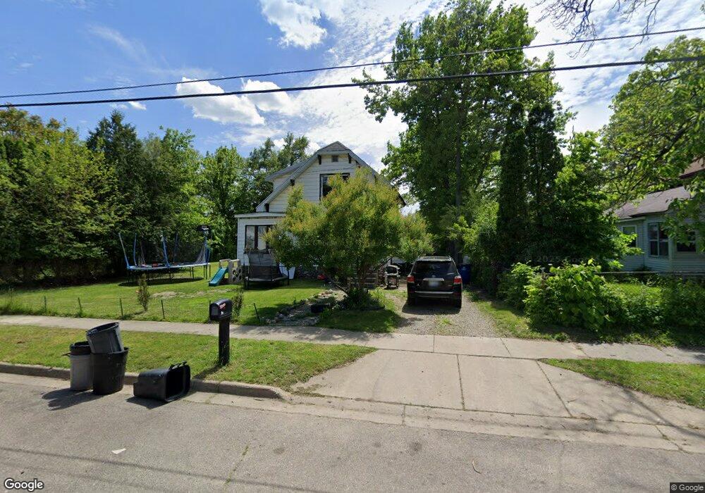
199 Graves Ave Battle Creek, MI 49037
North Central NeighborhoodEstimated Value: $63,000 - $109,000
3
Beds
1
Bath
1,158
Sq Ft
$77/Sq Ft
Est. Value
About This Home
This home is located at 199 Graves Ave, Battle Creek, MI 49037 and is currently estimated at $88,739, approximately $76 per square foot. 199 Graves Ave is a home located in Calhoun County with nearby schools including Ann J. Kellogg School, Northwestern Middle School, and Battle Creek Central High School.
Ownership History
Date
Name
Owned For
Owner Type
Purchase Details
Closed on
Nov 29, 2018
Sold by
Weber Leslie G
Bought by
Weber Kc
Current Estimated Value
Purchase Details
Closed on
Nov 19, 2018
Sold by
Weber Leslie
Bought by
Davis Brandon
Purchase Details
Closed on
Nov 16, 2017
Sold by
Garrity Joshua and Garrity Helen
Bought by
Weber Leslie
Purchase Details
Closed on
Jul 21, 2014
Sold by
Fullerton Patricia and Hanna Ebbin
Bought by
Garrity Joshia and Garrity Helen
Create a Home Valuation Report for This Property
The Home Valuation Report is an in-depth analysis detailing your home's value as well as a comparison with similar homes in the area
Home Values in the Area
Average Home Value in this Area
Purchase History
| Date | Buyer | Sale Price | Title Company |
|---|---|---|---|
| Weber Kc | -- | None Available | |
| Davis Brandon | $3,000 | None Available | |
| Weber Leslie | $3,000 | None Available | |
| Garrity Joshia | $3,000 | None Available |
Source: Public Records
Tax History Compared to Growth
Tax History
| Year | Tax Paid | Tax Assessment Tax Assessment Total Assessment is a certain percentage of the fair market value that is determined by local assessors to be the total taxable value of land and additions on the property. | Land | Improvement |
|---|---|---|---|---|
| 2025 | -- | $31,400 | $0 | $0 |
| 2024 | $736 | $24,669 | $0 | $0 |
| 2023 | $936 | $21,049 | $0 | $0 |
| 2022 | $665 | $18,428 | $0 | $0 |
| 2021 | $890 | $13,711 | $0 | $0 |
| 2020 | $707 | $14,488 | $0 | $0 |
| 2019 | $1,200 | $14,927 | $0 | $0 |
| 2018 | $1,200 | $15,211 | $660 | $14,551 |
| 2017 | $1,428 | $16,279 | $0 | $0 |
| 2016 | $1,112 | $17,275 | $0 | $0 |
| 2015 | $436 | $19,390 | $3,275 | $16,115 |
| 2014 | $436 | $14,977 | $3,275 | $11,702 |
Source: Public Records
Map
Nearby Homes
- 89 Somerset Ave
- 629 Van Buren St W
- 69 Jordan St
- 60 Graves Ave
- 253 Greenwood Ave
- 167 Hubbard St
- 636 Hamblin Ave W
- 562 Van Buren St W
- 0 W Vanburen 027 St Unit 22040287
- 0 W Vanburen 025 St Unit 22040286
- 224 Hubbard St
- 0 W Michigan 011 Ave Unit 22040285
- 0 W Michigan 010 Ave Unit 22040284
- 0 W Vanburen 032 St Unit 22040288
- 35 Hubbard St
- 0 W Ave Unit 22040282
- 0 W Michigan 005 Ave Unit 22040281
- 9 Thorne St
- 188 Roseneath Ave
- 16 Wood St S
- 205 Graves Ave
- 202 Graves Ave
- 744 Van Buren St W
- 738 Van Buren St W
- 740 Van Buren St W
- 198 Graves Ave
- 217 Graves Ave
- 192 Graves Ave
- 754 Van Buren St W
- 181 Graves Ave
- 732 Van Buren St W
- 730 Van Buren St W
- 177 Graves Ave
- 214 Graves Ave
- 221 Graves Ave
- 762 Van Buren St W
- 182 Graves Ave
- 743 Van Buren St W
- 737 Van Buren St W
- 218 Graves Ave